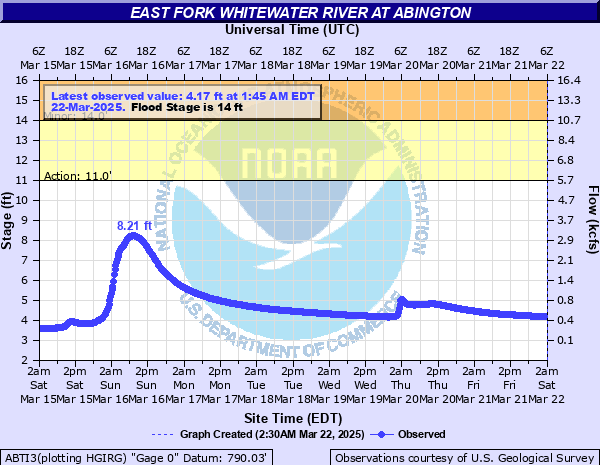
East Fork Whitewater River at Abington
Critical Stages
11' - Action
14' - Flood
18' - Moderate
22' - Major
Latest Observation
Updated: 12:45 AM EST 12/6/25
Status: No Flooding
Stage: 3.3 ft
Flow: 0.0516 kcfs
Forecast
Forecast not available for this location.
| Time | Stage (ft) | Flow (kcfs) |
|---|---|---|
| 12:45 AM 12/6 | 3.3 | 0.0516 |
| 12:30 AM 12/6 | 3.3 | 0.0516 |
| 12:15 AM 12/6 | 3.3 | 0.0516 |
| 12:00 AM 12/6 | 3.3 | 0.0516 |
| 11:45 PM 12/5 | 3.3 | 0.0516 |
| 11:30 PM 12/5 | 3.3 | 0.0516 |
| 11:15 PM 12/5 | 3.3 | 0.0516 |
| 11:00 PM 12/5 | 3.3 | 0.0516 |
| 10:45 PM 12/5 | 3.3 | 0.0516 |
| 10:30 PM 12/5 | 3.3 | 0.0516 |
| 10:15 PM 12/5 | 3.3 | 0.0516 |
| 10:00 PM 12/5 | 3.3 | 0.0516 |
| 9:45 PM 12/5 | 3.3 | 0.0516 |
| 9:30 PM 12/5 | 3.3 | 0.0516 |
| 9:15 PM 12/5 | 3.3 | 0.0516 |
| 9:00 PM 12/5 | 3.3 | 0.0516 |
| 8:45 PM 12/5 | 3.3 | 0.0516 |
| 8:30 PM 12/5 | 3.29 | 0.0502 |
| 8:15 PM 12/5 | 3.29 | 0.0502 |
| 8:00 PM 12/5 | 3.29 | 0.0502 |
| 7:45 PM 12/5 | 3.29 | 0.0502 |
| 7:30 PM 12/5 | 3.29 | 0.0502 |
| 7:15 PM 12/5 | 3.29 | 0.0502 |
| 7:00 PM 12/5 | 3.29 | 0.0502 |
| 6:45 PM 12/5 | 3.28 | 0.0489 |
| 6:30 PM 12/5 | 3.28 | 0.0489 |
| 6:15 PM 12/5 | 3.28 | 0.0489 |
| 6:00 PM 12/5 | 3.28 | 0.0489 |
| 5:45 PM 12/5 | 3.27 | 0.0475 |
| 5:30 PM 12/5 | 3.27 | 0.0475 |
22' -
Much of the flood plain is inundated, with several homes near the river in Yankee Town and Brownsville flooded. Long stretches of River Road and Brownsville Road are flooded, with some homes cut off due to flooding.
20' -
Flooding occurs along Water and Front Streets in Abington, with areas of Abington Pike Flooded. Stretches of River Road are flooded, with flooding in Brownsville and Yankee Town. Much of North Brownsville Road is flooded, with no access around the Paddocks Ford Bridge on Clifton Road near Yankee Town.
18' -
This is approximately the FEMA 1 percent flood level. Stretches of River Road are flooded, with some properties in Brownsville and Yankee Town incurring flooding, with much of North Brownsville Road underwater. No access is available around the Paddocks Ford Bridge on Clifton Road near Yankee Town.
16' -
This approaches the flood of record of 16.19 feet set in 1969. Stretches of North Brownsville Road are impacted, with water approaching some homes in Brownsville. In addition, flooding impacts Paddocks Ford Bridge on Clifton Road near Yankee Town.
15' -
Water begins to cover portions of North Brownsville Road, with access cut off along the West Clifton Road Bridge near Yankee Town.
14' -
Water spills onto low-lying property along the river downstream of Abington from Yankee Town to Brownsville.
| Date | Stage (ft) |
|---|---|
| Jul 20, 1969 | 16.18 |
| Apr 3, 2018 | 15.95 |
| Jan 22, 1999 | 15.67 |
| Jan 6, 2005 | 15.36 |
| Apr 5, 2025 | 15.28 |
| Dec 30, 1990 | 15.16 |
| Oct 1, 1986 | 14.74 |
| Nov 6, 2017 | 14.61 |
| Dec 22, 2013 | 14.6 |
| Jul 18, 2001 | 14.56 |
| Apr 29, 1996 | 14.54 |
| May 26, 1989 | 14.45 |
| Jan 5, 2004 | 14.37 |
| May 24, 1968 | 14.05 |
| Jan 9, 2008 | 13.99 |
| Sep 2, 2003 | 13.96 |
| May 7, 1967 | 13.54 |
| Apr 2, 1970 | 13.54 |
| Nov 14, 1993 | 13.47 |
| Dec 1, 2006 | 13.31 |
Data provided by the National Weather Service.