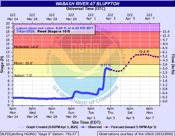
Wabash River at Bluffton
Critical Stages
7' - Action
10' - Flood
14' - Moderate
18' - Major
Latest Observation
Updated: 12:45 AM EST 12/6/25
Status: No Flooding
Stage: 1.26 ft
Flow: 0.0065 kcfs
Forecast
Forecast not available for this location.
| Time | Stage (ft) | Flow (kcfs) |
|---|---|---|
| 12:45 AM 12/6 | 1.26 | 0.0065 |
| 12:30 AM 12/6 | 1.26 | 0.0065 |
| 12:15 AM 12/6 | 1.25 | 0.0059 |
| 12:00 AM 12/6 | 1.25 | 0.0059 |
| 11:45 PM 12/5 | 1.25 | 0.0059 |
| 11:30 PM 12/5 | 1.25 | 0.0059 |
| 11:15 PM 12/5 | 1.25 | 0.0059 |
| 11:00 PM 12/5 | 1.24 | 0.0055 |
| 10:45 PM 12/5 | 1.24 | 0.0055 |
| 10:30 PM 12/5 | 1.24 | 0.0055 |
| 10:15 PM 12/5 | 1.24 | 0.0055 |
| 10:00 PM 12/5 | 1.24 | 0.0055 |
| 9:45 PM 12/5 | 1.23 | 0.005 |
| 9:30 PM 12/5 | 1.23 | 0.005 |
| 9:15 PM 12/5 | 1.23 | 0.005 |
| 9:00 PM 12/5 | 1.23 | 0.005 |
| 8:45 PM 12/5 | 1.23 | 0.005 |
| 8:30 PM 12/5 | 1.23 | 0.005 |
| 8:15 PM 12/5 | 1.23 | 0.005 |
| 8:00 PM 12/5 | 1.23 | 0.005 |
| 7:45 PM 12/5 | 1.23 | 0.005 |
| 7:30 PM 12/5 | 1.23 | 0.005 |
| 7:15 PM 12/5 | 1.23 | 0.005 |
| 7:00 PM 12/5 | 1.23 | 0.005 |
| 6:45 PM 12/5 | 1.23 | 0.005 |
| 6:30 PM 12/5 | 1.23 | 0.005 |
| 6:15 PM 12/5 | 1.23 | 0.005 |
| 6:00 PM 12/5 | 1.23 | 0.005 |
| 5:45 PM 12/5 | 1.23 | 0.005 |
| 5:30 PM 12/5 | 1.24 | 0.0055 |
20.5' -
Flood water hits the highest point of the bottom of the bridge at the gage site.
20' -
Water is at the top of the levee protecting the wastewater treatment plant. The power plant area is affected by high water with extensive flooding of rural areas. Homes are flooded and some county and state roads are closed. Flood water may stop rail traffic. A record flood is in progress at this stage. There is extensive flooding or northern parts of Bluffton. The commercial area in northwest Bluffton along SR 1 is affected by flood water. Some evacutations are necessary.
18' -
Water approaches the power plant. Rural residences along Elm Road begin to flood and the railroad is threatened. A major flood is in progress. Commercial and municipal property along SR 1 begins to flood. Evacuations are necessary in northern parts of Bluffton. Water is at a critical level on the levee protecting the wastewater treatment plant.
16' -
The outlying portion of West Washington Street becomes impassible and SR 116 west of Bluffton begins to flood.
14' -
Flooding begins to affect residential areas in northern Bluffton. Low areas near the wastewater treatment plant begin to flood. Portions of Elm Grove Road and County Road 450 begin to flood.
13.3' -
River Road in Bluffton is flooded and closed along the River Green Way.
13' -
Access road to Bluffton wastewater treatment plant is flooded.
12' -
Water reaching the bottom of the bridge at East River Road and 450 East. River Road and a few county roads are closed by high water.
11' -
River Road at Bluffton begins to flood. Flood waters isolate the amphitheater at Kehoe Park in Bluffton.
10' -
The river is at flood stage. Flooding of agricultural land begins.
| Date | Stage (ft) |
|---|---|
| Mar 25, 1913 | 21 |
| Jul 9, 2003 | 18.43 |
| Jan 14, 2005 | 17.17 |
| Jun 19, 2015 | 16.74 |
| Mar 1, 1904 | 16.7 |
| Feb 7, 2008 | 16.43 |
| Feb 25, 1985 | 16.2 |
| Mar 2, 2011 | 16.12 |
| Feb 15, 1950 | 16.07 |
| Mar 13, 1982 | 16 |
| Jan 24, 1999 | 15.5 |
| Feb 23, 2014 | 15.49 |
| Jan 14, 2013 | 15.36 |
| Jan 14, 1930 | 15.2 |
| Jan 16, 1937 | 15.02 |
| Mar 2, 2011 | 15 |
| Feb 10, 1959 | 14.95 |
| May 19, 1943 | 14.74 |
| Apr 28, 2019 | 14.73 |
| Mar 18, 1978 | 14.7 |
Data provided by the National Weather Service.