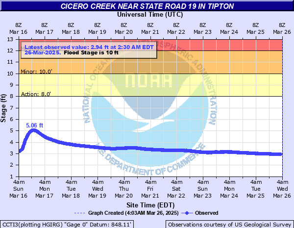
Cicero Creek near State Road 19 in Tipton
Critical Stages
8' - Action
10' - Flood
12' - Moderate
16.5' - Major
Latest Observation
Updated: 12:30 AM EST 12/6/25
Status: No Flooding
Stage: 2.6 ft
Flow: -999 kcfs
Forecast
Forecast not available for this location.
| Time | Stage (ft) | Flow (kcfs) |
|---|---|---|
| 12:30 AM 12/6 | 2.6 | -999 |
| 12:15 AM 12/6 | 2.59 | -999 |
| 12:00 AM 12/6 | 2.6 | -999 |
| 11:45 PM 12/5 | 2.6 | -999 |
| 11:30 PM 12/5 | 2.6 | -999 |
| 11:15 PM 12/5 | 2.6 | -999 |
| 11:00 PM 12/5 | 2.6 | -999 |
| 10:45 PM 12/5 | 2.61 | -999 |
| 10:30 PM 12/5 | 2.6 | -999 |
| 10:15 PM 12/5 | 2.6 | -999 |
| 10:00 PM 12/5 | 2.61 | -999 |
| 9:45 PM 12/5 | 2.61 | -999 |
| 9:30 PM 12/5 | 2.6 | -999 |
| 9:15 PM 12/5 | 2.62 | -999 |
| 9:00 PM 12/5 | 2.61 | -999 |
| 8:45 PM 12/5 | 2.61 | -999 |
| 8:30 PM 12/5 | 2.6 | -999 |
| 8:15 PM 12/5 | 2.62 | -999 |
| 8:00 PM 12/5 | 2.61 | -999 |
| 7:45 PM 12/5 | 2.6 | -999 |
| 7:30 PM 12/5 | 2.6 | -999 |
| 7:15 PM 12/5 | 2.61 | -999 |
| 7:00 PM 12/5 | 2.61 | -999 |
| 6:45 PM 12/5 | 2.6 | -999 |
| 6:30 PM 12/5 | 2.62 | -999 |
| 6:15 PM 12/5 | 2.61 | -999 |
| 6:00 PM 12/5 | 2.6 | -999 |
| 5:45 PM 12/5 | 2.6 | -999 |
| 5:30 PM 12/5 | 2.6 | -999 |
| 5:15 PM 12/5 | 2.61 | -999 |
17.01' -
In April 2013 more than 250 homes in Tipton county affected by flood waters. More than 50 homes suffered major damage while nearly 100 had minor damage. Flooding impacted much of the City of Tipton south of SR 28.
17' -
Massive flooding of Tipton and nearby area in April 2013. Flood waters higher than in June 1957, possibly exceeding March 1913. SR roads 28 and 19 both closed by at least one foot of water. Nearby mobile home park severely flooded. Homes and businesses on South Street in Tipton flooded. Portions of the Tipton Hospital parking lot may have flooded.
16.98' -
Although there is no river gage on Duck Creek in Madison County...immediately east of the Cicero Creek watershed...in April 2013 the town of Elwood experienced record flooding with more than 60 homes at least affected by flooding. Over half of the homes sustained minor damage or worse.
16.5' -
Near record flooding of Cicero Creek on the south side of Tipton. Residential areas in Tipton mainly south of SR 28 are threatened and/or flooded. Water may be over SR 19. Water possibly 2 or more feet deep on portions of South Street in Tipton, CR 300 S and SR 19 a block or two south of Cicero Creek.
15' -
Flooding from Cicero Creek becoming serious at this level. Areas of Tipton south of SR 28 may begin to flood.
14.32' -
Check Bar Reading of the wire weight gage on SR 19.
13.7' -
Tipton Golf Course completely flooded. CR 200 and a few other nearby roads flood. Portions of Tipton Park extensively flooded by 5 or more feet of water.
12.4' -
Tipton Park and Golf Course flood. Almost all of the foot bridges in the park are completely underwater. South Street in Tipton, CR 300 S and SR 19 a block or two south of Cicero Creek all flood.
12' -
Unusual flooding in progress. Tipton Park is likely closed. Extensive flooding of Golf Course.
10.5' -
Tipton Park flooded at this level, especially with locally heavy rain.
10' -
Some flooding of the low areas of Tipton Park. Water within one foot of a foot bridge in park. Portions of the back nine of the golf course are flooded. Golf Course is closed. Flooding at this level is common and rates a 3 out of 10 for severity by the golf course.
8' -
Bankfull level for Cicero Creek in the Tipton Area. Flooding begins at local golf course.
7' -
High levels along the Cicero Creek in the Tipton area.
| Date | Stage (ft) |
|---|---|
| Apr 19, 2013 | 17.09 |
| Jun 28, 1957 | 16.5 |
| Dec 30, 1990 | 14.5 |
| Jun 23, 2010 | 13.7 |
| Jun 21, 2011 | 13.33 |
| Jan 26, 1962 | 13.3 |
| May 5, 2017 | 12.99 |
| Jan 13, 2013 | 12.71 |
| Feb 12, 2009 | 12.38 |
| Feb 28, 2011 | 12.19 |
| Jun 27, 2015 | 11.91 |
| Feb 6, 2008 | 11.47 |
| Apr 4, 2018 | 11.46 |
| Jun 29, 2010 | 11.15 |
| Apr 4, 2014 | 10.77 |
| Jul 8, 2017 | 10.25 |
| Nov 19, 2017 | 9.05 |
| Dec 29, 2015 | 8.86 |
| Jan 9, 2008 | 8.78 |
| Jan 20, 2017 | 8.64 |
Data provided by the National Weather Service.