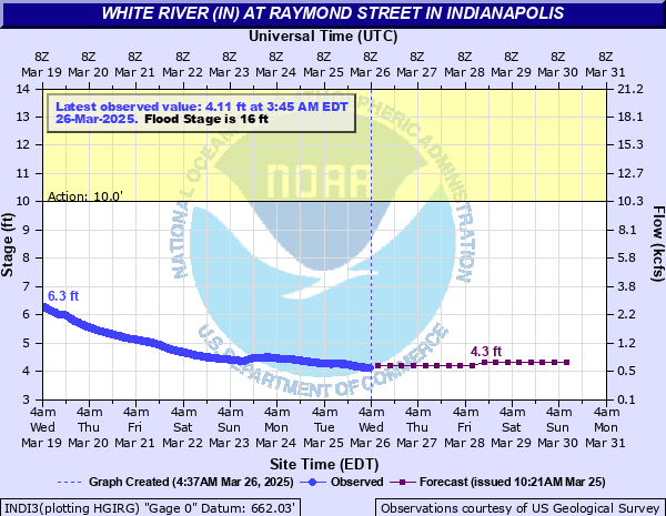
White River (IN) at Raymond Street in Indianapolis
Critical Stages
10' - Action
16' - Flood
20' - Moderate
25' - Major
Latest Observation
Updated: 12:45 AM EST 12/6/25
Status: No Flooding
Stage: 3.28 ft
Flow: 0.204 kcfs
Forecast
| Time | Stage (ft) | Flow (kcfs) |
|---|---|---|
| 7 AM 12/6 | 3.2 | 0.183 |
| 1 PM 12/6 | 3.2 | 0.183 |
| 7 PM 12/6 | 3.2 | 0.183 |
| 1 AM 12/7 | 3.1 | 0.158 |
| 7 AM 12/7 | 3.1 | 0.158 |
| 1 PM 12/7 | 3.1 | 0.158 |
| 7 PM 12/7 | 3.1 | 0.158 |
| 1 AM 12/8 | 3.1 | 0.158 |
| 7 AM 12/8 | 3.1 | 0.158 |
| 1 PM 12/8 | 3.1 | 0.158 |
| 7 PM 12/8 | 3.1 | 0.158 |
| 1 AM 12/9 | 3.1 | 0.158 |
| 7 AM 12/9 | 3.1 | 0.158 |
| 1 PM 12/9 | 3.1 | 0.158 |
| 7 PM 12/9 | 3.1 | 0.158 |
| 1 AM 12/10 | 3.1 | 0.158 |
| 7 AM 12/10 | 3.1 | 0.158 |
| Time | Stage (ft) | Flow (kcfs) |
|---|---|---|
| 12:45 AM 12/6 | 3.28 | 0.204 |
| 12:30 AM 12/6 | 3.28 | 0.204 |
| 12:15 AM 12/6 | 3.28 | 0.204 |
| 12:00 AM 12/6 | 3.28 | 0.204 |
| 11:45 PM 12/5 | 3.28 | 0.204 |
| 11:30 PM 12/5 | 3.28 | 0.204 |
| 11:15 PM 12/5 | 3.28 | 0.204 |
| 11:00 PM 12/5 | 3.28 | 0.204 |
| 10:45 PM 12/5 | 3.28 | 0.204 |
| 10:30 PM 12/5 | 3.28 | 0.204 |
| 10:15 PM 12/5 | 3.28 | 0.204 |
| 10:00 PM 12/5 | 3.28 | 0.204 |
| 9:45 PM 12/5 | 3.28 | 0.204 |
| 9:30 PM 12/5 | 3.28 | 0.204 |
| 9:15 PM 12/5 | 3.28 | 0.204 |
| 9:00 PM 12/5 | 3.28 | 0.204 |
| 8:45 PM 12/5 | 3.28 | 0.204 |
| 8:30 PM 12/5 | 3.28 | 0.204 |
| 8:15 PM 12/5 | 3.28 | 0.204 |
| 8:00 PM 12/5 | 3.28 | 0.204 |
| 7:45 PM 12/5 | 3.28 | 0.204 |
| 7:30 PM 12/5 | 3.28 | 0.204 |
| 7:15 PM 12/5 | 3.28 | 0.204 |
| 7:00 PM 12/5 | 3.27 | 0.202 |
| 6:45 PM 12/5 | 3.28 | 0.204 |
| 6:30 PM 12/5 | 3.28 | 0.204 |
| 6:15 PM 12/5 | 3.28 | 0.204 |
| 6:00 PM 12/5 | 3.28 | 0.204 |
| 5:45 PM 12/5 | 3.27 | 0.202 |
| 5:30 PM 12/5 | 3.27 | 0.202 |
40' -
Approximate low steel of Raymond Street Bridge. This height is well above the record flood of the White River at this site.
30' -
Record flood is in progress. Unprotected areas of Marion County wash away. Water is at critical levels on levee protecting IUPUI, downtown Indianapolis, Haughville area, and levees in southern Marion County. The levee on the east side of the White River immediately south of Southport Road will likely fail. Failure floods residential areas along Southport Road and eastward to SR 37.
25' -
Major flood in progress. Flood waters approaching S West Street.
21.3' -
Flood waters threaten levees particularly in southwest portions of Marion County.
20.5' -
Flooding of residential areas near I-465 on the south side occurs, including Hoosier Acres and High Acre Manor. Flooding begins to affect south side wastewater plant.
19' -
Flood waters possibly threaten Broad Ripple. Troy Avenue floods from backwater. Other areas that flood are Rocky Ripple and Ravenswood.
18.5' -
Levee at Mann Road may overtop. Flooding affects area known as High Acre Manor on the southwest side.
17.5' -
Hoosier Acres and High Acre Manor on the city's south and west side begins to flood.
16' -
Extensive flooding occurs in unprotected areas of Marion County, particularly southwest portions. Water extremely high and swift between the levees from 10th Street to Harding Street. Normal river side locations flooded by six to ten feet of water.
14' -
Lowland flooding begins in central and southern Marion County. Riverside Golf Course may begin to flood.
10' -
Little, if any, flooding in the central part of the city. Numerous flap gates close. Flooding begins outside of protected areas.
| Date | Stage (ft) |
|---|---|
| Mar 26, 1913 | 30 |
| Feb 1, 1916 | 24 |
| Mar 27, 1904 | 24 |
| Mar 21, 1927 | 23 |
| Jan 16, 1937 | 21.57 |
| May 18, 1943 | 21.39 |
| May 13, 1933 | 21.28 |
| Dec 31, 1990 | 20.51 |
| Jan 15, 1930 | 20.5 |
| May 28, 1956 | 20.2 |
| Apr 22, 1964 | 19.88 |
| Sep 1, 2003 | 19.65 |
| Apr 1, 1938 | 19.46 |
| Jun 30, 1957 | 19.03 |
| Jun 15, 1958 | 18.87 |
| Jan 5, 1950 | 18.65 |
| Nov 17, 1993 | 18.6 |
| Jan 6, 2005 | 18.53 |
| Jan 14, 2005 | 18.43 |
| Apr 17, 1939 | 18.28 |
Data provided by the National Weather Service.