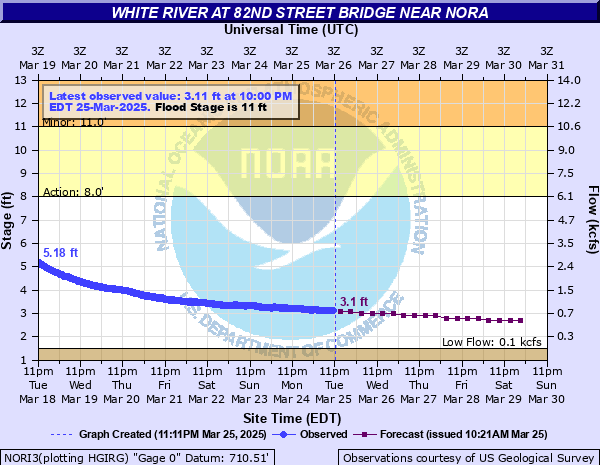
White River (IN) at 82nd Street Bridge near Nora
Critical Stages
8' - Action
11' - Flood
16' - Moderate
19' - Major
Latest Observation
Updated: 1:00 AM EST 12/6/25
Status: No Flooding
Stage: 1.88 ft
Flow: 0.157 kcfs
Forecast
| Time | Stage (ft) | Flow (kcfs) |
|---|---|---|
| 7 AM 12/6 | 1.9 | 0.164 |
| 1 PM 12/6 | 1.9 | 0.164 |
| 7 PM 12/6 | 1.9 | 0.164 |
| 1 AM 12/7 | 1.8 | 0.131 |
| 7 AM 12/7 | 1.8 | 0.131 |
| 1 PM 12/7 | 1.8 | 0.131 |
| 7 PM 12/7 | 1.8 | 0.131 |
| 1 AM 12/8 | 1.8 | 0.131 |
| 7 AM 12/8 | 1.8 | 0.131 |
| 1 PM 12/8 | 1.8 | 0.131 |
| 7 PM 12/8 | 1.8 | 0.131 |
| 1 AM 12/9 | 1.8 | 0.131 |
| 7 AM 12/9 | 1.8 | 0.131 |
| 1 PM 12/9 | 1.8 | 0.131 |
| 7 PM 12/9 | 1.8 | 0.131 |
| 1 AM 12/10 | 1.8 | 0.131 |
| 7 AM 12/10 | 1.8 | 0.131 |
| Time | Stage (ft) | Flow (kcfs) |
|---|---|---|
| 1:00 AM 12/6 | 1.88 | 0.157 |
| 12:45 AM 12/6 | 1.88 | 0.157 |
| 12:30 AM 12/6 | 1.89 | 0.16 |
| 12:15 AM 12/6 | 1.9 | 0.164 |
| 12:00 AM 12/6 | 1.9 | 0.164 |
| 11:45 PM 12/5 | 1.9 | 0.164 |
| 11:30 PM 12/5 | 1.9 | 0.164 |
| 11:15 PM 12/5 | 1.9 | 0.164 |
| 11:00 PM 12/5 | 1.89 | 0.16 |
| 10:45 PM 12/5 | 1.89 | 0.16 |
| 10:30 PM 12/5 | 1.89 | 0.16 |
| 10:15 PM 12/5 | 1.89 | 0.16 |
| 10:00 PM 12/5 | 1.89 | 0.16 |
| 9:45 PM 12/5 | 1.89 | 0.16 |
| 9:30 PM 12/5 | 1.89 | 0.16 |
| 9:15 PM 12/5 | 1.89 | 0.16 |
| 9:00 PM 12/5 | 1.89 | 0.16 |
| 8:45 PM 12/5 | 1.9 | 0.164 |
| 8:30 PM 12/5 | 1.9 | 0.164 |
| 8:15 PM 12/5 | 1.89 | 0.16 |
| 8:00 PM 12/5 | 1.9 | 0.164 |
| 7:45 PM 12/5 | 1.9 | 0.164 |
| 7:30 PM 12/5 | 1.9 | 0.164 |
| 7:15 PM 12/5 | 1.9 | 0.164 |
| 7:00 PM 12/5 | 1.9 | 0.164 |
| 6:45 PM 12/5 | 1.9 | 0.164 |
| 6:30 PM 12/5 | 1.9 | 0.164 |
| 6:15 PM 12/5 | 1.91 | 0.167 |
| 6:00 PM 12/5 | 1.91 | 0.167 |
| 5:45 PM 12/5 | 1.91 | 0.167 |
26' -
Maximum reading possible at gaging station is 26 to 27 feet.
24.5' -
Flood waters reach the bottom of 82nd Street.
22.4' -
Flood waters reach record flood height. Flood waters at the top of Warfleigh levee project in the Broad Ripple area that protects nearly 1400 homes and more than 200 businesses. Thousands of evacuations are necessary. Many local roads and possibly some major highways are flooded. Flood waters begin to enter the Fashion Mall and Clearwater Crossings Shopping Center areas.
21' -
The highest flood since March 1913 is in progress. Flood waters cross Keystone Avenue south of East 80th Street and Westfield Drive in Shore Acres. Extensive flooding of Ravenswood, Mystic Bay, Shore Acres, Rocky Ripple, and areas near the Fashion Mall and Clearwater Crossings Shopping Center. Water more than a foot deep in Riviera Club area. Evacuations are likely to exceed one thousand residents. Flood waters approaching critical levels on the Warfleigh levee project.
20' -
Flood waters approach Keystone Avenue north of White River. Much of Ravenswood, Mystic Bay, and areas on both sides of Keystone Avenue south of East 80th Street are flooded by three feet of water. Flood waters nearing residential areas in Shore Acres, Williams Creek Cutoff east of Marott Park, and on the river side of Union Chapel Road. Extensive flooding of the river side of the flood protection in the vicinity of the Indianapolis Art Center and Edgewater Apartments. Flood waters nearing Arden Drive.
19' -
Major flood is in progress. 200 to 400 homes flood. Water overtops an agricultural levee at Conner Prairie Settlement and is at the top of levee in Rocky Ripple. Warfleigh levee raised and fortified in June 2008 from McDonalds in Broad Ripple to Kessler Boulevard. Luxury homes located on Beach Avenue have three feet of water in their basements. Extensive flooding on both sides of Keystone Avenue south of East 80th Street.
18.75' -
Flood waters reach low steel of the Monon Trail Bridge over the White River.
18.5' -
An agricultural levee may fail at the Connor Prairie Farm located in southern Hamilton County.
18' -
Major damage occurs in the Ravenswood area. Considerable flooding in the Indianapolis Art Center and Edgewater Apartments area. Numerous local streets on the north side of Indianapolis are flooded.
16' -
Many homes experience basement to first floor flooding near White River at East 116th Street and in Ravenswood. River Edge roads flood.
15.3' -
River Road just north of 86th Street near the Fashion Mall at the entrance to condominiums begins to flood. High water affects Ravenswood and River Edge Drive. Many basements in Ravenswood fill with one to two feet of water. Some basements fill with more than three feet of water.
14' -
High water closes East 77th Street near Mystic Bay. River Road floods. River Edge Lane and River Road just north of 86th Street flood. Lowest residential areas begin to flood on River Edge Lane. High water staff gage readings begin at 14 feet and continue to 25 feet.
12.5' -
East 77th Street near Mystic Bay begins to flood.
12' -
White River begins to back up into Mystic Bay and cause the lake level to rise.
11.5' -
A few streets flood in Ravenswood.
11' -
Local roads begin to flood. Howland Ditch begins to flood 69th Street west of Kingsley Drive. Water is at the edge of River Edge Lane and the section of River Road located north of 86th Street and south of I-465.
8.5' -
Backyards of a few homes begin to flood in the Ravenswood area.
3.5' -
River at low level. Using appropriate protection and care, the river can be waded on the south side of 82nd Street bridge.
| Date | Stage (ft) |
|---|---|
| Mar 26, 1913 | 22.4 |
| Jan 1, 1991 | 19.19 |
| Apr 23, 1964 | 18.65 |
| Jan 14, 2005 | 18.56 |
| May 19, 1943 | 18.19 |
| Jun 30, 1957 | 18.04 |
| Jun 15, 1958 | 17.96 |
| Apr 20, 2013 | 17.88 |
| Jul 11, 2003 | 17.78 |
| Feb 25, 1985 | 17.24 |
| Jan 16, 1937 | 17.23 |
| Mar 25, 2007 | 17.06 |
| Jan 6, 1950 | 16.88 |
| Jan 7, 2005 | 16.85 |
| Jan 15, 1930 | 16.8 |
| Jan 24, 1999 | 16.69 |
| May 14, 2002 | 16.58 |
| May 13, 1933 | 16.49 |
| Mar 7, 1963 | 16.48 |
| Mar 2, 2011 | 16.48 |
Data provided by the National Weather Service.