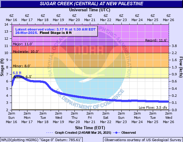
Sugar Creek (central) at New Palestine
Critical Stages
6.5' - Action
8' - Flood
10' - Moderate
11' - Major
Latest Observation
Updated: 12:30 AM EST 12/6/25
Status: No Flooding
Stage: 2.44 ft
Flow: 0.0077 kcfs
Forecast
Forecast not available for this location.
| Time | Stage (ft) | Flow (kcfs) |
|---|---|---|
| 12:30 AM 12/6 | 2.44 | 0.0077 |
| 12:15 AM 12/6 | 2.44 | 0.0077 |
| 12:00 AM 12/6 | 2.44 | 0.0077 |
| 11:45 PM 12/5 | 2.44 | 0.0077 |
| 11:30 PM 12/5 | 2.44 | 0.0077 |
| 11:15 PM 12/5 | 2.44 | 0.0077 |
| 11:00 PM 12/5 | 2.44 | 0.0077 |
| 10:45 PM 12/5 | 2.44 | 0.0077 |
| 10:30 PM 12/5 | 2.44 | 0.0077 |
| 10:15 PM 12/5 | 2.44 | 0.0077 |
| 10:00 PM 12/5 | 2.44 | 0.0077 |
| 9:45 PM 12/5 | 2.44 | 0.0077 |
| 9:30 PM 12/5 | 2.44 | 0.0077 |
| 9:15 PM 12/5 | 2.44 | 0.0077 |
| 9:00 PM 12/5 | 2.44 | 0.0077 |
| 8:45 PM 12/5 | 2.44 | 0.0077 |
| 8:30 PM 12/5 | 2.44 | 0.0077 |
| 8:15 PM 12/5 | 2.44 | 0.0077 |
| 8:00 PM 12/5 | 2.44 | 0.0077 |
| 7:45 PM 12/5 | 2.44 | 0.0077 |
| 7:30 PM 12/5 | 2.44 | 0.0077 |
| 7:15 PM 12/5 | 2.44 | 0.0077 |
| 7:00 PM 12/5 | 2.44 | 0.0077 |
| 6:45 PM 12/5 | 2.44 | 0.0077 |
| 6:30 PM 12/5 | 2.44 | 0.0077 |
| 6:15 PM 12/5 | 2.44 | 0.0077 |
| 6:00 PM 12/5 | 2.44 | 0.0077 |
| 5:45 PM 12/5 | 2.44 | 0.0077 |
| 5:30 PM 12/5 | 2.44 | 0.0077 |
| 5:15 PM 12/5 | 2.44 | 0.0077 |
11.5' -
Extensive flooding occurred along Sugar Creek during December 2013. Local road to the Waste Water Treatment Plant and a few other roads nearby closed by high water. Water 8 inches below the bridge deck on US Hwy 52 on the east side of New Palestine. Flooding of at least one home downstream in Johnson County. This was the highest level for this site since establishment in October 1967.
11' -
Major flood in progress. Flooding of a few homes in the New Palestine area begins. Sugar Creek is extensively flooding. Some local river roads flooded by a few feet of water. Shelby CR 700N may be flooded east of the bridge over Sugar Creek especially if Buck Creek at Acton is 13 feet or higher. Several homes possibly damaged in western Shelby County.
9.5' -
Extensive lowland flooding in progress along Sugar Creek in New Palestine area. Local river roads closed by high water. Flooding of some residential property and backyards begins.
9' -
Extensive flooding along Sugar Creek in southern Hancock and western Shelby Counties. After reaching this level, and when the Big Blue River was near 16.5 feet, one day later several homes along the creek west of Shelbyville were evacuated.
8' -
Lowland flooding in progress along Sugar Creek in New Palestine area. Some local roads may be affected by high water.
7.5' -
Lowland flooding south in Johnson County along the creek.
6.5' -
Lowest areas along Sugar Creek begin to flood in New Palestine area.
| Date | Stage (ft) |
|---|---|
| Dec 22, 2013 | 11.58 |
| Jan 6, 2005 | 10.8 |
| Apr 5, 2025 | 10.35 |
| Feb 23, 1979 | 10.34 |
| Dec 30, 1990 | 10.31 |
| Nov 14, 1993 | 10.08 |
| Jan 13, 2005 | 9.68 |
| Oct 4, 1986 | 9.5 |
| Apr 3, 2018 | 9.5 |
| Jun 15, 1998 | 9.47 |
| Jun 16, 2019 | 9.47 |
| Jun 18, 1992 | 9.47 |
| Jan 5, 2004 | 9.38 |
| Feb 2, 1968 | 9.34 |
| Jan 13, 2013 | 9.33 |
| Feb 24, 1985 | 9.19 |
| Feb 8, 2019 | 9.15 |
| Jun 23, 1974 | 9.12 |
| Mar 5, 2011 | 9.11 |
| May 14, 2002 | 9.09 |
Data provided by the National Weather Service.