Ocmulgee River at US 341 at Hawkinsville
Critical Stages
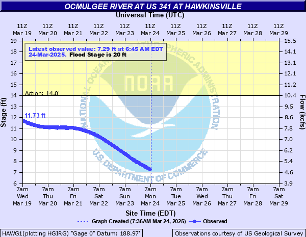
14' - Action
20' - Flood
26' - Moderate
40' - Major
Latest Observation
Updated: 9:45 PM EST 12/15/25
Status: No Flooding
Stage: 2.41 ft
Flow: 1.66 kcfs
Forecast
Forecast not available for this location.
| Time | Stage (ft) | Flow (kcfs) |
|---|---|---|
| 9:45 PM 12/15 | 2.41 | 1.66 |
| 9:30 PM 12/15 | 2.41 | 1.66 |
| 9:15 PM 12/15 | 2.42 | 1.67 |
| 9:00 PM 12/15 | 2.42 | 1.67 |
| 8:45 PM 12/15 | 2.42 | 1.67 |
| 8:30 PM 12/15 | 2.43 | 1.67 |
| 8:15 PM 12/15 | 2.43 | 1.67 |
| 8:00 PM 12/15 | 2.43 | 1.67 |
| 7:45 PM 12/15 | 2.44 | 1.68 |
| 7:30 PM 12/15 | 2.44 | 1.68 |
| 7:15 PM 12/15 | 2.44 | 1.68 |
| 7:00 PM 12/15 | 2.45 | 1.68 |
| 6:45 PM 12/15 | 2.45 | 1.68 |
| 6:30 PM 12/15 | 2.45 | 1.68 |
| 6:15 PM 12/15 | 2.45 | 1.68 |
| 6:00 PM 12/15 | 2.46 | 1.69 |
| 5:45 PM 12/15 | 2.46 | 1.69 |
| 5:30 PM 12/15 | 2.47 | 1.69 |
| 5:15 PM 12/15 | 2.47 | 1.69 |
| 5:00 PM 12/15 | 2.48 | 1.7 |
| 4:45 PM 12/15 | 2.48 | 1.7 |
| 4:30 PM 12/15 | 2.42 | 1.67 |
| 4:15 PM 12/15 | 2.48 | 1.7 |
| 4:00 PM 12/15 | 2.49 | 1.71 |
| 3:45 PM 12/15 | 2.5 | 1.71 |
| 3:30 PM 12/15 | 2.49 | 1.71 |
| 3:15 PM 12/15 | 2.51 | 1.72 |
| 3:00 PM 12/15 | 2.51 | 1.72 |
| 2:45 PM 12/15 | 2.52 | 1.72 |
| 2:30 PM 12/15 | 2.51 | 1.72 |
47.7' -
Major flooding continues in Hawkinsville...and points upstream and downstream of the city. Flood waters reach the Hawkinsville Division Plant. Serious flooding is now occurring through much of the city except for the higher terrain in western downtown and points west.
46.5' -
Major flooding continues in Hawkinsville. This includes points upstream and downstream of the city. The Veterans Memorial Parking lot in Downtown Hawkinsville floods. Much of the south...east...and north sides of the city floods.
45.8' -
Major flooding is occurring in Hawkinsville. Veterans Memorial Monument begins flooding.
42.8' -
Major flooding continues in the city of Hawkinsville and points upstream and downstream from the city. Hollingsworth and Vose Corporation begins to flood.
41.8' -
Major flooding occurs in the city of Hawkinsville and the river reach upstream and downstream from Hawkinsville. Bearden Oil begins flooding on the east side of Hawkinsville.
40.9' -
Major flooding occurs along the river...especially east of the city...in the flood plain. The record crest was 40.9 feet on July 9...1994. This was the result of 10 to 13 inches of rain which fell upstream between Macon and southern part of metro Atlanta.
36.5' -
Moderate flooding continues...as flood waters now will begin entering rail road buildings along the river.
31' -
Moderate flooding occurs...with at least 10 to 15 homes flooded on the south end of Hawkinsville.
26' -
Moderate flooding begins...with several homes surrounded by flood waters and at least 3 homes begin flooding near Gooseneck Lane and RiverView Road.
25' -
Minor flooding occurs...with some roads closed with access to residences. RiverView Road closes to residents.
23' -
Minor flooding continues of roads on the southside of Hawkinsville along Gooseneck Lane, cutting off access to homes. The water will be from 1 to 3 feet deep over the road.
20.5' -
Minor flooding of roads continues on the southside of Hawkinsville...along Gooseneck Lane. Water continues to inundate Gooseneck Lane, cutting off access to homes.
20' -
Minor flooding of roads occurs on the southside of Hawkinsville...along Gooseneck Lane. With the flooding of Gooseneck Lane...residents are cutoff from reaching their homes.
19' -
The river begins to cover Riverside Drive and cutoff residents from their homes.
16' -
Timberlands begin to flood.
14' -
The river comes out of its banks, but impacts are limited.
| Date | Stage (ft) |
|---|---|
| Jul 9, 1994 | 40.91 |
| Jan 21, 1925 | 36.5 |
| Mar 8, 1929 | 34.9 |
| Dec 2, 1948 | 34.4 |
| Apr 12, 1936 | 33 |
| Mar 7, 1971 | 32.1 |
| Mar 25, 1942 | 32.1 |
| Mar 12, 1998 | 32 |
| Mar 19, 1913 | 31 |
| Oct 6, 1929 | 30.5 |
| Mar 22, 1990 | 30.4 |
| Apr 12, 1964 | 30.3 |
| Mar 2, 1961 | 30 |
| Dec 29, 2015 | 29.79 |
| Mar 26, 1944 | 29.7 |
| Dec 15, 1919 | 29.3 |
| Mar 19, 1912 | 29.1 |
| Mar 14, 1922 | 29 |
| Apr 19, 1928 | 28.6 |
| Mar 23, 1943 | 28.4 |
Data provided by the National Weather Service.