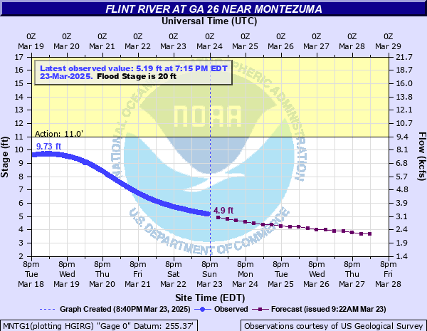
Flint River at GA 26 near Montezuma
Critical Stages
11' - Action
20' - Flood
28' - Moderate
31' - Major
Latest Observation
Updated: 7:15 PM EST 12/15/25
Status: No Flooding
Stage: 2.05 ft
Flow: 1.41 kcfs
Forecast
| Time | Stage (ft) | Flow (kcfs) |
|---|---|---|
| 1 AM 12/16 | 2 | 1.38 |
| 7 AM 12/16 | 2 | 1.38 |
| 1 PM 12/16 | 2 | 1.38 |
| 7 PM 12/16 | 2 | 1.38 |
| 1 AM 12/17 | 2 | 1.38 |
| 7 AM 12/17 | 1.9 | 1.34 |
| 1 PM 12/17 | 1.9 | 1.34 |
| 7 PM 12/17 | 1.9 | 1.34 |
| 1 AM 12/18 | 1.9 | 1.34 |
| 7 AM 12/18 | 1.9 | 1.34 |
| 1 PM 12/18 | 1.9 | 1.34 |
| 7 PM 12/18 | 1.9 | 1.34 |
| 1 AM 12/19 | 1.9 | 1.34 |
| 7 AM 12/19 | 1.8 | 1.3 |
| 1 PM 12/19 | 1.8 | 1.3 |
| 7 PM 12/19 | 1.8 | 1.3 |
| 1 AM 12/20 | 1.7 | 1.25 |
| 7 AM 12/20 | 1.7 | 1.25 |
| Time | Stage (ft) | Flow (kcfs) |
|---|---|---|
| 7:15 PM 12/15 | 2.05 | 1.41 |
| 7:00 PM 12/15 | 2.05 | 1.41 |
| 6:45 PM 12/15 | 2.05 | 1.41 |
| 6:30 PM 12/15 | 2.05 | 1.41 |
| 6:15 PM 12/15 | 2.06 | 1.41 |
| 6:00 PM 12/15 | 2.05 | 1.41 |
| 5:45 PM 12/15 | 2.05 | 1.41 |
| 5:30 PM 12/15 | 2 | 1.38 |
| 5:15 PM 12/15 | 1.94 | 1.36 |
| 5:00 PM 12/15 | 1.93 | 1.35 |
| 4:45 PM 12/15 | 2.06 | 1.41 |
| 4:30 PM 12/15 | 2.05 | 1.41 |
| 4:15 PM 12/15 | 2.05 | 1.41 |
| 4:00 PM 12/15 | 2.07 | 1.41 |
| 3:45 PM 12/15 | 2.07 | 1.41 |
| 3:30 PM 12/15 | 2.06 | 1.41 |
| 3:15 PM 12/15 | 2.06 | 1.41 |
| 3:00 PM 12/15 | 2.05 | 1.41 |
| 2:45 PM 12/15 | 2.07 | 1.41 |
| 2:30 PM 12/15 | 2.07 | 1.41 |
| 2:15 PM 12/15 | 2.06 | 1.41 |
| 2:00 PM 12/15 | 2.05 | 1.41 |
| 1:45 PM 12/15 | 2.06 | 1.41 |
| 1:30 PM 12/15 | 2.06 | 1.41 |
| 1:15 PM 12/15 | 2.07 | 1.41 |
| 1:00 PM 12/15 | 2.06 | 1.41 |
| 12:45 PM 12/15 | 2.06 | 1.41 |
| 12:30 PM 12/15 | 2.07 | 1.41 |
| 12:15 PM 12/15 | 2.06 | 1.41 |
| 12:00 PM 12/15 | 2.08 | 1.42 |
34.11' -
Flood of record. Extensive flooding occurs in downtown Montezuma to stores and businesses. Homes also flood.
33' -
Extensive flood event. Montezuma and Highway 49 bridge flood.
32' -
Major flooding expands. Church just east of Highway 49 Bridge floods. Town of Montezuma floods.
31.5' -
Major flooding begins. The levee at Montezuma will prevent flood waters from entering the town. Any higher level will breech and flood the town.
30' -
Moderate flooding continues. Highway 49 begins to flood.
28' -
Moderate flooding begins. Two businesses just west of Highway 49 bridge flood. In order to prevent rail road from flooding sandbags are required for a levee.
25' -
Flooding of auto store at west end of Highway 26 and 49 occurs.
23' -
Minor flooding continues in the woodlands and extensive flood plain along the river upstream and downstream from the gage on Georgia Highway 26. The access road to Georges Boat Landing will be flooded at least 3 feet deep.
20' -
Flood Stage is reached. Minor flooding begins in the woodlands and extensive flood plain along the river upstream and downstream from the gage on Georgia Highway 26. The access road to Georges Boat Landing is flooded.
17' -
Georges Landing parking lot is completely flooded out. Bankfull conditions expand further into the extensive flood plain of the river upstream and downstream from the gage on Georgia Highway 26. Some low lying areas of pasture lands begin to flood.
11' -
Georges Landing parking lot starts to flood. Water passes top of boat ramp and bankfull conditions occur upstream and downstream from the gage on Georgia Highway 26.
| Date | Stage (ft) |
|---|---|
| Jul 8, 1994 | 34.11 |
| Mar 17, 1929 | 27.4 |
| Mar 1, 1929 | 26.3 |
| Mar 7, 1929 | 26.1 |
| Mar 20, 1990 | 26.05 |
| Mar 2, 1897 | 26 |
| Nov 30, 1948 | 25.2 |
| Jan 20, 1925 | 25 |
| Apr 10, 1964 | 25 |
| Mar 6, 1971 | 24.73 |
| Mar 11, 1998 | 24.16 |
| Feb 28, 1961 | 24 |
| Apr 29, 1908 | 23.2 |
| Apr 12, 1936 | 22.85 |
| Dec 28, 2015 | 22.56 |
| Mar 24, 1943 | 22.5 |
| Mar 25, 1944 | 22.4 |
| Jul 12, 1916 | 22.3 |
| Mar 18, 1913 | 22.3 |
| Mar 30, 2023 | 22.22 |
Data provided by the National Weather Service.