« Back to Onion Mountain Lookout Rivers
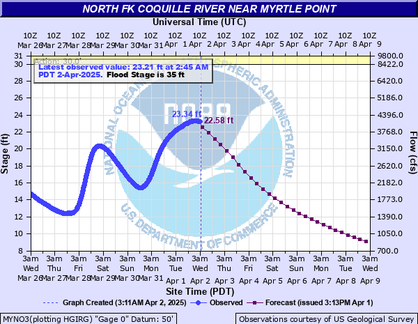
North Fk Coquille River near Myrtle Point
Critical Stages
30' - Action
35' - Flood
36' - Moderate
37' - Major
Latest Observation
Updated: 6:45 AM PST 12/11/25
Status: No Flooding
Stage: 7.83 ft
Flow: 0.669 kcfs
Forecast
| Time | Stage (ft) | Flow (kcfs) |
|---|---|---|
| 10 AM 12/11 | 7.26 | 0.572 |
| 4 PM 12/11 | 7.16 | 0.556 |
| 10 PM 12/11 | 7.03 | 0.535 |
| 4 AM 12/12 | 6.9 | 0.513 |
| 10 AM 12/12 | 6.76 | 0.489 |
| 4 PM 12/12 | 6.62 | 0.466 |
| 10 PM 12/12 | 6.48 | 0.442 |
| 4 AM 12/13 | 6.34 | 0.418 |
| 10 AM 12/13 | 6.21 | 0.395 |
| 4 PM 12/13 | 6.08 | 0.373 |
| 10 PM 12/13 | 5.95 | 0.351 |
| 4 AM 12/14 | 5.82 | 0.328 |
| 10 AM 12/14 | 5.69 | 0.306 |
| 4 PM 12/14 | 5.57 | 0.286 |
| 10 PM 12/14 | 5.44 | 0.266 |
| 4 AM 12/15 | 5.3 | 0.245 |
| 10 AM 12/15 | 5.16 | 0.226 |
| 4 PM 12/15 | 5.04 | 0.21 |
| 10 PM 12/15 | 5.11 | 0.219 |
| 4 AM 12/16 | 5.41 | 0.261 |
| 10 AM 12/16 | 5.88 | 0.338 |
| 4 PM 12/16 | 6.35 | 0.419 |
| 10 PM 12/16 | 6.76 | 0.489 |
| 4 AM 12/17 | 7.04 | 0.536 |
| 10 AM 12/17 | 7.25 | 0.571 |
| 4 PM 12/17 | 7.44 | 0.602 |
| 10 PM 12/17 | 7.63 | 0.634 |
| 4 AM 12/18 | 7.9 | 0.682 |
| 10 AM 12/18 | 8.29 | 0.75 |
| 4 PM 12/18 | 8.91 | 0.863 |
| 10 PM 12/18 | 10.12 | 1.07 |
| 4 AM 12/19 | 12.04 | 1.4 |
| 10 AM 12/19 | 14.06 | 1.78 |
| 4 PM 12/19 | 16.11 | 2.21 |
| 10 PM 12/19 | 17.94 | 2.61 |
| 4 AM 12/20 | 19.5 | 3 |
| Time | Stage (ft) | Flow (kcfs) |
|---|---|---|
| 6:45 AM 12/11 | 7.83 | 0.669 |
| 6:30 AM 12/11 | 7.85 | 0.673 |
| 6:15 AM 12/11 | 7.88 | 0.678 |
| 6:00 AM 12/11 | 7.88 | 0.678 |
| 5:45 AM 12/11 | 7.89 | 0.68 |
| 5:30 AM 12/11 | 7.9 | 0.682 |
| 5:15 AM 12/11 | 7.94 | 0.689 |
| 5:00 AM 12/11 | 7.94 | 0.689 |
| 4:45 AM 12/11 | 7.96 | 0.693 |
| 4:30 AM 12/11 | 7.98 | 0.696 |
| 4:15 AM 12/11 | 7.97 | 0.695 |
| 4:00 AM 12/11 | 8 | 0.7 |
| 3:45 AM 12/11 | 8.01 | 0.702 |
| 3:30 AM 12/11 | 8 | 0.7 |
| 3:15 AM 12/11 | 8.02 | 0.703 |
| 3:00 AM 12/11 | 8.03 | 0.705 |
| 2:45 AM 12/11 | 8.04 | 0.707 |
| 2:30 AM 12/11 | 8.05 | 0.709 |
| 2:15 AM 12/11 | 8.08 | 0.714 |
| 2:00 AM 12/11 | 8.07 | 0.712 |
| 1:45 AM 12/11 | 8.08 | 0.714 |
| 1:30 AM 12/11 | 8.1 | 0.717 |
| 1:15 AM 12/11 | 8.09 | 0.715 |
| 1:00 AM 12/11 | 8.1 | 0.717 |
| 12:45 AM 12/11 | 8.1 | 0.717 |
| 12:30 AM 12/11 | 8.09 | 0.715 |
| 12:15 AM 12/11 | 8.09 | 0.715 |
| 12:00 AM 12/11 | 8.12 | 0.721 |
| 11:45 PM 12/10 | 8.12 | 0.721 |
| 11:30 PM 12/10 | 8.11 | 0.719 |
37' -
Expect significant flooding along the North Fork Coquille River and its tributaries. Significant agricultural flooding can be expected from the Gravelford area to the confluence with the South Fork Coquille River. Log jams are possible above the Copper Bridge which will have greater impacts on this situation should they occur.
35' -
Expect widespread pasture and agricultural flooding. Moderate bank erosion along the North Fork Coquille River and its tributaries can also be expected.
33' -
Expect many areas of pasture flooding particularly near the confluence with the South Fork Coquille River near Myrtle Point. Impacts on cattle and other farm animal grazing should be anticipated.
30' -
Expect some flooding of pasture areas along the North Fork Coquille River in low-lying areas near the river. The rising water may impact cattle and other pasture grazing farm animals.
| Date | Stage (ft) |
|---|---|
| Jan 1, 1910 | 41.2 |
| Dec 22, 2014 | 38.39 |
| Mar 17, 2025 | 37.72 |
| Dec 23, 1964 | 37.45 |
| Mar 10, 1966 | 37.32 |
| Dec 14, 2003 | 37.14 |
| Dec 3, 1998 | 37 |
| Dec 6, 1981 | 37 |
| Jan 8, 1976 | 37 |
| Dec 26, 1955 | 37 |
| Feb 23, 1986 | 36.8 |
| Nov 25, 1977 | 36.5 |
| Jan 4, 1966 | 36.2 |
| Dec 13, 2015 | 36.02 |
| Dec 29, 2008 | 36 |
| Nov 22, 1998 | 35.8 |
| Jan 20, 2012 | 35.76 |
| Jan 20, 2012 | 35.76 |
| Jan 14, 2000 | 35.15 |
| Jan 14, 2024 | 35.07 |
Data provided by the National Weather Service.