Kishwaukee River at Belvidere
Critical Stages
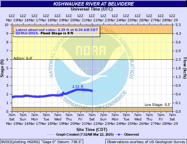
6' - Action
9' - Flood
10' - Moderate
12' - Major
Latest Observation
Updated: 10:30 AM CST 12/6/25
Status: No Flooding
Stage: 1.09 ft
Flow: 0.118 kcfs
Forecast
Forecast not available for this location.
| Time | Stage (ft) | Flow (kcfs) |
|---|---|---|
| 10:30 AM 12/6 | 1.09 | 0.118 |
| 10:15 AM 12/6 | 1.09 | 0.118 |
| 10:00 AM 12/6 | 1.09 | 0.118 |
| 9:45 AM 12/6 | 1.09 | 0.118 |
| 9:30 AM 12/6 | 1.09 | 0.118 |
| 9:15 AM 12/6 | 1.08 | 0.116 |
| 9:00 AM 12/6 | 1.09 | 0.118 |
| 8:45 AM 12/6 | 1.08 | 0.116 |
| 8:30 AM 12/6 | 1.08 | 0.116 |
| 8:15 AM 12/6 | 1.08 | 0.116 |
| 8:00 AM 12/6 | 1.08 | 0.116 |
| 7:45 AM 12/6 | 1.08 | 0.116 |
| 7:30 AM 12/6 | 1.08 | 0.116 |
| 7:15 AM 12/6 | 1.08 | 0.116 |
| 7:00 AM 12/6 | 1.08 | 0.116 |
| 6:45 AM 12/6 | 1.07 | 0.114 |
| 6:30 AM 12/6 | 1.08 | 0.116 |
| 6:15 AM 12/6 | 1.08 | 0.116 |
| 6:00 AM 12/6 | 1.08 | 0.116 |
| 5:45 AM 12/6 | 1.08 | 0.116 |
| 5:30 AM 12/6 | 1.08 | 0.116 |
| 5:15 AM 12/6 | 1.08 | 0.116 |
| 5:00 AM 12/6 | 1.08 | 0.116 |
| 4:45 AM 12/6 | 1.08 | 0.116 |
| 4:30 AM 12/6 | 1.08 | 0.116 |
| 4:15 AM 12/6 | 1.07 | 0.114 |
| 4:00 AM 12/6 | 1.07 | 0.114 |
| 3:45 AM 12/6 | 1.07 | 0.114 |
| 3:30 AM 12/6 | 1.07 | 0.114 |
| 3:15 AM 12/6 | 1.07 | 0.114 |
21' -
I-90 may be threatened west of Belvidere.
19' -
Union Pacific Railroad tracks threatened in Cherry Valley.
16.5' -
Newburg Road threatened west of Belvidere.
16' -
Inundation of structures and roadways reaches 1-2 blocks from the river in downtown Belvidere. Roadways and structures threatened at Bel Mo Mobile Home Park in Belvidere. US-20 Business and Appleton Road threatened in Belvidere. Residences threatened along East Street and Van Buren Street in Cherry Valley.
15.5' -
Belvidere Sewage Treatment Plant threatened. US-20 and Union Pacific Railroad tracks threatened east of Belvidere. Main Street threatened in Belvidere.
15' -
Commercial structures threatened in downtown Belvidere. Widespread inundation of agricultural land and woodland near Belvidere. Water reaches the top of the levee along River Drive in Belvidere. Residential structures threatened along Grove Street and Cherry Street in Cherry Valley. Athletic fields threatened and overflow begins into lake at Baumann Park in Cherry Valley.
14' -
Parking lots threatened in downtown Belvidere.
12' -
Parking lots threatened at Baumann Park in Cherry Valley.
11.5' -
Lawrenceville Road threatened east of Belvidere. Structures in Belvidere Park are threatened. Without flood protection, multiple residential structures threatened along Gaynor Street, Gladys Court, Burgess Road, and River Drive.
11' -
Industrial structures threatened along Pleasant Street and Meadow Street in Belvidere. Epworth Road threatened east of Belvidere. Widespread inundation in Belvidere Park.
10.5' -
Water begins to bypass the main channel east of Belvidere toward Coon Creek and Belmar Golf Club. Without flood protection, Gaynor Street threatened in Belvidere. Trails threatened at Baumann Park in Cherry Valley.
10' -
Trails in Spencer Park threatened. Parking lots threatened in Belvidere Park.
9.5' -
Holiday Acres Campground threatened east of Belvidere. Northwoods RV Resort is threatened in Garden Prairie.
9' -
Boone-McHenry County Line Road threatened. Low-lying areas are threatened in Belvidere Park.
8' -
Trails in Belvidere Park threatened.
6' -
Water overtops low-lying banks along the river in and near Belvidere.
| Date | Stage (ft) |
|---|---|
| Jan 24, 1938 | 16.9 |
| Feb 20, 1994 | 14.19 |
| Jun 14, 1999 | 13.97 |
| Mar 16, 1943 | 13.1 |
| Jan 6, 1946 | 12.9 |
| Jul 3, 1978 | 12.88 |
| Mar 20, 1979 | 12.76 |
| Feb 20, 1971 | 12.74 |
| Mar 31, 1960 | 12.7 |
| Mar 15, 1944 | 12.56 |
| Apr 19, 2013 | 12.31 |
| Sep 4, 2018 | 12 |
| Mar 20, 1948 | 12 |
| Jul 1, 1993 | 11.91 |
| Sep 19, 1972 | 11.8 |
| Feb 22, 1997 | 11.74 |
| Aug 21, 2007 | 11.6 |
| May 17, 1974 | 11.42 |
| Mar 12, 1952 | 11.24 |
| Sep 14, 2019 | 11.21 |
Data provided by the National Weather Service.