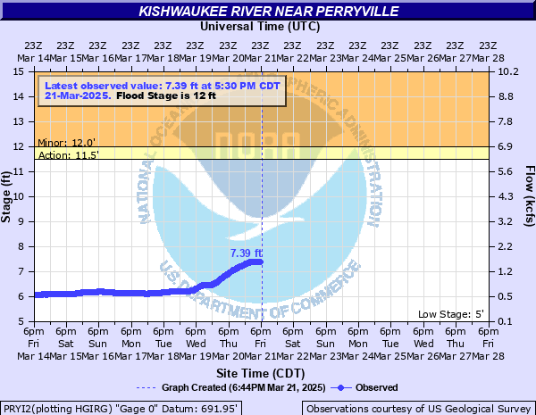
Kishwaukee River near Perryville
Critical Stages
11.5' - Action
12' - Flood
18' - Moderate
22' - Major
Latest Observation
Updated: 10:30 AM CST 12/6/25
Status: No Flooding
Stage: 5.41 ft
Flow: 0.223 kcfs
Forecast
Forecast not available for this location.
| Time | Stage (ft) | Flow (kcfs) |
|---|---|---|
| 10:30 AM 12/6 | 5.41 | 0.223 |
| 10:15 AM 12/6 | 5.41 | 0.223 |
| 10:00 AM 12/6 | 5.41 | 0.223 |
| 9:45 AM 12/6 | 5.41 | 0.223 |
| 9:30 AM 12/6 | 5.41 | 0.223 |
| 9:15 AM 12/6 | 5.4 | 0.219 |
| 9:00 AM 12/6 | 5.4 | 0.219 |
| 8:45 AM 12/6 | 5.4 | 0.219 |
| 8:30 AM 12/6 | 5.4 | 0.219 |
| 8:15 AM 12/6 | 5.4 | 0.219 |
| 8:00 AM 12/6 | 5.4 | 0.219 |
| 7:45 AM 12/6 | 5.4 | 0.219 |
| 7:30 AM 12/6 | 5.41 | 0.223 |
| 7:15 AM 12/6 | 5.41 | 0.223 |
| 7:00 AM 12/6 | 5.41 | 0.223 |
| 6:45 AM 12/6 | 5.41 | 0.223 |
| 6:30 AM 12/6 | 5.41 | 0.223 |
| 6:15 AM 12/6 | 5.41 | 0.223 |
| 6:00 AM 12/6 | 5.41 | 0.223 |
| 5:45 AM 12/6 | 5.41 | 0.223 |
| 5:30 AM 12/6 | 5.41 | 0.223 |
| 5:15 AM 12/6 | 5.41 | 0.223 |
| 5:00 AM 12/6 | 5.41 | 0.223 |
| 4:45 AM 12/6 | 5.41 | 0.223 |
| 4:30 AM 12/6 | 5.41 | 0.223 |
| 4:15 AM 12/6 | 5.41 | 0.223 |
| 4:00 AM 12/6 | 5.41 | 0.223 |
| 3:45 AM 12/6 | 5.41 | 0.223 |
| 3:30 AM 12/6 | 5.41 | 0.223 |
| 3:15 AM 12/6 | 5.42 | 0.226 |
30' -
Beltline Road and Kishwaukee Road threatened south of Rockford. A runway and taxiway may be inundated at Chicago Rockford International Airport.
28' -
Industrial structures threatened along Beltline Road south of Rockford.
27' -
Commercial structures threatened along IL-251 (11th Street) near Rockford and New Milford.
25.5' -
Blackhawk Road threatened south of Rockford.
25' -
Widespread inundation of the floodplain reaches numerous structures along Will James Road, Schell Drive, Milton Road, Vesta Drive, Ralph Road, and Rydberg Road near Rockford and New Milford.
24.5' -
IL-251 (11th Street) threatened near Rockford and New Milford.
23.5' -
Rydberg Road threatened near Rockford and New Milford.
23' -
Residential structures threatened along Rydberg Road near Rockford and New Milford.
22' -
Residential structures threatened along Will James Road near Rockford and New Milford. Structures threatened at Rockford Christian Camp. Water nears a runway at Chicago Rockford International Airport.
21.5' -
Residences threatened along Schell Drive near Rockford and New Milford. Falcon Road threatened at Chicago Rockford International Airport.
21' -
Mulford Road threatened south of Rockford.
19' -
Campsites threatened at Blackhawk Valley Campground south of Rockford.
17' -
Will James Road threatened near Rockford and New Milford.
16' -
Low-lying sections of Atwood Park inundated south of Rockford.
15' -
Old Perryville Road threatened south of Rockford. Widespread inundation of agricultural land and forest land near Chicago Rockford International Airport.
13' -
Roadways threatened at Blackhawk Valley Campground south of Rockford.
12' -
Water overtops low-lying banks in Blackhawk Springs Forest Preserve and in south Rockford near Chicago Rockford International Airport. Trails threatened at Blackhawk Springs Forest Preserve.
10' -
Flooding begins of low lying agricultural lands near the river.
| Date | Stage (ft) |
|---|---|
| Jul 18, 1996 | 23.54 |
| Feb 21, 1994 | 20.71 |
| Mar 21, 1979 | 20.48 |
| Feb 22, 1997 | 19.76 |
| Apr 22, 1973 | 19.65 |
| Jan 6, 1946 | 19.5 |
| Mar 31, 1960 | 19.05 |
| Feb 20, 1971 | 19.03 |
| Jun 15, 1999 | 18.96 |
| Mar 20, 1948 | 18.78 |
| Mar 15, 1944 | 18.63 |
| Jul 3, 1978 | 18.39 |
| May 17, 1974 | 18.27 |
| May 29, 1996 | 18.21 |
| Apr 19, 2013 | 18.19 |
| Jul 25, 2010 | 18.16 |
| Dec 29, 2008 | 17.83 |
| Aug 25, 2007 | 17.56 |
| Mar 16, 1943 | 17.43 |
| Feb 25, 1949 | 17.25 |
Data provided by the National Weather Service.