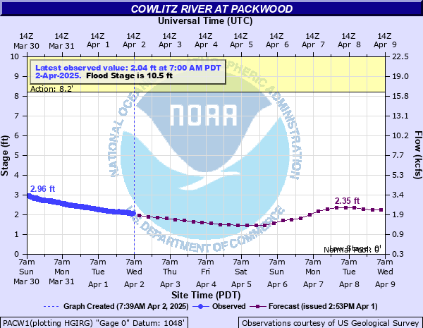
Cowlitz River at Packwood
Critical Stages
8.2' - Action
10.5' - Flood
11' - Moderate
12' - Major
Latest Observation
Updated: 6:00 PM PST 12/14/25
Status: No Flooding
Stage: 2.14 ft
Flow: 1.86 kcfs
Forecast
| Time | Stage (ft) | Flow (kcfs) |
|---|---|---|
| 10 PM 12/14 | 2.25 | 2 |
| 4 AM 12/15 | 2.54 | 2.38 |
| 10 AM 12/15 | 4.63 | 6.3 |
| 4 PM 12/15 | 5.76 | 9.15 |
| 10 PM 12/15 | 5.58 | 8.66 |
| 4 AM 12/16 | 5.25 | 7.81 |
| 10 AM 12/16 | 5.21 | 7.71 |
| 4 PM 12/16 | 5.92 | 9.59 |
| 10 PM 12/16 | 7.79 | 15.1 |
| 4 AM 12/17 | 9.08 | 19.3 |
| 10 AM 12/17 | 8.02 | 15.8 |
| 4 PM 12/17 | 6.67 | 11.8 |
| 10 PM 12/17 | 5.89 | 9.5 |
| 4 AM 12/18 | 5.3 | 7.94 |
| 10 AM 12/18 | 4.77 | 6.63 |
| 4 PM 12/18 | 4.77 | 6.63 |
| 10 PM 12/18 | 5.14 | 7.54 |
| 4 AM 12/19 | 5.23 | 7.76 |
| 10 AM 12/19 | 4.84 | 6.8 |
| 4 PM 12/19 | 4.42 | 5.81 |
| 10 PM 12/19 | 4.11 | 5.14 |
| 4 AM 12/20 | 3.84 | 4.58 |
| 10 AM 12/20 | 3.56 | 4.05 |
| 4 PM 12/20 | 3.27 | 3.53 |
| 10 PM 12/20 | 3.02 | 3.11 |
| 4 AM 12/21 | 2.84 | 2.82 |
| 10 AM 12/21 | 2.71 | 2.63 |
| 4 PM 12/21 | 2.61 | 2.48 |
| 10 PM 12/21 | 2.55 | 2.4 |
| 4 AM 12/22 | 2.51 | 2.34 |
| 10 AM 12/22 | 2.47 | 2.29 |
| 4 PM 12/22 | 2.43 | 2.23 |
| 10 PM 12/22 | 2.38 | 2.17 |
| 4 AM 12/23 | 2.33 | 2.1 |
| 10 AM 12/23 | 2.27 | 2.02 |
| 4 PM 12/23 | 2.22 | 1.96 |
| 10 PM 12/23 | 2.16 | 1.88 |
| 4 AM 12/24 | 2.11 | 1.82 |
| Time | Stage (ft) | Flow (kcfs) |
|---|---|---|
| 6:00 PM 12/14 | 2.14 | 1.86 |
| 5:45 PM 12/14 | 2.14 | 1.86 |
| 5:30 PM 12/14 | 2.16 | 1.88 |
| 5:15 PM 12/14 | 2.15 | 1.87 |
| 5:00 PM 12/14 | 2.17 | 1.9 |
| 4:45 PM 12/14 | 2.15 | 1.87 |
| 4:30 PM 12/14 | 2.19 | 1.92 |
| 4:15 PM 12/14 | 2.19 | 1.92 |
| 4:00 PM 12/14 | 2.19 | 1.92 |
| 3:45 PM 12/14 | 2.2 | 1.93 |
| 3:30 PM 12/14 | 2.2 | 1.93 |
| 3:15 PM 12/14 | 2.21 | 1.94 |
| 3:00 PM 12/14 | 2.22 | 1.96 |
| 2:45 PM 12/14 | 2.22 | 1.96 |
| 2:30 PM 12/14 | 2.21 | 1.94 |
| 2:15 PM 12/14 | 2.19 | 1.92 |
| 2:00 PM 12/14 | 2.2 | 1.93 |
| 1:45 PM 12/14 | 2.2 | 1.93 |
| 1:30 PM 12/14 | 2.23 | 1.97 |
| 1:15 PM 12/14 | 2.24 | 1.98 |
| 1:00 PM 12/14 | 2.22 | 1.96 |
| 12:45 PM 12/14 | 2.21 | 1.94 |
| 12:30 PM 12/14 | 2.26 | 2.01 |
| 12:15 PM 12/14 | 2.22 | 1.96 |
| 12:00 PM 12/14 | 2.27 | 2.02 |
| 11:45 AM 12/14 | 2.23 | 1.97 |
| 11:30 AM 12/14 | 2.26 | 2.01 |
| 11:15 AM 12/14 | 2.26 | 2.01 |
| 11:00 AM 12/14 | 2.23 | 1.97 |
| 10:45 AM 12/14 | 2.27 | 2.02 |
13' -
the Cowlitz River will cause severe near record flooding from the upper reaches of the river downstream through Packwood...with dangerous inundation of residential and commercial areas...roads...and farms throughout the flood plain. Flooding will occur all along the river including headwaters...tributaries...and other streams within and near the Cowlitz River Basin.
12' -
the Cowlitz River will cause major flooding from the upper reaches of the river downstream through Packwood...with dangerous flooding of roads including US Highway 12...pasture lands...and farms throughout the flood plain. Flood waters will inundate some residential and commercial areas. Flooding will occur all along the river including headwaters...tributaries...and other streams within and near the Cowlitz River Basin.
11' -
the Cowlitz River will cause flooding from the upper reaches of the river downstream through Packwood...inundating roads...pasture lands...and some farms.
10.5' -
the Cowlitz River will cause minor flooding from the upper reaches of the river downstream through Packwood...covering several roads along the river and nearby pasture lands.
10' -
the Cowlitz River will spill over its banks into nearby low pasture lands from the upper reaches downstream through Packwood.
| Date | Stage (ft) |
|---|---|
| Nov 6, 2006 | 14.59 |
| Dec 2, 1977 | 13.73 |
| Nov 23, 1959 | 13.54 |
| Nov 20, 1962 | 13.23 |
| Dec 21, 1933 | 13 |
| Dec 26, 1980 | 12.8 |
| Dec 4, 1975 | 12.8 |
| Nov 24, 1990 | 12.48 |
| Nov 27, 1949 | 11.98 |
| Jan 31, 2003 | 11.93 |
| Dec 19, 1917 | 11.9 |
| Jan 15, 1974 | 11.88 |
| Nov 24, 1986 | 11.41 |
| Jan 9, 1990 | 11.34 |
| Nov 23, 1942 | 11.26 |
| Nov 25, 1999 | 11.22 |
| Oct 19, 1947 | 11.19 |
| Oct 27, 1967 | 11.1 |
| Nov 5, 1934 | 11.08 |
| Oct 22, 1959 | 10.92 |
Data provided by the National Weather Service.