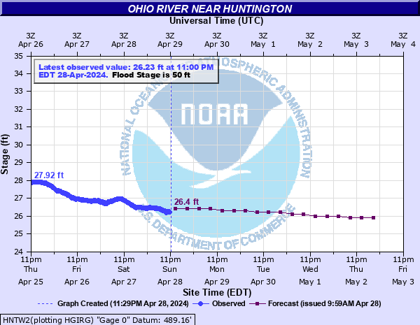
Ohio River near Huntington
Critical Stages
48' - Action
50' - Flood
55' - Moderate
59' - Major
Latest Observation
Updated: 11:00 PM EST 12/4/25
Status: No Flooding
Stage: 25.89 ft
Flow: -999 kcfs
Forecast
| Time | Stage (ft) | Flow (kcfs) |
|---|---|---|
| 1 AM 12/5 | 26.3 | -999 |
| 7 AM 12/5 | 26.2 | -999 |
| 1 PM 12/5 | 26.2 | -999 |
| 7 PM 12/5 | 26.2 | -999 |
| 1 AM 12/6 | 26.1 | -999 |
| 7 AM 12/6 | 26.1 | -999 |
| 1 PM 12/6 | 26.1 | -999 |
| 7 PM 12/6 | 26 | -999 |
| 1 AM 12/7 | 26 | -999 |
| 7 AM 12/7 | 26 | -999 |
| 1 PM 12/7 | 26 | -999 |
| 7 PM 12/7 | 26 | -999 |
| 1 AM 12/8 | 26 | -999 |
| 7 AM 12/8 | 26 | -999 |
| 1 PM 12/8 | 26 | -999 |
| 7 PM 12/8 | 25.9 | -999 |
| 1 AM 12/9 | 25.9 | -999 |
| 7 AM 12/9 | 25.9 | -999 |
| Time | Stage (ft) | Flow (kcfs) |
|---|---|---|
| 12:00 AM 12/5 | 25.93 | -999 |
| 11:45 PM 12/4 | 25.94 | -999 |
| 11:30 PM 12/4 | 25.94 | -999 |
| 11:15 PM 12/4 | 25.93 | -999 |
| 11:00 PM 12/4 | 25.89 | -999 |
| 10:45 PM 12/4 | 25.89 | -999 |
| 10:30 PM 12/4 | 25.91 | -999 |
| 10:15 PM 12/4 | 25.9 | -999 |
| 10:00 PM 12/4 | 25.91 | -999 |
| 9:45 PM 12/4 | 25.91 | -999 |
| 9:30 PM 12/4 | 25.92 | -999 |
| 9:15 PM 12/4 | 25.9 | -999 |
| 9:00 PM 12/4 | 25.81 | -999 |
| 8:45 PM 12/4 | 25.97 | -999 |
| 8:30 PM 12/4 | 25.94 | -999 |
| 8:15 PM 12/4 | 25.92 | -999 |
| 8:00 PM 12/4 | 25.96 | -999 |
| 7:45 PM 12/4 | 26.04 | -999 |
| 7:30 PM 12/4 | 25.98 | -999 |
| 7:15 PM 12/4 | 25.97 | -999 |
| 7:00 PM 12/4 | 25.91 | -999 |
| 6:45 PM 12/4 | 25.93 | -999 |
| 6:30 PM 12/4 | 25.95 | -999 |
| 6:15 PM 12/4 | 25.98 | -999 |
| 6:00 PM 12/4 | 25.99 | -999 |
| 5:45 PM 12/4 | 25.94 | -999 |
| 5:30 PM 12/4 | 25.97 | -999 |
| 5:15 PM 12/4 | 26 | -999 |
| 5:00 PM 12/4 | 26.03 | -999 |
| 4:45 PM 12/4 | 26.07 | -999 |
66.5' -
WV Route 60 West near the Big Sandy flood gate floods. The C&O railroad, near 31st Street (OH section), flood gate, is closed at 67.5 feet.
65' -
Between 65 and 66 feet, WV Route 10 at Salt Rock and Sarah, flood. The C&O railroad, at Hite Street, and 5th Street Bridge Crossing (Guyadotte section) flood gates are closed.
63' -
Between 63 and 64.5 feet, WV Route 152 near Lavalette, floods. Sunset Drive, WV American Water Plant (OH section), and C&O railroad at 6th Street (Guyandotte section) flood gates are closed.
62' -
WV Route 75 between Kenova and Wayne flood. WV Route 60 West near the James River bridge floods.
60' -
3rd Avenue (OH section) floods at 60.7 feet and C&O railroad west floods at 62.7 feet, and the flood gates are closed.
59' -
OH Route 7 near Chesapeake and at Proctorville flood between 59 and 60 feet. The 5th Avenue, Piedmont Road, Waverly Road (Route 60), 20th Street East (OH Section), 3rd Avenue, Main Street, and Altizer Avenue (Guyandotte section) flood gates are closed.
57' -
OH Route 52 near Chesapeake floods. OH Route 52 in South Point, 5 miles west of the bridge at 6th Street, floods.
56' -
WV Route 60 West floods near the Old Lock 1 barge tieoff on the Big Sandy River. The 1st Street at Taylor's Scrap Metal, 18th Street East at Steel of WV (Ohio Section), and the B&O railroad at 40th Street (Guyandotte Section) flood gates are closed.
55' -
Between 55 and 56 feet, WV Route 2 at the Huntington flood wall gate floods. WV Route 60 East, between Barboursville and Milton, at the railroad overpass floods. KY Route 3 in Catlettsburg, near Old Dam 29, floods due to backwater. WV Route 60 East, at Eastern Heights, floods. The Riverside Drive (Guyandotte Section) flood gate is closed.
53.5' -
Between 53.5 and 55 feet, WV Route 60 West, near the Catlettsburg west gate flood wall, near the Ceredo flood gate, and near the Roby Road flood gate flood. West Gate Special Metals, Buffington Street, 9th Avenue, East Gate Special Metals, 5th Avenue, and WV State Route 2 (Guyandotte section) flood gates are closed.
52' -
Between 52 and 53 feet, WV Route 60 East, above the Roby Road bridge, and Riverside Drive flood. The 12th Street East and the 10th Street East flood gates are closed.
51' -
WV Route 60 East, Main Street, and above Pats Branch flood.
50' -
WV Route 2 at Glenwood floods. Many low lying sections near the river flood due to backwater.
| Date | Stage (ft) |
|---|---|
| Jan 28, 1937 | 69.45 |
| Mar 30, 1913 | 66.3 |
| Feb 11, 1884 | 64.8 |
| Jan 1, 1832 | 61.8 |
| Apr 16, 1948 | 61.6 |
| Jan 1, 1847 | 61.1 |
| Jan 1, 1883 | 60.5 |
| Jan 1, 1943 | 60.11 |
| Mar 9, 1945 | 59.86 |
| Mar 7, 1955 | 59.54 |
| Jan 1, 1897 | 59.4 |
| Jan 1, 1910 | 59 |
| Mar 23, 1936 | 58.82 |
| Mar 18, 1907 | 58.2 |
| Mar 5, 1997 | 57.52 |
| Feb 5, 1939 | 56.92 |
| Apr 23, 1940 | 56.66 |
| Mar 13, 1964 | 54.79 |
| Feb 27, 1979 | 54.24 |
| Dec 11, 1978 | 54 |
Data provided by the National Weather Service.