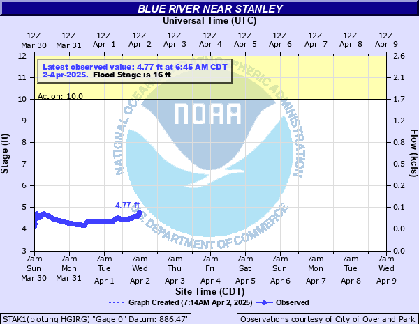
Blue River near Stanley
Critical Stages
10' - Action
16' - Flood
18' - Moderate
30' - Major
Latest Observation
Updated: 3:45 PM CST 12/15/25
Status: No Flooding
Stage: 3.62 ft
Flow: 0.0023 kcfs
Forecast
Forecast not available for this location.
| Time | Stage (ft) | Flow (kcfs) |
|---|---|---|
| 4:45 PM 12/15 | 3.62 | 0.0023 |
| 4:30 PM 12/15 | 3.62 | 0.0023 |
| 4:15 PM 12/15 | 3.62 | 0.0023 |
| 4:00 PM 12/15 | 3.61 | 0.0021 |
| 3:45 PM 12/15 | 3.62 | 0.0023 |
| 3:30 PM 12/15 | 3.62 | 0.0023 |
| 3:15 PM 12/15 | 3.62 | 0.0023 |
| 3:00 PM 12/15 | 3.62 | 0.0023 |
| 2:45 PM 12/15 | 3.62 | 0.0023 |
| 2:30 PM 12/15 | 3.61 | 0.0021 |
| 2:15 PM 12/15 | 3.62 | 0.0023 |
| 2:00 PM 12/15 | 3.62 | 0.0023 |
| 1:45 PM 12/15 | 3.62 | 0.0023 |
| 1:30 PM 12/15 | 3.62 | 0.0023 |
| 1:15 PM 12/15 | 3.62 | 0.0023 |
| 1:00 PM 12/15 | 3.61 | 0.0021 |
| 12:45 PM 12/15 | 3.62 | 0.0023 |
| 12:30 PM 12/15 | 3.62 | 0.0023 |
| 12:15 PM 12/15 | 3.62 | 0.0023 |
| 12:00 PM 12/15 | 3.62 | 0.0023 |
| 11:45 AM 12/15 | 3.62 | 0.0023 |
| 11:30 AM 12/15 | 3.62 | 0.0023 |
| 11:15 AM 12/15 | 3.63 | 0.0025 |
| 11:00 AM 12/15 | 3.62 | 0.0023 |
| 10:45 AM 12/15 | 3.61 | 0.0021 |
| 10:30 AM 12/15 | 3.61 | 0.0021 |
| 10:15 AM 12/15 | 3.61 | 0.0021 |
| 10:00 AM 12/15 | 3.62 | 0.0023 |
| 9:45 AM 12/15 | 3.61 | 0.0021 |
| 9:30 AM 12/15 | 3.61 | 0.0021 |
37.1' -
Water overtops the U.S. Highway 69 bridge over the Blue River around 3 miles south of Stanley.
32.8' -
Water reaches the bottom of the U.S. Highway 69 bridge over the Blue River around 3 miles south of Stanley.
18' -
Flood waters enter the yards of a few homes along the river and threaten rural roads.
16' -
Farmland adjacent to the Blue River floods.
| Date | Stage (ft) |
|---|---|
| Aug 22, 2017 | 21.7 |
| May 15, 1990 | 20.51 |
| Jul 27, 2017 | 20.19 |
| May 19, 2004 | 20.12 |
| Jul 10, 1993 | 20.1 |
| Jun 4, 2008 | 19.68 |
| Mar 4, 2004 | 19.44 |
| Jun 9, 1984 | 18.98 |
| May 17, 1995 | 18.77 |
| May 31, 2013 | 18.31 |
| Sep 27, 1986 | 18.31 |
| Oct 8, 2018 | 17.51 |
| Jun 14, 2010 | 17.41 |
| Jun 25, 1969 | 17.11 |
| Jul 6, 1993 | 17.1 |
| Jun 4, 2005 | 16.89 |
| Jun 9, 1974 | 16.83 |
| Jun 12, 2010 | 16.83 |
| May 28, 2020 | 16.59 |
| May 16, 1982 | 16.46 |
Data provided by the National Weather Service.