« Back to Pittsburg County Rivers
Canadian River near Calvin
Critical Stages
18' - Action
20' - Flood
23' - Moderate
25' - Major
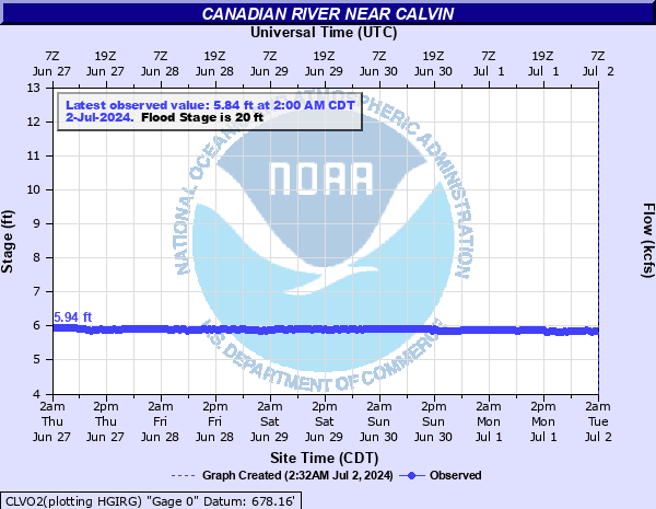
Latest Observation
Updated: 9:00 AM CST 12/6/25
Status: No Flooding
Stage: 5.93 ft
Flow: 0.385 kcfs
Forecast
Forecast not available for this location.
| Time | Stage (ft) | Flow (kcfs) |
|---|---|---|
| 9:00 AM 12/6 | 5.93 | 0.385 |
| 8:30 AM 12/6 | 5.94 | 0.388 |
| 8:00 AM 12/6 | 5.93 | 0.385 |
| 7:30 AM 12/6 | 5.93 | 0.385 |
| 7:00 AM 12/6 | 5.93 | 0.385 |
| 6:30 AM 12/6 | 5.92 | 0.381 |
| 6:00 AM 12/6 | 5.93 | 0.385 |
| 5:30 AM 12/6 | 5.91 | 0.377 |
| 5:00 AM 12/6 | 5.93 | 0.385 |
| 4:30 AM 12/6 | 5.92 | 0.381 |
| 4:00 AM 12/6 | 5.92 | 0.381 |
| 3:30 AM 12/6 | 5.93 | 0.385 |
| 3:00 AM 12/6 | 5.92 | 0.381 |
| 2:30 AM 12/6 | 5.93 | 0.385 |
| 2:00 AM 12/6 | 5.92 | 0.381 |
| 1:30 AM 12/6 | 5.93 | 0.385 |
| 1:00 AM 12/6 | 5.93 | 0.385 |
| 12:30 AM 12/6 | 5.92 | 0.381 |
| 12:00 AM 12/6 | 5.92 | 0.381 |
| 11:30 PM 12/5 | 5.92 | 0.381 |
| 11:00 PM 12/5 | 5.94 | 0.388 |
| 10:30 PM 12/5 | 5.93 | 0.385 |
| 10:00 PM 12/5 | 5.93 | 0.385 |
| 9:30 PM 12/5 | 5.93 | 0.385 |
| 9:00 PM 12/5 | 5.93 | 0.385 |
| 8:30 PM 12/5 | 5.94 | 0.388 |
| 8:00 PM 12/5 | 5.93 | 0.385 |
| 7:30 PM 12/5 | 5.94 | 0.388 |
| 7:00 PM 12/5 | 5.93 | 0.385 |
| 6:30 PM 12/5 | 5.93 | 0.385 |
28' -
Valley-wide flooding of agricultural lands and rural roads occurs. Varying water depths up to about 8 feet may result in severe damage to property and the loss of livestock. Upstream areas along the river in northern Pontotoc... southern Seminole... and west central Hughes counties are flooded before the areas near Calvin. Downstream areas in eastern Hughes County are affected hours later. The town of Calvin and U.S. Highway 75 are not threatened.
27' -
Flooding of agricultural lands... oilfeilds... and rural roads occurs. Varying water depths up to about 7 feet may result in severe damage to property and the loss of livestock. Upstream areas along the river in northern Pontotoc... southern Seminole... and west central Hughes counties are flooded before the areas near Calvin. Downstream areas in eastern Hughes County are affected hours later. The town of Calvin and U.S. Highway 75 are not threatened.
26' -
Flooding of agricultural lands... oilfields... and rural roads occurs. Varying water depths up to about 6 feet may result in severe damage to property and the loss of livestock. Upstream areas along the river in northern Pontotoc... southern Seminole... and west central Hughes counties are flooded before the areas near Calvin. Downstream areas in eastern Hughes County are affected hours later. The town of Calvin and U.S. Highway 75 are not threatened.
25' -
Flooding of agricultural lands... oilfields... and rural roads occurs. Varying water depths up to about 5 feet may result in severe damage to property and the loss of livestock. Upstream areas along the river in northern Pontotoc... southern Seminole... and west central Hughes counties are flooded before the areas near Calvin. Downstream areas in eastern Hughes County are affected hours later. The town of Calvin and U.S. Highway 75 are not threatened.
24' -
Flooding of croplands... pastures... oilfields and rural roads... with water depths up to 4 feet may occur. Upstream areas along the river in northern Pontotoc... southern Seminole... and west central Hughes counties are flooded before the areas near Calvin. Downstream areas in eastern Hughes County are affected hours later. The town of Calvin and U.S. Highway 75 are not threatened.
23' -
Flooding of croplands... pastures... oilfields and rural roads... with water depths up to 3 feet may occur. Upstream areas along the river in northern Pontotoc... southern Seminole... and west central Hughes counties are flooded before the areas near Calvin. Downstream areas in eastern Hughes County are affected hours later. The town of Calvin and U.S. Highway 75 are not threatened.
22' -
Flooding of croplands... pastures... oilfields and rural roads... with water depths up to 2 feet may occur. Upstream areas along the river in northern Pontotoc... southern Seminole... and west central Hughes counties are flooded before the areas near Calvin. Downstream areas in eastern Hughes County are affected hours later. The town of Calvin and U.S. Highway 75 are not threatened.
21' -
Croplands... pastures... oilfields... and local roads may sustain shallow overflows. Upstream areas along the river in northern Pontotoc... southern Seminole... and west central Hughes counties are flooded before the areas near Calvin. Downstream areas in eastern Hughes County are affected hours later. The town of Calvin and U.S. Highway 75 are not threatened.
20' -
Croplands... pastures... oilfields... and local roads may sustain shallow overflows. Upstream areas along the river in northern Pontotoc... southern Seminole... and west central Hughes counties are flooded before the areas near Calvin. Downstream areas in eastern Hughes County are affected hours later. The town of Calvin and U.S. Highway 75 are not threatened.
19' -
Croplands... pastures... oilfields... and local roads may sustain shallow overflows. Upstream areas along the river in northern Pontotoc... southern Seminole... and west central Hughes counties are covered before the areas near Calvin. Downstream areas in eastern Hughes County are affected hours later.
18' -
Croplands... pastures... oilfields... and local roads may sustain shallow overflows. Upstream areas along the river in northern Pontotoc... southern Seminole... and west central Hughes counties are covered before the areas near Calvin. Downstream areas in eastern Hughes County are affected hours later.
| Date | Stage (ft) |
|---|---|
| Aug 7, 1906 | 26 |
| Oct 4, 1904 | 25.5 |
| May 3, 1914 | 25 |
| May 11, 1950 | 24.35 |
| May 24, 1908 | 24.2 |
| May 5, 1941 | 24 |
| May 3, 1990 | 23.97 |
| May 18, 1949 | 22.55 |
| Jun 24, 1948 | 22.2 |
| May 31, 1937 | 22 |
| Jun 18, 2015 | 21.84 |
| May 25, 2015 | 21.82 |
| May 10, 1943 | 21.8 |
| Apr 28, 2021 | 21.46 |
| Apr 26, 1990 | 21.33 |
| May 18, 1957 | 21.1 |
| Oct 30, 1941 | 20.9 |
| May 29, 1987 | 20.88 |
| Sep 25, 1941 | 20.85 |
| Jul 8, 2015 | 20.64 |
Data provided by the National Weather Service.