« Back to Pittsburg County Rivers
Little River (OK) near Sasakwa
Critical Stages
24' - Action
26' - Flood
28' - Moderate
30' - Major
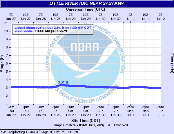
Latest Observation
Updated: 8:30 AM CST 12/6/25
Status: No Flooding
Stage: 3.14 ft
Flow: 0.0156 kcfs
Forecast
Forecast not available for this location.
| Time | Stage (ft) | Flow (kcfs) |
|---|---|---|
| 9:30 AM 12/6 | 3.14 | 0.0156 |
| 9:15 AM 12/6 | 3.14 | 0.0156 |
| 9:00 AM 12/6 | 3.13 | 0.0149 |
| 8:45 AM 12/6 | 3.14 | 0.0156 |
| 8:30 AM 12/6 | 3.14 | 0.0156 |
| 8:15 AM 12/6 | 3.13 | 0.0149 |
| 8:00 AM 12/6 | 3.13 | 0.0149 |
| 7:45 AM 12/6 | 3.13 | 0.0149 |
| 7:30 AM 12/6 | 3.13 | 0.0149 |
| 7:15 AM 12/6 | 3.13 | 0.0149 |
| 7:00 AM 12/6 | 3.12 | 0.0142 |
| 6:45 AM 12/6 | 3.12 | 0.0142 |
| 6:30 AM 12/6 | 3.12 | 0.0142 |
| 6:15 AM 12/6 | 3.12 | 0.0142 |
| 6:00 AM 12/6 | 3.12 | 0.0142 |
| 5:45 AM 12/6 | 3.12 | 0.0142 |
| 5:30 AM 12/6 | 3.12 | 0.0142 |
| 5:15 AM 12/6 | 3.12 | 0.0142 |
| 5:00 AM 12/6 | 3.12 | 0.0142 |
| 4:45 AM 12/6 | 3.12 | 0.0142 |
| 4:30 AM 12/6 | 3.11 | 0.0135 |
| 4:15 AM 12/6 | 3.11 | 0.0135 |
| 4:00 AM 12/6 | 3.11 | 0.0135 |
| 3:45 AM 12/6 | 3.11 | 0.0135 |
| 3:30 AM 12/6 | 3.11 | 0.0135 |
| 3:15 AM 12/6 | 3.1 | 0.0128 |
| 3:00 AM 12/6 | 3.1 | 0.0128 |
| 2:45 AM 12/6 | 3.09 | 0.0122 |
| 2:30 AM 12/6 | 3.09 | 0.0122 |
| 2:15 AM 12/6 | 3.1 | 0.0128 |
35' -
Dangerous flood depths varying up to 9 feet inundate croplands and pastures along the Little River extending from near the State Highway 99 bridge to north of Sasakwa in Seminole County... to the confluence with the Canadian River in Hughes County. Floodwaters close State Highway 99 near the river and south of Bowlegs. Flood levels will be a 1.5 feet higher than the flood crest of May 11...1950.
34' -
Dangerous flood depths varying up to 8 feet inundate croplands and pastures along the Little River extending from near the State Highway 99 bridge to north of Sasakwa in Seminole County... to the confluence with the Canadian River in Hughes County. Floodwaters close State Highway 99 near the river and south of Bowlegs. Flood levels will be a half foot higher than the flood crest of May 11...1950.
33' -
Flood depths varying up to 7 feet inundate croplands and pastures along the Little River extending from near the State Highway 99 bridge to north of Sasakwa in Seminole County... to the confluence with the Canadian River in Hughes County. Floodwaters close State Highway 99 near the river and south of Bowlegs.
32' -
Flood depths varying up to 6 feet inundate croplands and pastures along the Little River extending from near the State Highway 99 bridge to north of Sasakwa in Seminole County... to the confluence with the Canadian River in Hughes County. Floodwaters close State Highway 99 near the river and south of Bowlegs.
31' -
Flood depths varying up to 5 feet inundate croplands and pastures along the Little River extending from near the State Highway 99 bridge to north of Sasakwa in Seminole County... to the confluence with the Canadian River in Hughes County. Floodwaters close State Highway 99 near the river and south of Bowlegs.
30' -
Flood depths varying up to 4 feet inundate croplands and pastures along the Little River extending from near the State Highway 99 bridge to north of Sasakwa in Seminole County... to the confluence with the Canadian River in Hughes County. Floodwaters close State Highway 99 near the river and south of Bowlegs.
29' -
Flood depths varying up to 3 feet inundate croplands and pastures along the Little River extending from near the State Highway 99 bridge to north of Sasakwa in Seminole County... to the confluence with the Canadian River in Hughes County. Floodwaters close State Highway 99 near the river and south of Bowlegs.
28' -
Flood depths varying up to 2 feet inundate croplands and pastures along the Little River extending from near the State Highway 99 bridge to north of Sasakwa in Seminole County... to the confluence with the Canadian River in Hughes County. Floodwaters close State Highway 99 near the river and south of Bowlegs.
27' -
Flood depths to about 1 foot of croplands and pastures along the Little River extending from near the State Highway 99 bridge to north of Sasakwa in Seminole County... to the confluence with the Canadian River in Hughes County. Floodwaters cover State Highway 99 near the river and south of Bowlegs.
26' -
Shallow flooding of croplands and pastures will extend along the Little River from near the State Highway 99 bridge to north of Sasakwa in Seminole County... to the confluence with the Canadian River in Hughes County. Floodwaters begin to overflow State Highway 99 near the river and south of Bowlegs.
25' -
Flooding of lowlands may occur along the Little River from near the State Highway 99 bridge to north of Sasakwa in Seminole County... to the confluence with the Canadian River in Hughes County.
24' -
Near bankfull conditions occur along the Little River from near the State Highway 99 bridge to north of Sasakwa in Seminole County... to the confluence with the Canadian River in Hughes County.
| Date | Stage (ft) |
|---|---|
| May 11, 1950 | 33.48 |
| Apr 15, 1945 | 32.5 |
| May 1, 1985 | 31.73 |
| Jun 19, 2015 | 31.67 |
| May 19, 1949 | 30.8 |
| May 11, 1943 | 30.8 |
| Jun 24, 1948 | 30.63 |
| Mar 27, 1990 | 29.96 |
| May 18, 1957 | 29.8 |
| Nov 12, 1992 | 29.53 |
| May 2, 2025 | 29.06 |
| May 27, 1957 | 28.71 |
| Jul 8, 2015 | 28.55 |
| Aug 21, 1958 | 28.24 |
| May 10, 2015 | 27.74 |
| Oct 1, 1945 | 27.5 |
| May 27, 2015 | 27.21 |
| Jun 10, 1979 | 27.14 |
| Mar 16, 1945 | 27 |
| Apr 27, 1999 | 26.77 |
Data provided by the National Weather Service.