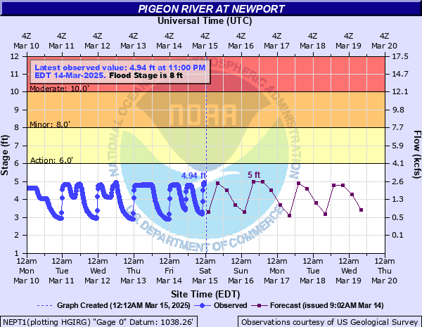
Pigeon River at Newport
Critical Stages
6' - Action
8' - Flood
10' - Moderate
12' - Major
Latest Observation
Updated: 10:00 AM EST 12/6/25
Status: No Flooding
Stage: 2.84 ft
Flow: 0.359 kcfs
Forecast
| Time | Stage (ft) | Flow (kcfs) |
|---|---|---|
| 1 PM 12/6 | 4.2 | 1.55 |
| 7 PM 12/6 | 2.9 | 0.393 |
| 1 AM 12/7 | 4.4 | 1.79 |
| 7 AM 12/7 | 2.9 | 0.393 |
| 1 PM 12/7 | 4 | 1.32 |
| 7 PM 12/7 | 4.2 | 1.55 |
| 1 AM 12/8 | 2.9 | 0.393 |
| 7 AM 12/8 | 3.7 | 1 |
| 1 PM 12/8 | 4 | 1.32 |
| 7 PM 12/8 | 3.9 | 1.21 |
| 1 AM 12/9 | 3.6 | 0.912 |
| 7 AM 12/9 | 3.3 | 0.658 |
| 1 PM 12/9 | 4.2 | 1.55 |
| 7 PM 12/9 | 4 | 1.32 |
| 1 AM 12/10 | 3.1 | 0.516 |
| 7 AM 12/10 | 3.3 | 0.658 |
| 1 PM 12/10 | 3.9 | 1.21 |
| 7 PM 12/10 | 4.3 | 1.67 |
| 1 AM 12/11 | 3.6 | 0.912 |
| 7 AM 12/11 | 3.6 | 0.912 |
| Time | Stage (ft) | Flow (kcfs) |
|---|---|---|
| 10:00 AM 12/6 | 2.84 | 0.359 |
| 9:45 AM 12/6 | 2.85 | 0.365 |
| 9:30 AM 12/6 | 2.85 | 0.365 |
| 9:15 AM 12/6 | 2.86 | 0.37 |
| 9:00 AM 12/6 | 2.87 | 0.376 |
| 8:45 AM 12/6 | 2.89 | 0.387 |
| 8:30 AM 12/6 | 2.9 | 0.393 |
| 8:15 AM 12/6 | 2.91 | 0.399 |
| 8:00 AM 12/6 | 2.93 | 0.411 |
| 7:45 AM 12/6 | 2.95 | 0.424 |
| 7:30 AM 12/6 | 2.97 | 0.436 |
| 7:15 AM 12/6 | 2.99 | 0.449 |
| 7:00 AM 12/6 | 3.02 | 0.467 |
| 6:45 AM 12/6 | 3.04 | 0.479 |
| 6:30 AM 12/6 | 3.07 | 0.497 |
| 6:15 AM 12/6 | 3.1 | 0.516 |
| 6:00 AM 12/6 | 3.13 | 0.536 |
| 5:45 AM 12/6 | 3.16 | 0.556 |
| 5:30 AM 12/6 | 3.2 | 0.584 |
| 5:15 AM 12/6 | 3.25 | 0.62 |
| 5:00 AM 12/6 | 3.3 | 0.658 |
| 4:45 AM 12/6 | 3.34 | 0.689 |
| 4:30 AM 12/6 | 3.4 | 0.738 |
| 4:15 AM 12/6 | 3.46 | 0.79 |
| 4:00 AM 12/6 | 3.53 | 0.852 |
| 3:45 AM 12/6 | 3.6 | 0.912 |
| 3:30 AM 12/6 | 3.67 | 0.976 |
| 3:15 AM 12/6 | 3.75 | 1.05 |
| 3:00 AM 12/6 | 3.83 | 1.13 |
| 2:45 AM 12/6 | 3.9 | 1.21 |
29.73' -
Preliminary Flood of Record from 2024 Helene event according to USGS analysis. Water inundates Grace Baptist Church to the lowest gutters; nearby houses inundated with nearly 4 to 6 feet of water. Large swath of downtown Newport including East Broadway and East Main flood with up to a foot or two of water, between N Jefferson Ave and Bear Ave, entering numerous buildings with street-level floors. Inundation of the East Broadway and TN-73 intersection but the Dollar General, mansion, and bridge do not flood.
28' -
Flooding of City Hall main floor begins. The Courthouse Annex may also be threatened with water.
27.5' -
Flooding of dance studio building next door to City Hall begins.
23.4' -
Previous Flood of Record from 1902. Water is perhaps beginning to enter Grace Baptist Church on TN-73 and adjacent houses.
18' -
Level of berm in yard on right bank, across from gage. No damage to house, but Jimtown Road impassable. Water is getting into a few parking spaces at Grace Baptist Church on TN-73 and adjacent front yards of houses. Water begins to enter the bottom floor of a church on River Road. A building behind the Newport Police on Main Street may begin to take water (this building was wrecked by Helene floodwaters inundating at least the entire first floor).
17' -
Portions of State Road TN-73 south of Newport become flooded.
16.5' -
Flooding along Pleasant Grove Road near Edwina expands.
14.5' -
Flooding of low spots along Pleasant Grove Road near farm land in Edwina.
14' -
Flooding occurs on the north side of River Street in Newport. The river walk behind Main Street in downtown Newport begins to take water in places.
8' -
Minor flooding occurs downstream from gage on Highway 25/70 and in the community of Edwina. Jimtown Road may be affected.
| Date | Stage (ft) |
|---|---|
| Sep 27, 2024 | 29.73 |
| Feb 28, 1902 | 23.4 |
| Sep 17, 2004 | 18.9 |
| Feb 6, 2020 | 18.18 |
| Sep 8, 2004 | 17.75 |
| May 7, 2003 | 17.67 |
| Apr 13, 2020 | 16.43 |
| Aug 18, 2021 | 16.42 |
| Jan 16, 2013 | 14.22 |
| Jan 9, 2024 | 14.19 |
| Jan 18, 2013 | 14.07 |
| May 27, 2022 | 13.61 |
| Dec 2, 2015 | 12.68 |
| Feb 23, 2019 | 12.64 |
| Feb 4, 2022 | 12.17 |
| Feb 13, 2025 | 12.06 |
| Nov 20, 2003 | 12.06 |
| Dec 9, 2009 | 11.86 |
| Mar 11, 1997 | 11.76 |
| Dec 29, 2024 | 11.47 |
Data provided by the National Weather Service.