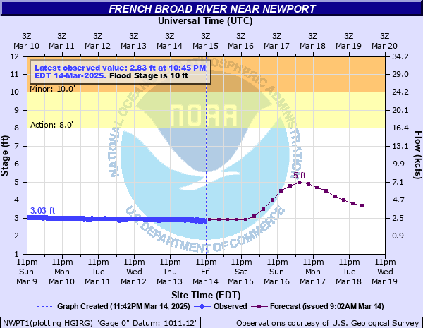
French Broad River near Newport
Critical Stages
8' - Action
10' - Flood
16' - Moderate
20' - Major
Latest Observation
Updated: 9:45 AM EST 12/6/25
Status: No Flooding
Stage: 2.48 ft
Flow: 1.57 kcfs
Forecast
| Time | Stage (ft) | Flow (kcfs) |
|---|---|---|
| 1 PM 12/6 | 2.5 | 1.6 |
| 7 PM 12/6 | 2.5 | 1.6 |
| 1 AM 12/7 | 2.5 | 1.6 |
| 7 AM 12/7 | 2.4 | 1.45 |
| 1 PM 12/7 | 2.4 | 1.45 |
| 7 PM 12/7 | 2.4 | 1.45 |
| 1 AM 12/8 | 2.4 | 1.45 |
| 7 AM 12/8 | 2.4 | 1.45 |
| 1 PM 12/8 | 2.4 | 1.45 |
| 7 PM 12/8 | 2.4 | 1.45 |
| 1 AM 12/9 | 2.4 | 1.45 |
| 7 AM 12/9 | 2.4 | 1.45 |
| 1 PM 12/9 | 2.4 | 1.45 |
| 7 PM 12/9 | 2.3 | 1.3 |
| 1 AM 12/10 | 2.3 | 1.3 |
| 7 AM 12/10 | 2.3 | 1.3 |
| 1 PM 12/10 | 2.3 | 1.3 |
| 7 PM 12/10 | 2.3 | 1.3 |
| 1 AM 12/11 | 2.3 | 1.3 |
| 7 AM 12/11 | 2.3 | 1.3 |
| Time | Stage (ft) | Flow (kcfs) |
|---|---|---|
| 9:45 AM 12/6 | 2.48 | 1.57 |
| 9:30 AM 12/6 | 2.49 | 1.58 |
| 9:15 AM 12/6 | 2.49 | 1.58 |
| 9:00 AM 12/6 | 2.49 | 1.58 |
| 8:45 AM 12/6 | 2.49 | 1.58 |
| 8:30 AM 12/6 | 2.49 | 1.58 |
| 8:15 AM 12/6 | 2.49 | 1.58 |
| 8:00 AM 12/6 | 2.49 | 1.58 |
| 7:45 AM 12/6 | 2.49 | 1.58 |
| 7:30 AM 12/6 | 2.49 | 1.58 |
| 7:15 AM 12/6 | 2.49 | 1.58 |
| 7:00 AM 12/6 | 2.49 | 1.58 |
| 6:45 AM 12/6 | 2.49 | 1.58 |
| 6:30 AM 12/6 | 2.49 | 1.58 |
| 6:15 AM 12/6 | 2.49 | 1.58 |
| 6:00 AM 12/6 | 2.49 | 1.58 |
| 5:45 AM 12/6 | 2.49 | 1.58 |
| 5:30 AM 12/6 | 2.48 | 1.57 |
| 5:15 AM 12/6 | 2.48 | 1.57 |
| 5:00 AM 12/6 | 2.48 | 1.57 |
| 4:45 AM 12/6 | 2.48 | 1.57 |
| 4:30 AM 12/6 | 2.48 | 1.57 |
| 4:15 AM 12/6 | 2.48 | 1.57 |
| 4:00 AM 12/6 | 2.48 | 1.57 |
| 3:45 AM 12/6 | 2.48 | 1.57 |
| 3:30 AM 12/6 | 2.48 | 1.57 |
| 3:15 AM 12/6 | 2.48 | 1.57 |
| 3:00 AM 12/6 | 2.47 | 1.55 |
| 2:45 AM 12/6 | 2.47 | 1.55 |
| 2:30 AM 12/6 | 2.47 | 1.55 |
24' -
Flood of record.
23.3' -
Around 4 feet of water floods the walk out basement of the large home 2 lots downstream from the new bypass bridge. Perhaps 6 or more feet of water is in the large storage building behind the house. Del Rio Baptist Church buildings on Fugate Road flood with water half way or more up the windows. The train tracks across from the church are inundated. Fugate Road is inundated perhaps 6 feet deep.
19.5' -
Water begins to enter the walk out basement of a large home two lots downstream from the new bypass bridge. There is perhaps two or three feet of water in their large storage building behind the house.
16' -
The campground and the other low-lying cabins are more substantially impacted. (Most of these structures were destroyed by Helene flooding, some may gradually be rebuilt.) Flooding of backyards begins along River Chase Trail. Flooding of Fugate Road in Del Rio is more widespread, including near Del Rio Baptist Church.
15' -
Buildings at the campground on Hwy 25/70E might begin to take water. A few low-lying riverfront cabins between Newport and Del Rio might begin to take water. (Most of these structures were destroyed by Helene flooding, some may gradually be rebuilt.)
14' -
Flooding begins on Rock Hill Road near Newport and low spots on Fugate Road near Del Rio.
10' -
Agricultural land near the gage on Highway 321 is flooded. Water begins entering a campground along Hwy 25/70E.
| Date | Stage (ft) |
|---|---|
| Mar 7, 1867 | 24 |
| Sep 27, 2024 | 23.34 |
| Feb 28, 1902 | 23 |
| Jul 17, 1916 | 22.5 |
| Aug 30, 1940 | 19.25 |
| Nov 6, 1977 | 18.36 |
| Sep 17, 2004 | 18.1 |
| Mar 26, 1965 | 17.93 |
| Mar 17, 1973 | 17.6 |
| Apr 5, 1977 | 17.57 |
| Mar 28, 1994 | 17.56 |
| Mar 13, 1963 | 16.75 |
| Mar 17, 1990 | 16.73 |
| Apr 20, 2019 | 16.69 |
| Feb 6, 2020 | 16.68 |
| Jan 27, 1996 | 16.66 |
| Jan 15, 1995 | 15.81 |
| Dec 28, 2018 | 15.78 |
| Apr 5, 1957 | 15.75 |
| Mar 14, 1975 | 15.7 |
Data provided by the National Weather Service.