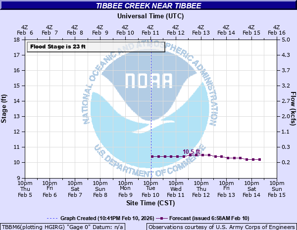
Tibbee Creek near Tibbee
Critical Stages
20' - Action
23' - Flood
28' - Moderate
30' - Major
Latest Observation
Updated: 6:09 PM LMT 12/31/00
Status: Obs Not Current
Stage: -999 ft
Flow: -999 kcfs
Forecast
| Time | Stage (ft) | Flow (kcfs) |
|---|---|---|
| 12 AM 12/7 | 11 | 0.335 |
| 6 AM 12/7 | 10.9 | 0.303 |
| 12 PM 12/7 | 10.8 | 0.274 |
| 6 PM 12/7 | 10.7 | 0.247 |
| 12 AM 12/8 | 10.7 | 0.247 |
| 6 AM 12/8 | 10.6 | 0.222 |
| 12 PM 12/8 | 10.5 | 0.2 |
| 6 PM 12/8 | 10.3 | 0.179 |
| 12 AM 12/9 | 10.2 | 0.169 |
| 6 AM 12/9 | 10.3 | 0.179 |
| 12 PM 12/9 | 10.1 | 0.159 |
| 6 PM 12/9 | 10 | 0.15 |
| 12 AM 12/10 | 10 | 0.15 |
| 6 AM 12/10 | 9.9 | 0.126 |
| 12 PM 12/10 | 9.9 | 0.126 |
| 6 PM 12/10 | 9.9 | 0.126 |
| 12 AM 12/11 | 9.9 | 0.126 |
| 6 AM 12/11 | 9.9 | 0.126 |
Observation history not available.
30' -
Extensive flooding is occcurring between Tibbee creek and the community of West Point.
26' -
Low land and agriculture land near the creek is flooded.
23.5' -
Flood water is covering the gravel road south of West Point that leads to the Tibbee Creek bridge near Tibbee.
23' -
Flooding in low areas on the left bank is occurring.
| Date | Stage (ft) |
|---|---|
| Mar 17, 1973 | 32.26 |
| May 27, 1991 | 31.16 |
| Mar 29, 1951 | 30.82 |
| Dec 4, 1983 | 30.52 |
| Dec 23, 1990 | 30.24 |
| Jan 5, 1949 | 30.15 |
| Dec 28, 1982 | 30.02 |
| Dec 31, 1969 | 29.73 |
| Feb 20, 1991 | 29.66 |
| Apr 30, 1991 | 29.58 |
| Mar 14, 1975 | 29.53 |
| Dec 18, 1961 | 29.51 |
| Feb 16, 2020 | 29.07 |
| Feb 22, 1961 | 29.06 |
| Mar 30, 1944 | 28.94 |
| Mar 5, 1977 | 28.89 |
| Jan 7, 1950 | 28.87 |
| Apr 15, 1969 | 28.69 |
| May 20, 1983 | 28.66 |
| Feb 14, 1948 | 28.49 |
Data provided by the National Weather Service.