Mahwah River at Suffern
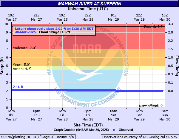
Critical Stages
4.5' - Action
5' - Flood
7' - Moderate
10.5' - Major
Latest Observation
Updated: 3:30 AM EST 12/16/25
Status: No Flooding
Stage: 1.66 ft
Flow: 0.0056 kcfs
Forecast
Forecast not available for this location.
| Time | Stage (ft) | Flow (kcfs) |
|---|---|---|
| 3:30 AM 12/16 | 1.66 | 0.0056 |
| 3:15 AM 12/16 | 1.65 | 0.0053 |
| 3:00 AM 12/16 | 1.65 | 0.0053 |
| 2:45 AM 12/16 | 1.65 | 0.0053 |
| 2:30 AM 12/16 | 1.66 | 0.0056 |
| 2:15 AM 12/16 | 1.66 | 0.0056 |
| 2:00 AM 12/16 | 1.66 | 0.0056 |
| 1:45 AM 12/16 | 1.66 | 0.0056 |
| 1:30 AM 12/16 | 1.67 | 0.0059 |
| 1:15 AM 12/16 | 1.65 | 0.0053 |
| 1:00 AM 12/16 | 1.65 | 0.0053 |
| 12:45 AM 12/16 | 1.66 | 0.0056 |
| 12:30 AM 12/16 | 1.66 | 0.0056 |
| 12:15 AM 12/16 | 1.65 | 0.0053 |
| 12:00 AM 12/16 | 1.66 | 0.0056 |
| 11:45 PM 12/15 | 1.66 | 0.0056 |
| 11:30 PM 12/15 | 1.66 | 0.0056 |
| 11:15 PM 12/15 | 1.65 | 0.0053 |
| 11:00 PM 12/15 | 1.66 | 0.0056 |
| 10:45 PM 12/15 | 1.65 | 0.0053 |
| 10:30 PM 12/15 | 1.66 | 0.0056 |
| 10:15 PM 12/15 | 1.67 | 0.0059 |
| 10:00 PM 12/15 | 1.65 | 0.0053 |
| 9:45 PM 12/15 | 1.65 | 0.0053 |
| 9:30 PM 12/15 | 1.66 | 0.0056 |
| 9:15 PM 12/15 | 1.66 | 0.0056 |
| 9:00 PM 12/15 | 1.66 | 0.0056 |
| 8:45 PM 12/15 | 1.66 | 0.0056 |
| 8:30 PM 12/15 | 1.67 | 0.0059 |
| 8:15 PM 12/15 | 1.66 | 0.0056 |
10.6' -
Major flooding along Mahwah River at Suffern. 8 feet of waters into homes basements. Major flooding in homes in the Squires Gate community along the Mahwah River, especially on Lonergan Drive.
7' -
Moderate flooding along Mahwah River at Suffern communities. Moderate flooding in homes in the Squires Gate community along the Mahwah River, especially on Lonergan Drive.
5' -
Minor flooding on homes along the Mahwah River at Suffern. Minor flooding in homes in the Squires Gate community along the Mahwah River, especially on Lonergan Drive.
| Date | Stage (ft) |
|---|---|
| Sep 16, 1999 | 9.7 |
Data provided by the National Weather Service.