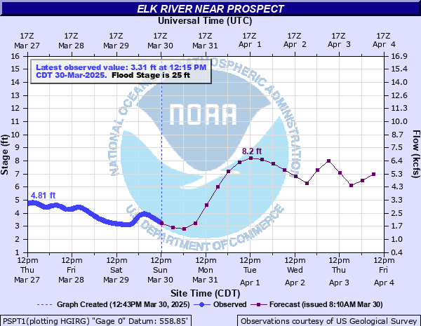
Elk River near Prospect
Critical Stages
22' - Action
25' - Flood
37' - Moderate
40' - Major
Latest Observation
Updated: 2:15 AM CST 12/16/25
Status: No Flooding
Stage: 1.56 ft
Flow: 0.819 kcfs
Forecast
| Time | Stage (ft) | Flow (kcfs) |
|---|---|---|
| 6 AM 12/16 | 3.5 | 2.29 |
| 12 PM 12/16 | 5.3 | 3.91 |
| 6 PM 12/16 | 5 | 3.61 |
| 12 AM 12/17 | 4.1 | 2.8 |
| 6 AM 12/17 | 3.3 | 2.12 |
| 12 PM 12/17 | 3.2 | 2.04 |
| 6 PM 12/17 | 3.7 | 2.46 |
| 12 AM 12/18 | 3.9 | 2.63 |
| 6 AM 12/18 | 3.6 | 2.37 |
| 12 PM 12/18 | 3.1 | 1.96 |
| 6 PM 12/18 | 3.1 | 1.96 |
| 12 AM 12/19 | 3.3 | 2.12 |
| 6 AM 12/19 | 3.1 | 1.96 |
| 12 PM 12/19 | 2.4 | 1.42 |
| 6 PM 12/19 | 2.5 | 1.49 |
| 12 AM 12/20 | 3.1 | 1.96 |
| 6 AM 12/20 | 3.1 | 1.96 |
| Time | Stage (ft) | Flow (kcfs) |
|---|---|---|
| 2:15 AM 12/16 | 1.56 | 0.819 |
| 2:00 AM 12/16 | 1.55 | 0.812 |
| 1:45 AM 12/16 | 1.54 | 0.806 |
| 1:30 AM 12/16 | 1.53 | 0.799 |
| 1:15 AM 12/16 | 1.53 | 0.799 |
| 1:00 AM 12/16 | 1.52 | 0.792 |
| 12:45 AM 12/16 | 1.53 | 0.799 |
| 12:30 AM 12/16 | 1.53 | 0.799 |
| 12:15 AM 12/16 | 1.53 | 0.799 |
| 12:00 AM 12/16 | 1.52 | 0.792 |
| 11:45 PM 12/15 | 1.53 | 0.799 |
| 11:30 PM 12/15 | 1.53 | 0.799 |
| 11:15 PM 12/15 | 1.53 | 0.799 |
| 11:00 PM 12/15 | 1.53 | 0.799 |
| 10:45 PM 12/15 | 1.53 | 0.799 |
| 10:30 PM 12/15 | 1.53 | 0.799 |
| 10:15 PM 12/15 | 1.53 | 0.799 |
| 10:00 PM 12/15 | 1.53 | 0.799 |
| 9:45 PM 12/15 | 1.53 | 0.799 |
| 9:30 PM 12/15 | 1.54 | 0.806 |
| 9:15 PM 12/15 | 1.54 | 0.806 |
| 9:00 PM 12/15 | 1.54 | 0.806 |
| 8:45 PM 12/15 | 1.54 | 0.806 |
| 8:30 PM 12/15 | 1.54 | 0.806 |
| 8:15 PM 12/15 | 1.54 | 0.806 |
| 8:00 PM 12/15 | 1.54 | 0.806 |
| 7:45 PM 12/15 | 1.54 | 0.806 |
| 7:30 PM 12/15 | 1.54 | 0.806 |
| 7:15 PM 12/15 | 1.54 | 0.806 |
| 7:00 PM 12/15 | 1.55 | 0.812 |
40' -
Widespread flooding continues to impact Hwy 237 near Elkton and Prospect, as well as Prospect Elkton Rd – Hwy 273 at Richland Creek, Pleasant Hill Rd at Bates Hollow Rd, Valley Ln, and Ragsdale Rd, and portions of Elkton Pike – U.S. 31south of Elkton. Several structures in Prospect are flooded, and water reaches Reeves Branch Rd at Baugh Rd, the access road to the weigh station, and approaches railroad tracks at the river near the Lincoln County line.
38' -
Widespread flooding is impacting portions of Hwy 237 near Elkton and Prospect, portions of Pleasant Hill Rd at Bates Hollow Rd, Valley Ln, and Ragsdale Rd, and Elkton Pike south of Ed McCormack Rd. Several structures in Prospect on Hwy 273 south of Prospect Rd are flooded. Water approaches Prospect Elkton Rd – Hwy 273 at Richland Creek, Reeves Branch Rd at Baugh Rd, the access road to the weigh station, and Elkton Pike - U.S. 31 south of Elkton, which may be impassable at higher levels.
36' -
Significant flooding continues across southeast Giles County, impacting portions of Hwy 237 near Elkton and Prospect, portions of Pleasant Hill Rd at Bates Hollow Rd, Valley Ln, and Ragsdale Rd, and Elkton Pike – U.S. 31 south of Ed McCormack Rd – Ardmore Ridge Rd. Several structures in Prospect on Hwy 273 south of Prospect Rd are flooded.
34' -
Significant flooding is occurring along the river, impacting Bryson Rd – Hwy 273 east of I-65, Pleasant Hill Rd at Bates Hollow Rd, Case Rd – Hwy 273 and structures in Prospect, and Bethel Prospect Rd near Birdsong Ln which are all impassable. Water approaches Elkton Pike - U.S. 31 south of Ed McCormack Rd – Ardmore Ridge Rd, and Pleasant Hill Rd at Valley Ln and near Ragsdale Rd which may be impassable at higher levels.
32' -
Extensive flooding continues across southeast Giles County, impacting area roads including Baugh Rd east of I-65, and Witt Rd between Beasley Branch Rd and River Bend Rd. Water approaches Bryson Rd – Hwy 273 east of I-65, Pleasant Hill Rd at Bates Hollow Rd, Case Rd – Hwy 273 and structures in Prospect, and Bethel Prospect Rd near Birdsong Ln. These roads may be impassable at higher levels.
30' -
Extensive flooding of agricultural areas along the river is occurring, with flood waters reaching Old Hwy 31 near Ed McCormack Rd which is impassable. Water approaches Baugh Rd east of I-65, and Witt Rd between Beasley Branch Rd and River Bend Rd which may be impassable at higher levels.
28' -
Water approaches Old Hwy 31 near Ed McCormack Rd and may be impassable at higher levels.
26' -
Flooding is impacting agricultural areas along the river across southeast Giles County. Water covers Veto Rd near the Hargrove - Johnson bridge south of Route 273. It may be unsafe to pass and motorists should seek an alternate route.
24' -
Water approaches Veto Rd near the Hargrove - Johnson bridge and may be impassable at higher levels.
22' -
Water continues to impact low lying and agricultural areas along the river across southeast Giles County.
20' -
Water has completely inundated the Veto Boat Ramp and the Matt Gardner Elk River Access Area. The boat ramps and parking areas are completely submerged at this level and unusable. Low lying and agricultural areas along the river begin to be inundated.
18' -
Water begins to inundate the Veto Boat Ramp at the Hargrove - Johnson bridge, and the Matt Gardner Elk River Access Area.
| Date | Stage (ft) |
|---|---|
| Mar 1, 1902 | 40.9 |
| Mar 17, 1973 | 40.12 |
| Mar 22, 1955 | 38.98 |
| Feb 14, 1948 | 38.17 |
| Mar 14, 1975 | 37.06 |
| Jan 11, 1974 | 36.43 |
| Feb 2, 1957 | 34.85 |
| Mar 13, 1963 | 34.26 |
| Feb 20, 1991 | 34.2 |
| Jan 6, 1949 | 34 |
| Mar 9, 1961 | 33.86 |
| Feb 2, 1951 | 33.66 |
| Dec 31, 1969 | 33.54 |
| Apr 6, 1983 | 33.51 |
| Nov 19, 1957 | 33.25 |
| Jan 9, 1946 | 33.2 |
| Feb 22, 1945 | 33.01 |
| Mar 21, 1980 | 32.9 |
| Jan 7, 1950 | 32.32 |
| Feb 24, 2019 | 32.31 |
Data provided by the National Weather Service.