Applegate River near Applegate
Critical Stages
12' - Action
13' - Flood
15' - Moderate
17' - Major
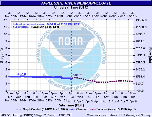
Latest Observation
Updated: 6:30 PM PST 12/16/25
Status: No Flooding
Stage: 1.4 ft
Flow: 0.197 kcfs
Forecast
| Time | Stage (ft) | Flow (kcfs) |
|---|---|---|
| 10 PM 12/16 | 1.76 | 0.302 |
| 4 AM 12/17 | 2.03 | 0.397 |
| 10 AM 12/17 | 1.99 | 0.382 |
| 4 PM 12/17 | 1.75 | 0.299 |
| 10 PM 12/17 | 1.53 | 0.233 |
| 4 AM 12/18 | 1.47 | 0.216 |
| 10 AM 12/18 | 1.51 | 0.227 |
| 4 PM 12/18 | 1.55 | 0.238 |
| 10 PM 12/18 | 1.81 | 0.319 |
| 4 AM 12/19 | 2.32 | 0.516 |
| 10 AM 12/19 | 2.86 | 0.806 |
| 4 PM 12/19 | 3.15 | 0.98 |
| 10 PM 12/19 | 2.87 | 0.812 |
| 4 AM 12/20 | 2.29 | 0.503 |
| 10 AM 12/20 | 1.93 | 0.361 |
| 4 PM 12/20 | 1.89 | 0.346 |
| 10 PM 12/20 | 2.16 | 0.448 |
| 4 AM 12/21 | 2.31 | 0.511 |
| 10 AM 12/21 | 2.35 | 0.529 |
| 4 PM 12/21 | 2.42 | 0.56 |
| 10 PM 12/21 | 2.51 | 0.606 |
| 4 AM 12/22 | 2.61 | 0.66 |
| 10 AM 12/22 | 2.65 | 0.682 |
| 4 PM 12/22 | 2.55 | 0.627 |
| 10 PM 12/22 | 2.28 | 0.498 |
| 4 AM 12/23 | 2.12 | 0.432 |
| 10 AM 12/23 | 2.02 | 0.394 |
| 4 PM 12/23 | 1.92 | 0.357 |
| 10 PM 12/23 | 1.87 | 0.339 |
| 4 AM 12/24 | 1.86 | 0.336 |
| 10 AM 12/24 | 1.87 | 0.339 |
| 4 PM 12/24 | 1.88 | 0.343 |
| 10 PM 12/24 | 1.9 | 0.35 |
| 4 AM 12/25 | 1.9 | 0.35 |
| 10 AM 12/25 | 1.92 | 0.357 |
| 4 PM 12/25 | 1.98 | 0.379 |
| 10 PM 12/25 | 1.99 | 0.382 |
| 4 AM 12/26 | 1.96 | 0.371 |
| Time | Stage (ft) | Flow (kcfs) |
|---|---|---|
| 7:00 PM 12/16 | 1.4 | 0.197 |
| 6:45 PM 12/16 | 1.4 | 0.197 |
| 6:30 PM 12/16 | 1.4 | 0.197 |
| 6:15 PM 12/16 | 1.4 | 0.197 |
| 6:00 PM 12/16 | 1.4 | 0.197 |
| 5:45 PM 12/16 | 1.4 | 0.197 |
| 5:30 PM 12/16 | 1.4 | 0.197 |
| 5:15 PM 12/16 | 1.4 | 0.197 |
| 5:00 PM 12/16 | 1.4 | 0.197 |
| 4:45 PM 12/16 | 1.4 | 0.197 |
| 4:30 PM 12/16 | 1.4 | 0.197 |
| 4:15 PM 12/16 | 1.4 | 0.197 |
| 4:00 PM 12/16 | 1.4 | 0.197 |
| 3:45 PM 12/16 | 1.4 | 0.197 |
| 3:30 PM 12/16 | 1.4 | 0.197 |
| 3:15 PM 12/16 | 1.4 | 0.197 |
| 3:00 PM 12/16 | 1.4 | 0.197 |
| 2:45 PM 12/16 | 1.4 | 0.197 |
| 2:30 PM 12/16 | 1.4 | 0.197 |
| 2:15 PM 12/16 | 1.4 | 0.197 |
| 2:00 PM 12/16 | 1.4 | 0.197 |
| 1:45 PM 12/16 | 1.4 | 0.197 |
| 1:30 PM 12/16 | 1.41 | 0.2 |
| 1:15 PM 12/16 | 1.41 | 0.2 |
| 1:00 PM 12/16 | 1.41 | 0.2 |
| 12:45 PM 12/16 | 1.41 | 0.2 |
| 12:30 PM 12/16 | 1.41 | 0.2 |
| 12:15 PM 12/16 | 1.41 | 0.2 |
| 12:00 PM 12/16 | 1.41 | 0.2 |
| 11:45 AM 12/16 | 1.41 | 0.2 |
17' -
Expect significant flooding along Highway 238 with widespread flooding of agricultural lands and private residences. Also expect significant damage to irrigation installations and major bank erosion.
15' -
Some sections of Applegate Road south of Ruch and south of the Little Applegate River confluence will begin to flood. Numerous homes and structures along and near the Applegate River banks will likely be threatened by flood waters.
14' -
Expect lowland agricultural flooding and flooding of structures along and near the Applegage River in lower spots.
13' -
The river has reached flood stage. Flooding of low-lying agricultural lands and structures along the river is likely.
12' -
Action stage. The Applegate River is at bankfull. Some minor flooding of structures along the river is likely.
6' -
Private low-lying bridges along the Applegate River are under water.
4.59' -
Private low-lying bridges along the Applegate River begin to flood.
| Date | Stage (ft) |
|---|---|
| Jan 15, 1974 | 20.41 |
| Dec 22, 1964 | 19.57 |
| Feb 20, 1927 | 18.7 |
| Dec 21, 1955 | 18 |
| Jan 1, 1997 | 17.9 |
| Jan 18, 1953 | 17.8 |
| Dec 2, 1962 | 14.23 |
| Jan 6, 1948 | 14.2 |
| Oct 1, 1950 | 13.2 |
| Dec 9, 1996 | 9.1 |
Data provided by the National Weather Service.