« Back to Pueblo Mountain Park Rivers
Fountain Creek at Pueblo
Critical Stages
8' - Action
10' - Flood
12' - Moderate
13.5' - Major
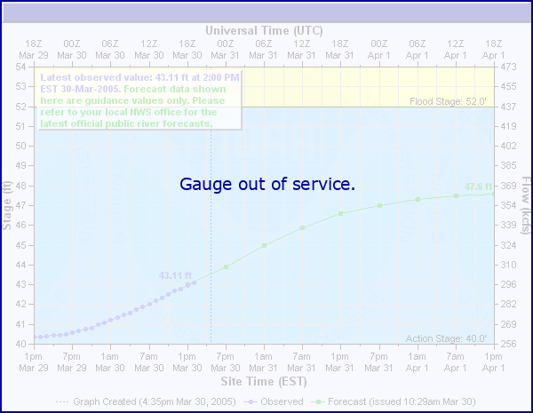
Latest Observation
Updated: 5:00 PM LMT 12/31/00
Status: Out Of Service
Stage: -999 ft
Flow: -999 kcfs
Forecast
Forecast not available for this location.
Observation history not available.
15' -
Flood waters reach the base of the bridge on Colorado Highway 47.
13.5' -
Flood waters reach the Pueblo Mall parking lots.
12' -
Water flows over the railroad tracks at the 4th Street Bridge in Pueblo.
11.5' -
Water reaches buildings near the mouth of Fountain Creek.
10' -
Minor lowland agricultural flooding occurs.
9.5' -
Water spills over the path at the base of the Colorado Highway 47 Bridge. Significant inundation of trails in Confluence Park.
8' -
Minor overbank flow spills into the park at the confluence of Fountain Creek and the Arkansas River.
7' -
Minor overbank flow spills into low spots along the creek north of Pueblo. Water flows over the bike path below the US HWY 50 bridge.
5.5' -
The river is bankfull.
| Date | Stage (ft) |
|---|---|
| Jul 9, 1996 | 10.82 |
| Apr 30, 1999 | 9.72 |
| Jun 22, 2023 | 9.55 |
| Sep 15, 2011 | 8.94 |
| Jun 3, 1994 | 8.68 |
| Sep 13, 2013 | 8.62 |
| Jul 9, 2006 | 8.27 |
| Jun 10, 1997 | 8.04 |
| Aug 14, 1980 | 7.8 |
| May 17, 1995 | 7.46 |
Data provided by the National Weather Service.