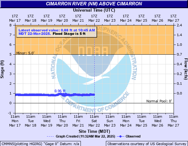
Cimarron River (NM) above Cimarron
Critical Stages
5' - Action
5' - Flood
10' - Moderate
12.5' - Major
Latest Observation
Updated: 8:45 AM MST 12/15/25
Status: No Flooding
Stage: 1 ft
Flow: 0 kcfs
Forecast
Forecast not available for this location.
| Time | Stage (ft) | Flow (kcfs) |
|---|---|---|
| 8:45 AM 12/15 | 1 | 0 |
| 8:40 AM 12/15 | 1 | 0 |
| 8:35 AM 12/15 | 1 | 0 |
| 8:30 AM 12/15 | 1 | 0 |
| 8:25 AM 12/15 | 1 | 0 |
| 8:20 AM 12/15 | 1 | 0 |
| 8:15 AM 12/15 | 1 | 0 |
| 8:10 AM 12/15 | 1 | 0 |
| 7:45 AM 12/15 | 1 | 0 |
| 7:40 AM 12/15 | 1 | 0 |
| 7:35 AM 12/15 | 1 | 0 |
| 7:30 AM 12/15 | 1 | 0 |
| 7:25 AM 12/15 | 1.01 | 0 |
| 7:20 AM 12/15 | 1.01 | 0 |
| 7:15 AM 12/15 | 1 | 0 |
| 7:10 AM 12/15 | 1.01 | 0 |
| 6:45 AM 12/15 | 1.01 | 0 |
| 6:40 AM 12/15 | 1.01 | 0 |
| 6:35 AM 12/15 | 1 | 0 |
| 6:30 AM 12/15 | 1.01 | 0 |
| 6:25 AM 12/15 | 1.01 | 0 |
| 6:20 AM 12/15 | 1.01 | 0 |
| 6:15 AM 12/15 | 1.01 | 0 |
| 6:10 AM 12/15 | 1.02 | 0 |
| 5:45 AM 12/15 | 1.01 | 0 |
| 5:40 AM 12/15 | 1.01 | 0 |
| 5:35 AM 12/15 | 1.01 | 0 |
| 5:30 AM 12/15 | 1.02 | 0 |
| 5:25 AM 12/15 | 1.02 | 0 |
| 5:20 AM 12/15 | 1.02 | 0 |
12.5' -
Record breaking flooding is occurring along the Cimarron River from the Cimarron Canyon region through southern sections of Cimarron and along Philmont Boy Scout Ranch property. Much of U.S. Highway 64 is flooded and the canyon section is inaccessible. All travelers are urged to avoid the region until flood waters subside.
10' -
The Cimarron River is in flood, approaching levels of the great flood of 1965. Water and debris cover U.S. Highway 64 in the Cimarron Canyon along several sections and camprgounds are in danger of being inundated. Further downstream from Cimarron to the Philmont Boy Scout Ranch, the state highway 21 bridge over the Cimarron River just south of Cimarron is in danger of being overtopped or the approaches to the bridge are already flooded. Philmont Ranch property is also flooding.
5' -
The Cimarron River from near Ute Park to just west of Cimarron is out of its banks and minor flooding is occuring along this reach. Further upstream in Cimarron Canyon, water may be flowing across U.S. Highway 64 and flooding campgrounds in the canyon. Further river rises in the canyon could render the highway impassable. Further downriver from Cimarron to the Philmont Boy Scout Ranch, additional flow contributed by Rayado Creek could flood campsites on the Philmont Scout Ranch.
| Date | Stage (ft) |
|---|---|
| Jun 17, 1965 | 12.42 |
| Sep 7, 2019 | 9.52 |
| Aug 16, 2018 | 8.15 |
| Jun 17, 2019 | 6.62 |
| Jul 23, 2019 | 6.44 |
| Jul 28, 2019 | 6.38 |
| Aug 7, 2019 | 6.28 |
| Aug 7, 2019 | 6.28 |
| Jul 24, 2018 | 5.67 |
| Aug 20, 2018 | 5.19 |
| Jul 11, 2018 | 5.16 |
| Jun 7, 2019 | 5.08 |
| Aug 18, 2018 | 5.02 |
| Jul 11, 2018 | 5 |
| Apr 30, 1999 | 4.63 |
| Jun 9, 1988 | 4.3 |
| Aug 1, 1976 | 3.81 |
| Jul 26, 1967 | 3.7 |
| Jun 1, 1979 | 3.69 |
| Sep 9, 1973 | 3.63 |
Data provided by the National Weather Service.