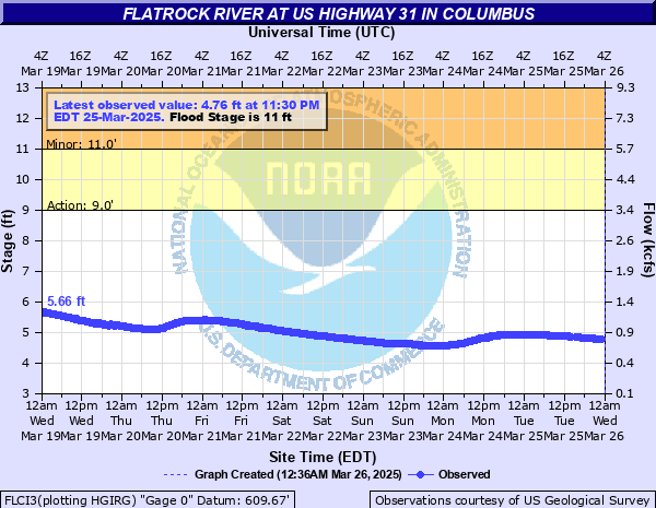
Flatrock River at Columbus
Critical Stages
9' - Action
11' - Flood
15' - Moderate
19' - Major
Latest Observation
Updated: 2:30 PM EST 12/6/25
Status: No Flooding
Stage: 3.3 ft
Flow: 0.141 kcfs
Forecast
Forecast not available for this location.
| Time | Stage (ft) | Flow (kcfs) |
|---|---|---|
| 3:30 PM 12/6 | 3.3 | 0.141 |
| 3:15 PM 12/6 | 3.3 | 0.141 |
| 3:00 PM 12/6 | 3.3 | 0.141 |
| 2:45 PM 12/6 | 3.3 | 0.141 |
| 2:30 PM 12/6 | 3.3 | 0.141 |
| 2:15 PM 12/6 | 3.3 | 0.141 |
| 2:00 PM 12/6 | 3.3 | 0.141 |
| 1:45 PM 12/6 | 3.29 | 0.139 |
| 1:30 PM 12/6 | 3.3 | 0.141 |
| 1:15 PM 12/6 | 3.3 | 0.141 |
| 1:00 PM 12/6 | 3.3 | 0.141 |
| 12:45 PM 12/6 | 3.3 | 0.141 |
| 12:30 PM 12/6 | 3.3 | 0.141 |
| 12:15 PM 12/6 | 3.3 | 0.141 |
| 12:00 PM 12/6 | 3.3 | 0.141 |
| 11:45 AM 12/6 | 3.3 | 0.141 |
| 11:30 AM 12/6 | 3.3 | 0.141 |
| 11:15 AM 12/6 | 3.3 | 0.141 |
| 11:00 AM 12/6 | 3.31 | 0.143 |
| 10:45 AM 12/6 | 3.3 | 0.141 |
| 10:30 AM 12/6 | 3.3 | 0.141 |
| 10:15 AM 12/6 | 3.3 | 0.141 |
| 10:00 AM 12/6 | 3.3 | 0.141 |
| 9:45 AM 12/6 | 3.3 | 0.141 |
| 9:30 AM 12/6 | 3.3 | 0.141 |
| 9:15 AM 12/6 | 3.3 | 0.141 |
| 9:00 AM 12/6 | 3.3 | 0.141 |
| 8:45 AM 12/6 | 3.31 | 0.143 |
| 8:30 AM 12/6 | 3.31 | 0.143 |
| 8:15 AM 12/6 | 3.31 | 0.143 |
21' -
Diastrous flooding along the Flatrock River in the Columbus area affecting residential, business and commercial areas. US 31 and numeorous other state and local roads are closed. Flood waters more than 3 feet deep in some neighborhoods downstream of US 31. Approximate low steel for US Highway 31 bridge.
19.82' -
During June 2008...Flatrock River at US 31 rose about 10 feet in 10 hours to cause a devastating flood to portions of the City of Columbus. US Highway 31 flooded as did Noblitt Lagoons and other neighborhoods. Water was 1 to 2 feet deep in many areas. This rise took place from Noon EDT to 10 pm EDT. The river was near bankfull before this tsunami like flood struck.
19.5' -
Near recording flooding in progress along Flatrock River. CR 800 N remains open according to Columbus Response Plan.
19' -
Approximate river height of when the flood waters came over several locations along Flatrock Dr and flooded Noblitt Lagoons and adjacent areas in June 2008. Adjacent areas included Washington St. from 17th to 12th St. and Lawton Ave. and possibly parts of Franklin and Lafayette Ave. on the east side of Washington St. At least 4 homes had first floor flooding, with possibly 50 homes or more with basement and carport flooding.
18.98' -
US Highway 31 on the northwest side of Columbus closed by flood waters from the Flatrock River.
18.95' -
After the river crested during the June 2008 flood...water levels in the Noblitt Lagoons fell only several inches. It took 5 or 6 days with 6 or 8 industrial pumps for the Lagoons to return to normal levels.
16.45' -
During the January 2005 flood...river level was about 1 foot below the lowest berm along Flatrock Drive in the northeast end of Noblitt Lagoons near the junction of Washington St. and Riverside Dr. A few Noblitt Lagoons residents had wet basements.
15' -
Extensive flooding in progress along the Flatrock River. Portions of Riverside Drive north of US Highway 31 are flooded. According to the Columbus Response Plan...Indianapolis Road is flooded.
12' -
On April 6, 2011 after reaching 13 feet...Noblitt Park...CR 400N and Owens Bend Park remained flooded.
10.5' -
Approaching flood stage on the Flatrock River at Columbus. CR 550 N flooded according to Columbus Flood Response Plan.
10.4' -
After the Great Flood of June 2008...both north and south bound US Highway 31 were reopened after reaching a record stage of 19.83 feet.
9.8' -
At this level on April 20, 2011 CR 400N to Columbus Airport was closed because of high water. Reading at St. Paul was 6.00 feet.
9.51' -
After the Great Flood of June 2008...SR 252 from I-65 to SR 9 remained closed. The river reading at St. Paul was only 2.57 feet...but had crested earlier at 12.82 feet.
9.3' -
During the evening of April 25, 2011 CR 400N to the Columbus Airport was closed because of high water. Reading at St. Paul was 5.4 feet.
7.9' -
River at a dangerour level for small watercraft near low head dams. Man rescued in southern Shelby County on November 20, 2017 at Shelby CR 300E and Vandalia Raod when trapped at a low head dam.
| Date | Stage (ft) |
|---|---|
| Jun 7, 2008 | 19.94 |
| Jan 7, 2005 | 16.45 |
| Apr 6, 2025 | 16.22 |
| Apr 6, 2025 | 16.22 |
| Feb 8, 2019 | 15.68 |
| Dec 23, 2013 | 15.34 |
| Mar 21, 2020 | 15.25 |
| Aug 5, 2009 | 14.74 |
| Apr 4, 2018 | 14.73 |
| Apr 21, 2011 | 14.61 |
| Jun 20, 2021 | 14.58 |
| Mar 20, 2008 | 14.4 |
| Jan 16, 2007 | 13.96 |
| Jun 18, 2019 | 13.62 |
| Feb 26, 2018 | 13.55 |
| Feb 7, 2008 | 13.49 |
| Mar 6, 2011 | 13.47 |
| Jul 18, 2021 | 13.37 |
| Dec 29, 2015 | 13.04 |
| Jan 13, 2020 | 12.96 |
Data provided by the National Weather Service.