« Back to Roaring River State Park Rivers
Spring River at Carthage
Critical Stages
8' - Action
10' - Flood
14' - Moderate
20' - Major
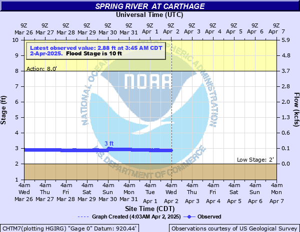
Latest Observation
Updated: 6:45 AM CST 12/6/25
Status: No Flooding
Stage: 2.65 ft
Flow: 0.0638 kcfs
Forecast
Forecast not available for this location.
| Time | Stage (ft) | Flow (kcfs) |
|---|---|---|
| 6:45 AM 12/6 | 2.65 | 0.0638 |
| 6:30 AM 12/6 | 2.65 | 0.0638 |
| 6:15 AM 12/6 | 2.65 | 0.0638 |
| 6:00 AM 12/6 | 2.65 | 0.0638 |
| 5:45 AM 12/6 | 2.65 | 0.0638 |
| 5:30 AM 12/6 | 2.65 | 0.0638 |
| 5:15 AM 12/6 | 2.65 | 0.0638 |
| 5:00 AM 12/6 | 2.65 | 0.0638 |
| 4:45 AM 12/6 | 2.65 | 0.0638 |
| 4:30 AM 12/6 | 2.65 | 0.0638 |
| 4:15 AM 12/6 | 2.65 | 0.0638 |
| 4:00 AM 12/6 | 2.65 | 0.0638 |
| 3:45 AM 12/6 | 2.66 | 0.0652 |
| 3:30 AM 12/6 | 2.66 | 0.0652 |
| 3:15 AM 12/6 | 2.66 | 0.0652 |
| 3:00 AM 12/6 | 2.66 | 0.0652 |
| 2:45 AM 12/6 | 2.66 | 0.0652 |
| 2:30 AM 12/6 | 2.66 | 0.0652 |
| 2:15 AM 12/6 | 2.66 | 0.0652 |
| 2:00 AM 12/6 | 2.66 | 0.0652 |
| 1:45 AM 12/6 | 2.66 | 0.0652 |
| 1:30 AM 12/6 | 2.66 | 0.0652 |
| 1:15 AM 12/6 | 2.66 | 0.0652 |
| 1:00 AM 12/6 | 2.66 | 0.0652 |
| 12:45 AM 12/6 | 2.66 | 0.0652 |
| 12:30 AM 12/6 | 2.66 | 0.0652 |
| 12:15 AM 12/6 | 2.66 | 0.0652 |
| 12:00 AM 12/6 | 2.66 | 0.0652 |
| 11:45 PM 12/5 | 2.66 | 0.0652 |
| 11:30 PM 12/5 | 2.66 | 0.0652 |
22' -
this is the record crest which occurred on May 18 1943.
20.33' -
this is the crest level reached December 27, 2015.
20' -
major flooding occurs at the gage site. Flood waters inundate homes on Garrison Road or Highway 571 north of the river, and along Java, Primm and Main Streets.
18.44' -
this is the crest level reached April 29, 2017.
16.5' -
flood waters affect the railroad tracks along Civil War and High Streets. Flood waters rise to one to two feet in depth along High Street on the southeast side of Civil War Road.
16' -
flood waters impact the railroad track on the north side of Carthage on Civil War Road and some homes in low lying areas along Garrison Street or Highway 571. Low lying areas along Primm Street and Main Street north of the Spring River also flood.
15.5' -
on Java Street, just southwest of the gage site, flood waters impact homes near the river.
15' -
flood waters rise to approximately one foot in depth along Civil War Road south and west of the river.Flood waters inundate homes on Garrison Road or Highway 571 north of the river, and along Java, Primm and Main Streets.
14.5' -
flood waters impact Civil War Road to the south and west of the river. North Woods Street west of Civil War Road floods as well as farm land along the river.
14' -
moderate flooding occurs at the gage site. The levee system closes due to flood waters affecting the north central industrial section of Carthage. Flood waters affect low lying areas and country roads north and west of Carthage along the river. Kellogg Lake Park floods and is closed.
10' -
minor flooding occurs at the gage site. Flood waters impact State Highway 37 east of Carthage between Avilla and Reeds.
| Date | Stage (ft) |
|---|---|
| May 18, 1943 | 22 |
| Dec 27, 2015 | 20.33 |
| Apr 30, 2017 | 18.44 |
| Mar 19, 2008 | 18.38 |
| May 24, 2019 | 17.98 |
| Apr 10, 2008 | 17.74 |
| Oct 10, 2009 | 17.72 |
| May 6, 2022 | 17.54 |
| Sep 8, 2007 | 17.3 |
| Nov 1, 1972 | 17.15 |
| Jun 12, 2007 | 16.71 |
| Apr 26, 2011 | 16.55 |
| Jul 30, 2013 | 16.15 |
| May 20, 1979 | 15.79 |
| May 1, 2019 | 15.58 |
| Nov 25, 1973 | 15.45 |
| Aug 21, 2007 | 15.33 |
| Sep 6, 1971 | 15 |
| May 8, 2002 | 14.97 |
| Jan 6, 2005 | 14.73 |
Data provided by the National Weather Service.