« Back to Roaring River State Park Rivers
James River (MO) at Galena
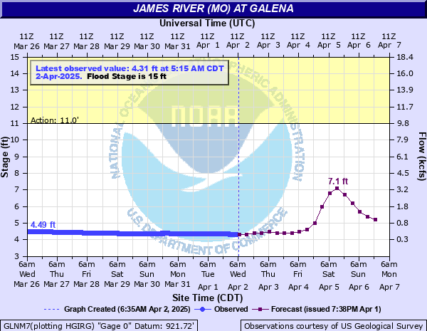
Critical Stages
11' - Action
15' - Flood
25' - Moderate
31' - Major
Latest Observation
Updated: 6:15 AM CST 12/6/25
Status: No Flooding
Stage: 4.31 ft
Flow: 0.348 kcfs
Forecast
| Time | Stage (ft) | Flow (kcfs) |
|---|---|---|
| 12 PM 12/6 | 4.3 | 0.344 |
| 6 PM 12/6 | 4.3 | 0.344 |
| 12 AM 12/7 | 4.3 | 0.344 |
| 6 AM 12/7 | 4.3 | 0.344 |
| 12 PM 12/7 | 4.3 | 0.344 |
| 6 PM 12/7 | 4.3 | 0.344 |
| 12 AM 12/8 | 4.3 | 0.344 |
| 6 AM 12/8 | 4.3 | 0.344 |
| 12 PM 12/8 | 4.3 | 0.344 |
| 6 PM 12/8 | 4.3 | 0.344 |
| 12 AM 12/9 | 4.3 | 0.344 |
| 6 AM 12/9 | 4.3 | 0.344 |
| 12 PM 12/9 | 4.3 | 0.344 |
| 6 PM 12/9 | 4.3 | 0.344 |
| 12 AM 12/10 | 4.3 | 0.344 |
| 6 AM 12/10 | 4.3 | 0.344 |
| Time | Stage (ft) | Flow (kcfs) |
|---|---|---|
| 7:15 AM 12/6 | 4.31 | 0.348 |
| 7:00 AM 12/6 | 4.31 | 0.348 |
| 6:45 AM 12/6 | 4.31 | 0.348 |
| 6:30 AM 12/6 | 4.31 | 0.348 |
| 6:15 AM 12/6 | 4.31 | 0.348 |
| 6:00 AM 12/6 | 4.31 | 0.348 |
| 5:45 AM 12/6 | 4.31 | 0.348 |
| 5:30 AM 12/6 | 4.31 | 0.348 |
| 5:15 AM 12/6 | 4.31 | 0.348 |
| 5:00 AM 12/6 | 4.31 | 0.348 |
| 4:45 AM 12/6 | 4.31 | 0.348 |
| 4:30 AM 12/6 | 4.31 | 0.348 |
| 4:15 AM 12/6 | 4.31 | 0.348 |
| 4:00 AM 12/6 | 4.31 | 0.348 |
| 3:45 AM 12/6 | 4.31 | 0.348 |
| 3:30 AM 12/6 | 4.31 | 0.348 |
| 3:15 AM 12/6 | 4.31 | 0.348 |
| 3:00 AM 12/6 | 4.31 | 0.348 |
| 2:45 AM 12/6 | 4.31 | 0.348 |
| 2:30 AM 12/6 | 4.31 | 0.348 |
| 2:15 AM 12/6 | 4.31 | 0.348 |
| 2:00 AM 12/6 | 4.31 | 0.348 |
| 1:45 AM 12/6 | 4.31 | 0.348 |
| 1:30 AM 12/6 | 4.31 | 0.348 |
| 1:15 AM 12/6 | 4.31 | 0.348 |
| 1:00 AM 12/6 | 4.31 | 0.348 |
| 12:45 AM 12/6 | 4.31 | 0.348 |
| 12:30 AM 12/6 | 4.31 | 0.348 |
| 12:15 AM 12/6 | 4.31 | 0.348 |
| 12:00 AM 12/6 | 4.31 | 0.348 |
35.97' -
This is the record crest set April 30, 2017. (957.44 feet MSL)
35.96' -
This is the crest set on March 19 2008. Flood waters reach the door of the Water Treatment Plant. Galena High School Park floods. (957.43 FT MSL)
34' -
Flood waters reach the Liberty Bank Building and other businesses near the river. Flood waters also approach the Post Office and portions of the High School Park. (955 FT MSL)
33.93' -
Approximate level of the one percent chance flood. (955.00 ft MSL)
33.46' -
Flood waters reach the ground floor of some homes on the east side of town, and approach the water treatment plant. This was the crest level during the 1993 floods. (954.53 FT MSL)
31' -
Major flooding affects the gage site. Flood waters impact some residences in Galena near the river. (952 FT MSL)
30' -
The rental building at Shoals Canoe Resort floods. (951 FT MSL)
29' -
The excavation site near the river floods. (950 FT MSL)
28' -
Some homes in Hootentown upstream of the gage site flood. (949 FT MSL)
27' -
The highway 413 bridge over Railey Creek south of the gage site floods. (948 FT MSL)
25' -
Moderate flooding occurs at the gage site. Flood waters reach the floor of the 413 bridge over Railey Creek near the confluence with the James River south of the gage site. (946 FT MSL)
17.5' -
Flood waters reach the second window level of the restrooms at the James River Outfitter Canoe Park area. (938.5 FT MSL)
16' -
Approximate level which floods Hootentown Access and Campground.
15' -
Flood waters impact Shoal Canoe Rental and Motel one mile south of the gage site. Railey Creek at the rental and hotel area south of the gage site begins to backwater along the James River. (936 FT MSL)
11' -
Flood waters impact the James River Outfitter Park on the northeast side of Galena, the boat access and parking areas, and the Ralph Cox Memorial Access north of the Old Bridge. Also, campgrounds near the gage site begin to flood. (932 FT MSL)
| Date | Stage (ft) |
|---|---|
| Apr 30, 2017 | 35.97 |
| Mar 19, 2008 | 35.96 |
| Dec 28, 2015 | 34.1 |
| Sep 25, 1993 | 33.46 |
| Apr 26, 2011 | 30.95 |
| May 20, 1943 | 29.82 |
| Mar 11, 1935 | 29.05 |
| Apr 20, 1941 | 28.87 |
| Jul 1, 1973 | 27.97 |
| Dec 4, 1982 | 26.89 |
| Apr 15, 1927 | 26.63 |
| May 9, 1961 | 26.2 |
| Jun 20, 2015 | 26.14 |
| Apr 15, 1945 | 25.87 |
| Apr 25, 1947 | 25.65 |
| Feb 24, 1985 | 25.29 |
| May 6, 2022 | 25.02 |
| May 21, 1979 | 24.43 |
| Feb 10, 1966 | 24.39 |
| May 14, 1933 | 24.08 |
Data provided by the National Weather Service.