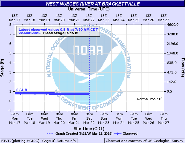
West Nueces River at Brackettville
Critical Stages
9' - Action
15' - Flood
17' - Moderate
18' - Major
Latest Observation
Updated: 5:45 PM CST 12/15/25
Status: No Flooding
Stage: 1.11 ft
Flow: 0.001 kcfs
Forecast
Forecast not available for this location.
| Time | Stage (ft) | Flow (kcfs) |
|---|---|---|
| 5:45 PM 12/15 | 1.11 | 0.001 |
| 5:30 PM 12/15 | 1.1 | 0.001 |
| 5:15 PM 12/15 | 1.1 | 0.001 |
| 5:00 PM 12/15 | 1.11 | 0.001 |
| 4:45 PM 12/15 | 1.11 | 0.001 |
| 4:30 PM 12/15 | 1.1 | 0.001 |
| 4:15 PM 12/15 | 1.1 | 0.001 |
| 4:00 PM 12/15 | 1.1 | 0.001 |
| 3:45 PM 12/15 | 1.11 | 0.001 |
| 3:30 PM 12/15 | 1.11 | 0.001 |
| 3:15 PM 12/15 | 1.1 | 0.001 |
| 3:00 PM 12/15 | 1.1 | 0.001 |
| 2:45 PM 12/15 | 1.1 | 0.001 |
| 2:30 PM 12/15 | 1.1 | 0.001 |
| 2:15 PM 12/15 | 1.1 | 0.001 |
| 2:00 PM 12/15 | 1.1 | 0.001 |
| 1:45 PM 12/15 | 1.1 | 0.001 |
| 1:30 PM 12/15 | 1.1 | 0.001 |
| 1:15 PM 12/15 | 1.11 | 0.001 |
| 1:00 PM 12/15 | 1.1 | 0.001 |
| 12:45 PM 12/15 | 1.1 | 0.001 |
| 12:30 PM 12/15 | 1.1 | 0.001 |
| 12:15 PM 12/15 | 1.1 | 0.001 |
| 12:00 PM 12/15 | 1.11 | 0.001 |
| 11:45 AM 12/15 | 1.1 | 0.001 |
| 11:30 AM 12/15 | 1.1 | 0.001 |
| 11:15 AM 12/15 | 1.1 | 0.001 |
| 11:00 AM 12/15 | 1.11 | 0.001 |
| 10:45 AM 12/15 | 1.1 | 0.001 |
| 10:30 AM 12/15 | 1.1 | 0.001 |
31' -
Disastrous flooding is over a half mile wide below the Nueces River headwaters to below Carrizo Springs. Several homes downstream in Crystal City will flood. Livestock can easily be drowned well into the flood plain. There is severe scouring of roads and fences in the flood plain. Flow is over the river gauge at Farm to Market 3199.
28' -
Massive lowland flooding puts flow to the tip of the gauge house. Miles of fencing and hundreds of yards of Farm to Market roads are destroyed. Livestock and equipment are cut off in the flood plain from the heawaters to below Tilden. Near ten homes downstream in Crystal City flood in less than two days. Flow is to the floor of the USGS cableway river gauging platform and one half mile wide near the river gauge.
26' -
Major flooding extends several hundred yards into the flood plain severely scouring roads and fences. Livestock are threatened from the headwaters to the Nueces River confluence. Residents of lowest homes downstream in Crystal City are threatened.
24' -
Major flooding several hundred yards wide severely scours roads and fencing in the flood plain. Livestock are endangered well into the flood plain. Residents of lowest homes downstream in Crystal City are threatened.
22' -
Major flooding is over four hundred yards wide, well into the flood plain. Livestock should be moved from the flood plain from the headwaters to the Nueces River confluence. Fencing and roads are severely scoured.
20' -
Major lowland flooding four hundred yards wide cuts off livestock and equipment in the flood plain. Flow is to the entrance platform of the gauge house. Many secondary and primary roads downstream are impassable.
18' -
Major flooding two hundred fifty yards wide puts secondary roads and low bridges downstream under several feet of fast moving water. Livestock near the channel are cut off and potentially drowned.
17' -
Moderate flooding over 200 yards wide exceeds the right bank well into the flood plain. Livestock from the headwaters to the Nueces River confluence should be moved from vulnerable areas of the flood plain.
15' -
Minor lowland flooding is over one hundred twenty yards wide at the gauge in one channel, and a second channel is fifteen yards wide. Secondary roads and crossings near the river are flooded and dangerous to motorists.
13' -
Overbank conditions with water into low areas of the flood plain making low water crossings dangerous to auto traffic.
| Date | Stage (ft) |
|---|---|
| Jun 14, 1935 | 40 |
| Jan 1, 1900 | 34 |
| Sep 20, 1964 | 31.3 |
| Oct 28, 1996 | 30.74 |
| Sep 24, 1955 | 27.1 |
| Jun 4, 2019 | 22.95 |
| Jun 22, 1997 | 22.71 |
| Aug 25, 1998 | 20 |
| Oct 10, 2018 | 18.49 |
| Sep 16, 1991 | 16.4 |
Data provided by the National Weather Service.