« Back to Rolling Hills Rivers
North Platte River near Glenrock
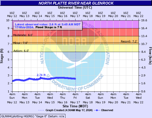
Critical Stages
6' - Action
7' - Flood
8' - Moderate
9' - Major
Latest Observation
Updated: 5:00 PM LMT 12/31/00
Status: Obs Not Current
Stage: -999 ft
Flow: -999 kcfs
Forecast
Forecast not available for this location.
Observation history not available.
9' -
Widespread lowland flooding in the vicinity of Glenrock and points up to five miles downstream of the gage. Unable to drive across the Converse Coounty Road 27 (Tank Farm Road) bridge approximately 1.25 miles below the gage due to flooding.
8' -
Flood waters totally inundate property across from the gage. Lowland flooding becomes more widespread in the vicinity of Glenrock and points up to five miles downstream of the gage. High water begins to affect access to the Converse County Road 27 (Tank Farm Road) bridge approximately 1.25 miles below the gage. The gage house is not accessible due to high water.
7.18' -
Record stage established on June 20 2011.
7' -
Flood stage. High water begins to inundate low lying areas of property across from the gage. Lowland flooding occurs in the vicinity of Glenrock and points up to five miles downstream of the gage.
6.1' -
Record flow of 16,000 cfs established on May 15 1965.
6' -
Action/Bankfull stage. River reaches the bottom of the gage house. Water begins to encroach low lying areas of property across from the gage.
| Date | Stage (ft) |
|---|---|
| Jun 20, 2011 | 7.18 |
| May 21, 1973 | 6.65 |
| Jun 10, 1984 | 6.39 |
| Jun 12, 1970 | 6.38 |
| Jul 23, 1983 | 6.21 |
| May 15, 1965 | 6.1 |
| Jun 14, 2016 | 6.02 |
| Jun 24, 2010 | 5.55 |
| Jun 16, 1997 | 5.4 |
| Jul 1, 1999 | 5.33 |
| Jul 5, 2001 | 4.92 |
| May 19, 1978 | 4.78 |
| May 9, 1995 | 4.76 |
| May 23, 2008 | 4.55 |
| Jun 16, 1996 | 4.35 |
| Aug 7, 2007 | 4.25 |
| Jul 25, 2000 | 4.23 |
| Jul 7, 1994 | 4.2 |
| Aug 27, 1989 | 4.09 |
| Aug 20, 1985 | 4.06 |
Data provided by the National Weather Service.