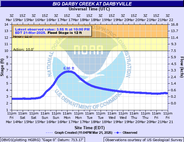
Big Darby Creek at Darbyville
Critical Stages
10' - Action
12' - Flood
17' - Moderate
20' - Major
Latest Observation
Updated: 12:00 AM EST 12/5/25
Status: No Flooding
Stage: 2.61 ft
Flow: 0.157 kcfs
Forecast
Forecast not available for this location.
| Time | Stage (ft) | Flow (kcfs) |
|---|---|---|
| 12:00 AM 12/5 | 2.61 | 0.157 |
| 11:45 PM 12/4 | 2.6 | 0.155 |
| 11:30 PM 12/4 | 2.61 | 0.157 |
| 11:15 PM 12/4 | 2.61 | 0.157 |
| 11:00 PM 12/4 | 2.61 | 0.157 |
| 10:45 PM 12/4 | 2.61 | 0.157 |
| 10:30 PM 12/4 | 2.61 | 0.157 |
| 10:15 PM 12/4 | 2.61 | 0.157 |
| 10:00 PM 12/4 | 2.61 | 0.157 |
| 9:45 PM 12/4 | 2.61 | 0.157 |
| 9:30 PM 12/4 | 2.61 | 0.157 |
| 9:15 PM 12/4 | 2.61 | 0.157 |
| 9:00 PM 12/4 | 2.61 | 0.157 |
| 8:45 PM 12/4 | 2.61 | 0.157 |
| 8:30 PM 12/4 | 2.61 | 0.157 |
| 8:15 PM 12/4 | 2.61 | 0.157 |
| 8:00 PM 12/4 | 2.61 | 0.157 |
| 7:45 PM 12/4 | 2.61 | 0.157 |
| 7:30 PM 12/4 | 2.61 | 0.157 |
| 7:15 PM 12/4 | 2.61 | 0.157 |
| 7:00 PM 12/4 | 2.61 | 0.157 |
| 6:45 PM 12/4 | 2.61 | 0.157 |
| 6:30 PM 12/4 | 2.61 | 0.157 |
| 6:15 PM 12/4 | 2.61 | 0.157 |
| 6:00 PM 12/4 | 2.61 | 0.157 |
| 5:45 PM 12/4 | 2.61 | 0.157 |
| 5:30 PM 12/4 | 2.61 | 0.157 |
| 5:15 PM 12/4 | 2.61 | 0.157 |
| 5:00 PM 12/4 | 2.61 | 0.157 |
| 4:45 PM 12/4 | 2.61 | 0.157 |
18' -
This is similar to the FEMA 1 percent flood and will exceed the flood of record of January 1959. Widespread lowland flooding occurs along Darby Creek from near Darbydale to near Orient downstream through areas near Darbyville and the creek valley in Pickaway County. Portions of Darby Creek Road and Route 762 near Orient are under water. Also, State Route 104 and McLean Mill Road may be restricted near Big Darby Creek.
15' -
Widespread flooding of low-lying roads occurs along Big Darby Creek in Franklin, Madison and Pickaway Counties. Numerous low-lying roads become flooded from near Georgesville to Darbydale to Darbyville to Circleville.
14' -
Flooding occurs near the Old Shady Acres Mobile Home Park near Circleville. Lowland flooding can be expected along Big Darby Creek from near Orient downstream through Pickaway County. Portions of Darby Creek Road are flooded, as well as some water rising onto Route 762 west of Orient.
12' -
Lowland flooding occurs along Big Darby Creek in Pickaway, Franklin and Madison Counties. Portions of Darby Creek Road north of Darbyville become flooded.
| Date | Stage (ft) |
|---|---|
| Jan 22, 1959 | 17.94 |
| Feb 27, 1929 | 15.9 |
| Jun 3, 1997 | 15.62 |
| Jan 7, 2005 | 15.3 |
| Feb 25, 1975 | 15.07 |
| Jun 29, 1998 | 14.77 |
| Jan 27, 1952 | 14.7 |
| Mar 11, 1964 | 14.31 |
| Sep 15, 1979 | 14 |
| Mar 6, 1963 | 13.92 |
| Jan 6, 2004 | 13.86 |
| Jun 9, 1924 | 13.7 |
| Dec 31, 1990 | 13.64 |
| Jan 13, 2005 | 13.41 |
| Mar 21, 2020 | 13.4 |
| Apr 5, 2018 | 13.32 |
| Apr 3, 2024 | 12.85 |
| Apr 5, 1957 | 12.83 |
| Mar 7, 1945 | 12.76 |
| May 14, 1933 | 12.7 |
Data provided by the National Weather Service.