« Back to Sabine Pass Coast Guard Station Rivers
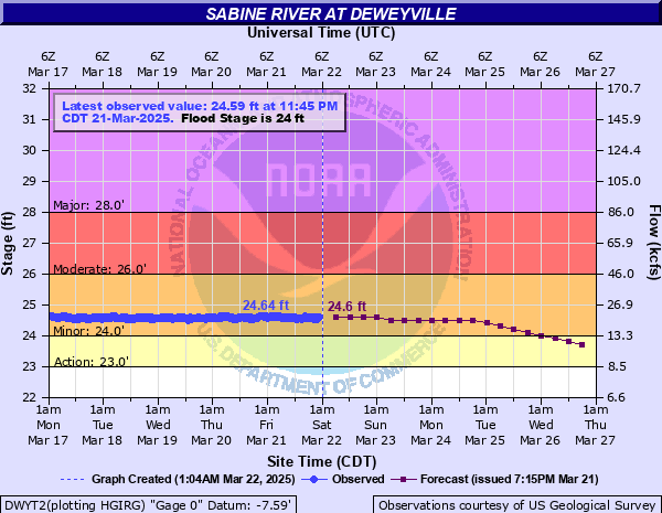
Sabine River at Deweyville
Critical Stages
23' - Action
24' - Flood
26' - Moderate
28' - Major
Latest Observation
Updated: 9:45 AM CST 12/6/25
Status: No Flooding
Stage: 17.89 ft
Flow: 2.17 kcfs
Forecast
| Time | Stage (ft) | Flow (kcfs) |
|---|---|---|
| 12 PM 12/6 | 18.1 | 2.28 |
| 6 PM 12/6 | 18.6 | 2.54 |
| 12 AM 12/7 | 18.8 | 2.66 |
| 6 AM 12/7 | 18.9 | 2.72 |
| 12 PM 12/7 | 18.9 | 2.72 |
| 6 PM 12/7 | 18.7 | 2.6 |
| 12 AM 12/8 | 18.4 | 2.43 |
| 6 AM 12/8 | 18.1 | 2.28 |
| 12 PM 12/8 | 17.7 | 2.08 |
| 6 PM 12/8 | 17.3 | 1.89 |
| 12 AM 12/9 | 16.9 | 1.71 |
| 6 AM 12/9 | 16.6 | 1.59 |
| 12 PM 12/9 | 16.3 | 1.46 |
| 6 PM 12/9 | 16 | 1.35 |
| 12 AM 12/10 | 15.7 | 1.24 |
| 6 AM 12/10 | 15.3 | 1.09 |
| 12 PM 12/10 | 15 | 0.989 |
| 6 PM 12/10 | 14.7 | 0.892 |
| 12 AM 12/11 | 14.4 | 0.799 |
| 6 AM 12/11 | 14.1 | 0.713 |
| Time | Stage (ft) | Flow (kcfs) |
|---|---|---|
| 9:45 AM 12/6 | 17.89 | 2.17 |
| 9:30 AM 12/6 | 17.86 | 2.16 |
| 9:15 AM 12/6 | 17.85 | 2.15 |
| 9:00 AM 12/6 | 17.83 | 2.14 |
| 8:45 AM 12/6 | 17.81 | 2.13 |
| 8:30 AM 12/6 | 17.79 | 2.12 |
| 8:15 AM 12/6 | 17.77 | 2.11 |
| 8:00 AM 12/6 | 17.77 | 2.11 |
| 7:45 AM 12/6 | 17.74 | 2.1 |
| 7:30 AM 12/6 | 17.72 | 2.09 |
| 7:15 AM 12/6 | 17.69 | 2.07 |
| 7:00 AM 12/6 | 17.68 | 2.07 |
| 6:45 AM 12/6 | 17.64 | 2.05 |
| 6:30 AM 12/6 | 17.63 | 2.05 |
| 6:15 AM 12/6 | 17.62 | 2.04 |
| 6:00 AM 12/6 | 17.59 | 2.03 |
| 5:45 AM 12/6 | 17.57 | 2.02 |
| 5:30 AM 12/6 | 17.56 | 2.01 |
| 5:15 AM 12/6 | 17.54 | 2 |
| 5:00 AM 12/6 | 17.53 | 2 |
| 4:45 AM 12/6 | 17.51 | 1.99 |
| 4:30 AM 12/6 | 17.5 | 1.98 |
| 4:15 AM 12/6 | 17.48 | 1.97 |
| 4:00 AM 12/6 | 17.46 | 1.97 |
| 3:45 AM 12/6 | 17.44 | 1.96 |
| 3:30 AM 12/6 | 17.41 | 1.94 |
| 3:15 AM 12/6 | 17.4 | 1.94 |
| 3:00 AM 12/6 | 17.37 | 1.92 |
| 2:45 AM 12/6 | 17.36 | 1.92 |
| 2:30 AM 12/6 | 17.33 | 1.9 |
33.2' -
The river is at its flood of record. Widespread catastrophic flooding will occur with approximately 1322 residential structures affected or destroyed and 440 businesses affected or destroyed. There are approximately 350 roads that are impassable and include Highway 12 and I-10 along the Louisiana Texas border.
29' -
Major flooding occurring leaving the town of Deweyville isolated. Numerous homes are flooded.
27.9' -
This flooding will be similar to the flooding expierenced in the flood of March 2001. Homes in Deweyville have water in them.
27' -
Widespread moderate lowland flooding will occur. Homes in Deweyville closest to the river are flooded. Flooding of homes in the Indian Lakes and River Oaks sections will also occur. Low-lying roads and a few homes in Southwest Beauregard Parish have some flooding.
26.8' -
Deweyville schools may be closed due to school bus routes being flooded.
26' -
Moderate lowland flooding will occur. The lowest homes between Deweyville and the river begin to flood, especially in the Indian Lakes and River Oaks sections. Low-lying roads and a few homes in Southwestern Beauregard Parish have some flooding. County Road 4130 and River Oaks Road are closed in Newton County around Deweyville. Bass Lake, Alligator Park, Wright, Jimmy Doyle and Steward Roads are flooded in Calcasieu Parish.
25' -
Lowest roads beside the river flood around Deweyville and subject to being closed. In addition, low-lying roads in Southwest Beauregard Parish are flooded including Robert Clark Road. Flooding occurs on the south side of Niblett Bluff Park with access roads to camp houses cut off around the park. Access roads to the river in Northeastern Orange County become flooded.
24' -
Minor lowland flooding will occur.
23' -
The river is at bankfull stage.
| Date | Stage (ft) |
|---|---|
| Mar 15, 2016 | 33.28 |
| May 1, 1884 | 32.2 |
| Sep 2, 2017 | 31.6 |
| May 22, 1953 | 29.98 |
| Apr 29, 1913 | 29.5 |
| Jul 6, 1989 | 29.15 |
| Aug 1, 1988 | 29.1 |
| Feb 6, 1999 | 28.18 |
| Dec 31, 1982 | 28 |
| Nov 8, 2009 | 27.94 |
| Oct 22, 2006 | 27.93 |
| May 25, 1989 | 27.9 |
| Mar 11, 2001 | 27.85 |
| Dec 16, 1940 | 27.81 |
| Feb 1, 1974 | 27.73 |
| May 21, 2021 | 27.65 |
| Apr 22, 1945 | 27.59 |
| May 25, 1935 | 27.3 |
| Jan 10, 2019 | 27.3 |
| Jun 9, 1950 | 27.28 |
Data provided by the National Weather Service.