« Back to Sabine Pass Coast Guard Station Rivers
Pine Island Bayou near Sour Lake
Critical Stages
22' - Action
25' - Flood
29' - Moderate
32' - Major
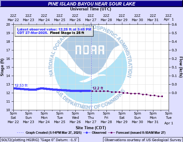
Latest Observation
Updated: 9:45 AM CST 12/6/25
Status: No Flooding
Stage: 13.3 ft
Flow: 0.049 kcfs
Forecast
| Time | Stage (ft) | Flow (kcfs) |
|---|---|---|
| 12 PM 12/6 | 13.3 | 0.049 |
| 6 PM 12/6 | 13.3 | 0.049 |
| 12 AM 12/7 | 13.2 | 0.045 |
| 6 AM 12/7 | 13.2 | 0.045 |
| 12 PM 12/7 | 13.1 | 0.041 |
| 6 PM 12/7 | 13.1 | 0.041 |
| 12 AM 12/8 | 13.1 | 0.041 |
| 6 AM 12/8 | 13 | 0.038 |
| 12 PM 12/8 | 13 | 0.038 |
| 6 PM 12/8 | 13 | 0.038 |
| 12 AM 12/9 | 12.9 | 0.034 |
| 6 AM 12/9 | 12.9 | 0.034 |
| 12 PM 12/9 | 12.8 | 0.031 |
| 6 PM 12/9 | 12.8 | 0.031 |
| 12 AM 12/10 | 12.8 | 0.031 |
| 6 AM 12/10 | 12.7 | 0.028 |
| 12 PM 12/10 | 12.7 | 0.028 |
| 6 PM 12/10 | 12.6 | 0.025 |
| 12 AM 12/11 | 12.6 | 0.025 |
| 6 AM 12/11 | 12.6 | 0.025 |
| Time | Stage (ft) | Flow (kcfs) |
|---|---|---|
| 9:45 AM 12/6 | 13.3 | 0.049 |
| 9:30 AM 12/6 | 13.31 | 0.0494 |
| 9:15 AM 12/6 | 13.31 | 0.0494 |
| 9:00 AM 12/6 | 13.32 | 0.0498 |
| 8:45 AM 12/6 | 13.32 | 0.0498 |
| 8:30 AM 12/6 | 13.33 | 0.0502 |
| 8:15 AM 12/6 | 13.34 | 0.0506 |
| 8:00 AM 12/6 | 13.34 | 0.0506 |
| 7:45 AM 12/6 | 13.35 | 0.051 |
| 7:30 AM 12/6 | 13.35 | 0.051 |
| 7:15 AM 12/6 | 13.36 | 0.0514 |
| 7:00 AM 12/6 | 13.36 | 0.0514 |
| 6:45 AM 12/6 | 13.37 | 0.0518 |
| 6:30 AM 12/6 | 13.37 | 0.0518 |
| 6:15 AM 12/6 | 13.38 | 0.0522 |
| 6:00 AM 12/6 | 13.39 | 0.0526 |
| 5:45 AM 12/6 | 13.39 | 0.0526 |
| 5:30 AM 12/6 | 13.4 | 0.053 |
| 5:15 AM 12/6 | 13.41 | 0.0534 |
| 5:00 AM 12/6 | 13.42 | 0.0538 |
| 4:45 AM 12/6 | 13.42 | 0.0538 |
| 4:30 AM 12/6 | 13.43 | 0.0542 |
| 4:15 AM 12/6 | 13.44 | 0.0546 |
| 4:00 AM 12/6 | 13.44 | 0.0546 |
| 3:45 AM 12/6 | 13.45 | 0.055 |
| 3:30 AM 12/6 | 13.46 | 0.0554 |
| 3:15 AM 12/6 | 13.47 | 0.0558 |
| 3:00 AM 12/6 | 13.48 | 0.0562 |
| 2:45 AM 12/6 | 13.48 | 0.0562 |
| 2:30 AM 12/6 | 13.49 | 0.0566 |
39.68' -
Flood of record in August 2017 from rainfall due to Hurricane Harvey. Widespread flooding along the bayou. Water inundates hwy 105 several feet and numerous homes in Bevil Oaks are flooded, some up to nine feet.
38.5' -
Water reaches the instrument shelf.
37.49' -
The river is at its previous flood of record reached on October 20th 1994. Widespread major flooding occurs. Numerous homes in Bevil Oaks have 3 to 4 feet of water in them.
35.5' -
Water reaches the gage shelter floor.
34' -
Water reaches homes along Old Sour Lake Road near the river.
32' -
Major lowland flooding occurs. Several homes on Riverbend Drive in Bevil Oaks have water in them. Water reaches floor of bridge along Old Sour Lake Road.
31' -
Homes in the Bevil oaks and Pinewood areas begin to flood.
30.5' -
Riverbend Drive in Bevil Oaks is impassable.
29' -
Moderate lowland flooding will occur. Water covers roads in Bevil Oaks.
25' -
Water inundates roads in lowland areas near the river. Low spots on Old Sour Lake Road are under water.
22' -
River is at bankfull stage.
| Date | Stage (ft) |
|---|---|
| Aug 30, 2017 | 39.68 |
| Oct 20, 1994 | 37.5 |
| Sep 21, 2019 | 35.7 |
| Apr 22, 1979 | 34.29 |
| May 22, 1989 | 33.7 |
| Jul 2, 1989 | 32.37 |
| Jun 10, 2001 | 31.9 |
| Jul 28, 1979 | 31.43 |
| Oct 22, 2006 | 31.03 |
| Sep 1, 1963 | 31 |
| Jun 6, 2016 | 30.84 |
| Jun 11, 1975 | 30.83 |
| Oct 31, 2002 | 30.65 |
| Jun 14, 1973 | 30.25 |
| May 6, 2024 | 29.96 |
| Nov 27, 1976 | 29.76 |
| Nov 26, 1986 | 29.7 |
| Jun 28, 2004 | 29.49 |
| Jan 22, 1974 | 29.48 |
| Jun 7, 1981 | 29.42 |
Data provided by the National Weather Service.