« Back to Saint Sebastian School Rivers
Sheboygan River at Sheboygan
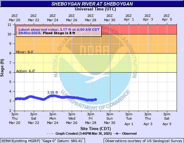
Critical Stages
6' - Action
8' - Flood
10' - Moderate
12' - Major
Latest Observation
Updated: 9:00 PM CST 12/14/25
Status: No Flooding
Stage: 2.3 ft
Flow: 0.184 kcfs
Forecast
Forecast not available for this location.
| Time | Stage (ft) | Flow (kcfs) |
|---|---|---|
| 9:00 PM 12/14 | 2.3 | 0.184 |
| 8:45 PM 12/14 | 2.3 | 0.184 |
| 8:30 PM 12/14 | 2.3 | 0.184 |
| 8:15 PM 12/14 | 2.31 | 0.188 |
| 8:00 PM 12/14 | 2.31 | 0.188 |
| 7:45 PM 12/14 | 2.32 | 0.191 |
| 7:30 PM 12/14 | 2.32 | 0.191 |
| 7:15 PM 12/14 | 2.33 | 0.195 |
| 7:00 PM 12/14 | 2.33 | 0.195 |
| 6:45 PM 12/14 | 2.33 | 0.195 |
| 6:30 PM 12/14 | 2.34 | 0.199 |
| 6:15 PM 12/14 | 2.34 | 0.199 |
| 6:00 PM 12/14 | 2.35 | 0.202 |
| 5:45 PM 12/14 | 2.35 | 0.202 |
| 5:30 PM 12/14 | 2.36 | 0.206 |
| 5:15 PM 12/14 | 2.36 | 0.206 |
| 5:00 PM 12/14 | 2.36 | 0.206 |
| 4:45 PM 12/14 | 2.37 | 0.21 |
| 4:30 PM 12/14 | 2.37 | 0.21 |
| 4:15 PM 12/14 | 2.38 | 0.214 |
| 4:00 PM 12/14 | 2.38 | 0.214 |
| 3:45 PM 12/14 | 2.39 | 0.218 |
| 3:30 PM 12/14 | 2.39 | 0.218 |
| 3:15 PM 12/14 | 2.39 | 0.218 |
| 3:00 PM 12/14 | 2.4 | 0.222 |
| 2:45 PM 12/14 | 2.4 | 0.222 |
| 2:30 PM 12/14 | 2.41 | 0.226 |
| 2:15 PM 12/14 | 2.41 | 0.226 |
| 2:00 PM 12/14 | 2.41 | 0.226 |
| 1:45 PM 12/14 | 2.41 | 0.226 |
12.5' -
Floodwaters affect the intersection of Indiana Ave and S Taylor Drive in Sheboygan. Other streets affected by floodwaters are Maryland Avenue in Sheboygan and Alpine Avenue and Meadowlark Road in Sheboygan Falls. Sections of Kiwanis Park, Rotary Park and Esslingen Park in Sheboygan are flooded.
11.5' -
About 3 miles west of Sheboygan Aiport, Woodland Road is flooded and closed between Rio Road and Willow Road. Sections of Alpine Road and Meadowlark Road in the Sheboygan Falls area are flooded and closed. Floodwaters affect Kiwanis and Esslingen Parks in Sheboygan.
10.5' -
About 3 miles west of Sheboygan Airport, Woodland Road is closed between Rio Road and Willow Road. A section of Alpine Road near the Sheboygan Airport is closed. There is flooding in River Park in Sheboygan Falls and in Esslingen Park in Sheboygan.
9.5' -
About 3 miles west of Sheboygan Airport, Woodland Road between Rio Road and Willow Road is closed. A section of Alpine Road near the Sheboygan Airport is closed. There is flooding in parts of River Park in Sheboygan Falls and Esslingen Park in Sheboygan.
8' -
Water nears a Road in Kiwanis Park in Sheboygan. There is localized flooding of River Park in Sheboygan Falls and Esslingen Park in Sheboygan. Water covers docks and piers in the Sheboygan area.
7' -
Minor lowland flooding occurs. Floodwaters cover marina docks and piers in Sheboygan.
6' -
Minor lowland flooding occurs. Floodwaters cover some marina docks and piers in the Sheboygan area.
| Date | Stage (ft) |
|---|---|
| Aug 6, 1998 | 12.02 |
| Mar 22, 1975 | 11.64 |
| Mar 15, 2019 | 11.5 |
| May 13, 1978 | 11.42 |
| May 18, 2020 | 11.11 |
| Jun 9, 2008 | 11.08 |
| May 18, 2020 | 11.07 |
| Jun 21, 1997 | 10.89 |
| Mar 31, 1979 | 10.77 |
| Jun 13, 2008 | 10.76 |
| Mar 30, 1960 | 10.65 |
| Oct 2, 2019 | 10.53 |
| Jun 12, 2004 | 10.4 |
| Mar 27, 1989 | 10.25 |
| Apr 10, 2013 | 10.23 |
| Mar 10, 2009 | 10.21 |
| Feb 15, 1984 | 9.84 |
| Apr 14, 2014 | 9.76 |
| Feb 10, 1966 | 9.76 |
| Feb 21, 2018 | 9.68 |
Data provided by the National Weather Service.