« Back to Shannon County Rivers
Eleven Point River near Bardley
Critical Stages
8' - Action
10' - Flood
Moderate
30' - Major
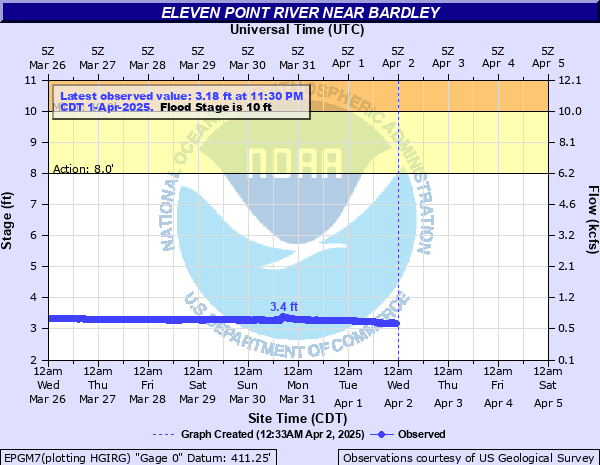
Latest Observation
Updated: 12:30 PM CST 12/6/25
Status: No Flooding
Stage: 2.81 ft
Flow: 0.422 kcfs
Forecast
Forecast not available for this location.
| Time | Stage (ft) | Flow (kcfs) |
|---|---|---|
| 12:30 PM 12/6 | 2.81 | 0.422 |
| 12:15 PM 12/6 | 2.82 | 0.427 |
| 12:00 PM 12/6 | 2.81 | 0.422 |
| 11:45 AM 12/6 | 2.81 | 0.422 |
| 11:30 AM 12/6 | 2.81 | 0.422 |
| 11:15 AM 12/6 | 2.81 | 0.422 |
| 11:00 AM 12/6 | 2.81 | 0.422 |
| 10:45 AM 12/6 | 2.81 | 0.422 |
| 10:30 AM 12/6 | 2.81 | 0.422 |
| 10:15 AM 12/6 | 2.81 | 0.422 |
| 10:00 AM 12/6 | 2.81 | 0.422 |
| 9:45 AM 12/6 | 2.81 | 0.422 |
| 9:30 AM 12/6 | 2.81 | 0.422 |
| 9:15 AM 12/6 | 2.81 | 0.422 |
| 9:00 AM 12/6 | 2.81 | 0.422 |
| 8:45 AM 12/6 | 2.81 | 0.422 |
| 8:30 AM 12/6 | 2.81 | 0.422 |
| 8:15 AM 12/6 | 2.81 | 0.422 |
| 8:00 AM 12/6 | 2.81 | 0.422 |
| 7:45 AM 12/6 | 2.81 | 0.422 |
| 7:30 AM 12/6 | 2.81 | 0.422 |
| 7:15 AM 12/6 | 2.81 | 0.422 |
| 7:00 AM 12/6 | 2.81 | 0.422 |
| 6:45 AM 12/6 | 2.81 | 0.422 |
| 6:30 AM 12/6 | 2.81 | 0.422 |
| 6:15 AM 12/6 | 2.81 | 0.422 |
| 6:00 AM 12/6 | 2.81 | 0.422 |
| 5:45 AM 12/6 | 2.81 | 0.422 |
| 5:30 AM 12/6 | 2.81 | 0.422 |
| 5:15 AM 12/6 | 2.81 | 0.422 |
40' -
Approximate level of the one percent chance flood.
30' -
Approximate level where flood waters affect the Highway 160 bridge.
10' -
The approximate level where picnic areas and river access ramps are flooded.
| Date | Stage (ft) |
|---|---|
| Apr 30, 2017 | 28.66 |
| Dec 3, 1982 | 21.64 |
| Mar 19, 2008 | 21.33 |
| Aug 1, 1915 | 19.7 |
| Apr 14, 1927 | 18.74 |
| Apr 26, 2011 | 17.83 |
| Nov 15, 1993 | 17.35 |
| Oct 31, 2009 | 17.33 |
| Jan 24, 1949 | 16.7 |
| Dec 22, 1984 | 16.45 |
| May 9, 2002 | 16.43 |
| Nov 17, 1958 | 16.1 |
| Apr 4, 1957 | 15.76 |
| Dec 29, 2015 | 15.72 |
| May 31, 1942 | 15.7 |
| Jun 13, 1928 | 15.6 |
| Feb 10, 1966 | 15.56 |
| Mar 31, 1945 | 15.5 |
| May 11, 1943 | 15.18 |
| Apr 14, 1991 | 15.04 |
Data provided by the National Weather Service.