« Back to Sheridan Lake Rivers
Arkansas River at Coolidge
Critical Stages
7' - Action
8' - Flood
10' - Moderate
12' - Major
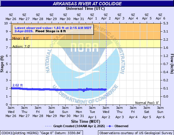
Latest Observation
Updated: 12:15 AM MST 12/16/25
Status: No Flooding
Stage: 2.26 ft
Flow: 0.0765 kcfs
Forecast
Forecast not available for this location.
| Time | Stage (ft) | Flow (kcfs) |
|---|---|---|
| 12:15 AM 12/16 | 2.26 | 0.0765 |
| 12:00 AM 12/16 | 2.26 | 0.0765 |
| 11:45 PM 12/15 | 2.26 | 0.0765 |
| 11:30 PM 12/15 | 2.26 | 0.0765 |
| 11:15 PM 12/15 | 2.25 | 0.0756 |
| 11:00 PM 12/15 | 2.25 | 0.0756 |
| 10:45 PM 12/15 | 2.25 | 0.0756 |
| 10:30 PM 12/15 | 2.25 | 0.0756 |
| 10:15 PM 12/15 | 2.25 | 0.0756 |
| 10:00 PM 12/15 | 2.25 | 0.0756 |
| 9:45 PM 12/15 | 2.24 | 0.0747 |
| 9:30 PM 12/15 | 2.25 | 0.0756 |
| 9:15 PM 12/15 | 2.24 | 0.0747 |
| 9:00 PM 12/15 | 2.25 | 0.0756 |
| 8:45 PM 12/15 | 2.25 | 0.0756 |
| 8:30 PM 12/15 | 2.25 | 0.0756 |
| 8:15 PM 12/15 | 2.25 | 0.0756 |
| 8:00 PM 12/15 | 2.25 | 0.0756 |
| 7:45 PM 12/15 | 2.25 | 0.0756 |
| 7:30 PM 12/15 | 2.25 | 0.0756 |
| 7:15 PM 12/15 | 2.25 | 0.0756 |
| 7:00 PM 12/15 | 2.25 | 0.0756 |
| 6:45 PM 12/15 | 2.25 | 0.0756 |
| 6:30 PM 12/15 | 2.26 | 0.0765 |
| 6:15 PM 12/15 | 2.25 | 0.0756 |
| 6:00 PM 12/15 | 2.26 | 0.0765 |
| 5:45 PM 12/15 | 2.26 | 0.0765 |
| 5:30 PM 12/15 | 2.26 | 0.0765 |
| 7:15 PM 12/14 | 2.25 | 0.0756 |
| 7:00 PM 12/14 | 2.25 | 0.0756 |
17' -
Expect near-record flooding along the Arkansas River from the state line to Medway, KS. The approaches to the river bridge south of Coolidge are in danger of overtopping. Floodwaters will inundate lowlands along the river south of the ATSF railroad tracks and flood farm houses and roads near the river. Flood waters 7 to 9 feet deep in places are possible.
10' -
Expect moderate flooding along the Arkansas River. Areas south of the river between the CO-KS state line and Medway, KS. Will be flooded with water up to 2 feet deep in some places. Flow over the road north of the bridge will begin when river rises to 10.1 feet. Flow over the road south of the gage will occur at a gage height of 11.0 feet.
9' -
Expect flooding of 1 to 2 feet along the Arkansas River from Coolidge to Medway. The road south of Coolidge which crosses the Arkansas River will begin to flood at a river stage between 9 to 10 feet.
8' -
Expect minor flooding in pastureland and farmland adjacent to the river. Low water areas along the unpaved River Road south of the Arkansas River will have water over the road... Exercise extreme caution.
| Date | Stage (ft) |
|---|---|
| Jun 17, 1965 | 14.8 |
| May 15, 1951 | 10.67 |
| Jul 16, 1984 | 8.88 |
| Aug 17, 2015 | 8.85 |
| May 6, 1999 | 8.62 |
| May 30, 1964 | 8.6 |
| Jun 30, 1987 | 8.44 |
| May 16, 1957 | 8.35 |
| Aug 14, 1997 | 8.25 |
| Jun 4, 1978 | 8.22 |
| May 26, 1987 | 8.2 |
| May 20, 1955 | 8.08 |
| Aug 2, 1998 | 8 |
| Jul 25, 1995 | 7.95 |
| Aug 7, 1954 | 7.67 |
| Jul 1, 2016 | 7.59 |
| Jul 28, 2018 | 7.51 |
| Aug 2, 1986 | 7.41 |
| Aug 20, 1956 | 7.4 |
| Jul 6, 2002 | 7.32 |
Data provided by the National Weather Service.