« Back to Sherwood Valley Rancheria Rivers
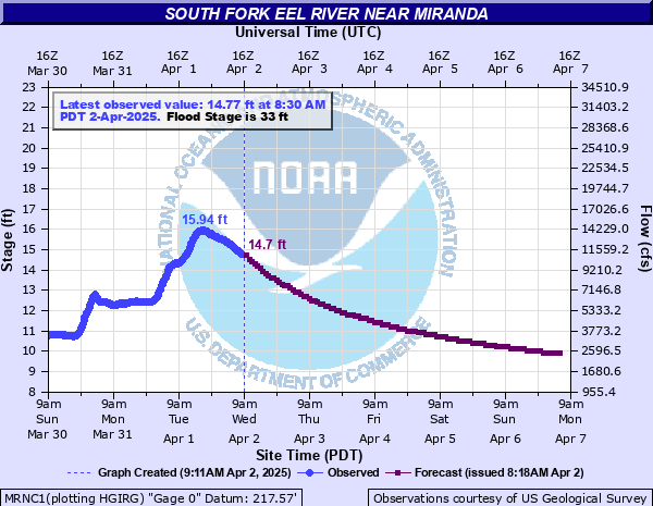
South Fork Eel River near Miranda
Critical Stages
27' - Action
33' - Flood
38' - Moderate
42' - Major
Latest Observation
Updated: 2:30 AM PST 12/16/25
Status: No Flooding
Stage: 6.25 ft
Flow: 0.145 kcfs
Forecast
| Time | Stage (ft) | Flow (kcfs) |
|---|---|---|
| 4 AM 12/16 | 6.2 | 0.133 |
| 5 AM 12/16 | 6.2 | 0.133 |
| 6 AM 12/16 | 6.21 | 0.135 |
| 7 AM 12/16 | 6.21 | 0.135 |
| 8 AM 12/16 | 6.21 | 0.135 |
| 9 AM 12/16 | 6.21 | 0.135 |
| 10 AM 12/16 | 6.22 | 0.138 |
| 11 AM 12/16 | 6.22 | 0.138 |
| 12 PM 12/16 | 6.23 | 0.14 |
| 1 PM 12/16 | 6.24 | 0.143 |
| 2 PM 12/16 | 6.25 | 0.145 |
| 3 PM 12/16 | 6.27 | 0.151 |
| 4 PM 12/16 | 6.29 | 0.156 |
| 5 PM 12/16 | 6.31 | 0.162 |
| 6 PM 12/16 | 6.33 | 0.167 |
| 7 PM 12/16 | 6.35 | 0.173 |
| 8 PM 12/16 | 6.38 | 0.181 |
| 9 PM 12/16 | 6.4 | 0.187 |
| 10 PM 12/16 | 6.43 | 0.196 |
| 11 PM 12/16 | 6.47 | 0.208 |
| 12 AM 12/17 | 6.51 | 0.221 |
| 1 AM 12/17 | 6.55 | 0.234 |
| 2 AM 12/17 | 6.6 | 0.25 |
| 3 AM 12/17 | 6.66 | 0.271 |
| 4 AM 12/17 | 6.73 | 0.296 |
| 5 AM 12/17 | 6.8 | 0.322 |
| 6 AM 12/17 | 6.89 | 0.357 |
| 7 AM 12/17 | 6.99 | 0.398 |
| 8 AM 12/17 | 7.09 | 0.441 |
| 9 AM 12/17 | 7.2 | 0.491 |
| 10 AM 12/17 | 7.31 | 0.544 |
| 11 AM 12/17 | 7.43 | 0.604 |
| 12 PM 12/17 | 7.54 | 0.662 |
| 1 PM 12/17 | 7.67 | 0.733 |
| 2 PM 12/17 | 7.79 | 0.802 |
| 3 PM 12/17 | 7.94 | 0.892 |
| 4 PM 12/17 | 8.11 | 1 |
| 5 PM 12/17 | 8.31 | 1.13 |
| 6 PM 12/17 | 9.09 | 1.74 |
| 7 PM 12/17 | 9.33 | 1.94 |
| 8 PM 12/17 | 9.47 | 2.07 |
| 9 PM 12/17 | 9.53 | 2.13 |
| 10 PM 12/17 | 9.52 | 2.12 |
| 11 PM 12/17 | 9.44 | 2.04 |
| 12 AM 12/18 | 9.34 | 1.95 |
| 1 AM 12/18 | 9.21 | 1.84 |
| 2 AM 12/18 | 9.08 | 1.73 |
| 3 AM 12/18 | 8.95 | 1.62 |
| 4 AM 12/18 | 8.8 | 1.5 |
| 5 AM 12/18 | 8.65 | 1.38 |
| 6 AM 12/18 | 8.55 | 1.31 |
| 7 AM 12/18 | 8.49 | 1.26 |
| 8 AM 12/18 | 8.4 | 1.2 |
| 9 AM 12/18 | 8.31 | 1.13 |
| 10 AM 12/18 | 8.22 | 1.07 |
| 11 AM 12/18 | 8.16 | 1.03 |
| 12 PM 12/18 | 8.13 | 1.01 |
| 1 PM 12/18 | 8.09 | 0.987 |
| 2 PM 12/18 | 8.05 | 0.961 |
| 3 PM 12/18 | 8.01 | 0.936 |
| 4 PM 12/18 | 7.97 | 0.911 |
| 5 PM 12/18 | 7.94 | 0.892 |
| 6 PM 12/18 | 7.92 | 0.88 |
| 7 PM 12/18 | 7.9 | 0.868 |
| 8 PM 12/18 | 7.89 | 0.862 |
| 9 PM 12/18 | 7.89 | 0.862 |
| 10 PM 12/18 | 7.89 | 0.862 |
| 11 PM 12/18 | 7.9 | 0.868 |
| 12 AM 12/19 | 7.92 | 0.88 |
| 1 AM 12/19 | 7.93 | 0.886 |
| 2 AM 12/19 | 7.95 | 0.898 |
| 3 AM 12/19 | 7.97 | 0.911 |
| 4 AM 12/19 | 8 | 0.93 |
| 5 AM 12/19 | 8.03 | 0.949 |
| 6 AM 12/19 | 8.07 | 0.974 |
| 7 AM 12/19 | 8.12 | 1.01 |
| 8 AM 12/19 | 8.19 | 1.05 |
| 9 AM 12/19 | 8.27 | 1.11 |
| 10 AM 12/19 | 8.36 | 1.17 |
| 11 AM 12/19 | 8.47 | 1.25 |
| 12 PM 12/19 | 8.6 | 1.34 |
| 1 PM 12/19 | 8.76 | 1.47 |
| 2 PM 12/19 | 8.93 | 1.6 |
| 3 PM 12/19 | 9.12 | 1.76 |
| 4 PM 12/19 | 9.31 | 1.93 |
| 5 PM 12/19 | 9.5 | 2.1 |
| 6 PM 12/19 | 9.71 | 2.3 |
| 7 PM 12/19 | 10.07 | 2.66 |
| 8 PM 12/19 | 10.28 | 2.88 |
| 9 PM 12/19 | 10.46 | 3.08 |
| 10 PM 12/19 | 10.62 | 3.26 |
| 11 PM 12/19 | 10.79 | 3.48 |
| 12 AM 12/20 | 11.37 | 4.32 |
| 1 AM 12/20 | 11.64 | 4.74 |
| 2 AM 12/20 | 11.87 | 5.12 |
| 3 AM 12/20 | 12.03 | 5.38 |
| 4 AM 12/20 | 12.16 | 5.61 |
| Time | Stage (ft) | Flow (kcfs) |
|---|---|---|
| 2:30 AM 12/16 | 6.25 | 0.145 |
| 2:15 AM 12/16 | 6.24 | 0.143 |
| 2:00 AM 12/16 | 6.24 | 0.143 |
| 1:45 AM 12/16 | 6.23 | 0.14 |
| 1:30 AM 12/16 | 6.22 | 0.138 |
| 1:15 AM 12/16 | 6.22 | 0.138 |
| 1:00 AM 12/16 | 6.21 | 0.135 |
| 12:45 AM 12/16 | 6.22 | 0.138 |
| 12:30 AM 12/16 | 6.22 | 0.138 |
| 12:15 AM 12/16 | 6.21 | 0.135 |
| 12:00 AM 12/16 | 6.21 | 0.135 |
| 11:45 PM 12/15 | 6.21 | 0.135 |
| 11:30 PM 12/15 | 6.2 | 0.133 |
| 11:15 PM 12/15 | 6.21 | 0.135 |
| 11:00 PM 12/15 | 6.2 | 0.133 |
| 10:45 PM 12/15 | 6.2 | 0.133 |
| 10:30 PM 12/15 | 6.2 | 0.133 |
| 10:15 PM 12/15 | 6.2 | 0.133 |
| 10:00 PM 12/15 | 6.2 | 0.133 |
| 9:45 PM 12/15 | 6.2 | 0.133 |
| 9:30 PM 12/15 | 6.2 | 0.133 |
| 9:15 PM 12/15 | 6.2 | 0.133 |
| 9:00 PM 12/15 | 6.2 | 0.133 |
| 8:45 PM 12/15 | 6.2 | 0.133 |
| 8:30 PM 12/15 | 6.2 | 0.133 |
| 8:15 PM 12/15 | 6.2 | 0.133 |
| 8:00 PM 12/15 | 6.2 | 0.133 |
| 7:45 PM 12/15 | 6.2 | 0.133 |
| 7:30 PM 12/15 | 6.2 | 0.133 |
| 7:15 PM 12/15 | 6.2 | 0.133 |
47' -
Extensive and severe flooding of all areas along the river. Severe damage to roads, bridges and structures can be expected. US Highway 101 and Highway 254 (Avenue of the Giants) will likely be closed. All persons in the vicinity of the river should take appropriate actions to protect life and property.
45' -
Severe flooding of many communities and roads along the river can be expected. Numerous road closures are likely, possibly including US Highway 101 and Highway 254 (Avenue of the Giants). All persons in the vicinity of the river should take appropriate actions to protect life and property.
42' -
Extensive and severe flooding of many portions of the Avenue of the Giants, especially areas in the vicinity of Sylvandale, Myers Flat, Weott and Phillipsville. Expect numerous road closures in these areas.
38' -
Considerable flooding of portions of the Avenue of the Giants (Highway 254) in the vicinity of Sylvandale, Myers Flat and Weott, with numerous road closures expected. Minor flooding will begin along Phillipsville Road and adjacent low lying areas.
35' -
Considerable flooding of portions of Avenue of the Giants in the vicinity of Sylvandale, Myers Flat and Weott is likely. Expect closure Of Avenue of the Giants (Highway 254) in numerous locations.
33' -
Flooding of portions of the Avenue of the Giants is likely in the vicinity of Sylvandale, and the Myers Flat and Redwood Giants Trailer Park. Flooding is also possible near Weott.
30' -
Flooding of portions of the Avenue of the Giants may occur, especially in the vicinity of Sylvandale and the Myers Flat and Redwood Giants Trailer Park.
27' -
Flooding of portions of the Avenue of the Giants (Highway 254) is possible near Sylvandale.
| Date | Stage (ft) |
|---|---|
| Dec 22, 1964 | 46 |
| Dec 22, 1955 | 42.7 |
| Feb 17, 1986 | 38.29 |
| Dec 19, 1981 | 34.79 |
| Feb 8, 1960 | 34.61 |
| Jan 16, 1974 | 34.57 |
| Jan 1, 1997 | 33.64 |
| Mar 30, 1974 | 33.39 |
| Jan 4, 1966 | 32.9 |
| Jan 11, 2017 | 32.47 |
| Jan 21, 1993 | 32.36 |
| Jan 9, 1995 | 31.29 |
| Feb 27, 2019 | 29.99 |
| Mar 18, 1975 | 29.84 |
| Dec 3, 1970 | 29.16 |
| Jan 26, 1983 | 28.43 |
| Jan 13, 1995 | 28.4 |
| Dec 30, 2022 | 28.11 |
| Jan 23, 1970 | 27.95 |
| Nov 22, 2024 | 27.95 |
Data provided by the National Weather Service.