« Back to Skiddy Cemetery Rivers
Neosho River near Americus
Critical Stages
21' - Action
26' - Flood
27' - Moderate
40' - Major
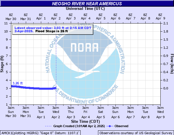
Latest Observation
Updated: 11:15 PM CST 12/14/25
Status: No Flooding
Stage: 3.2 ft
Flow: 0.0523 kcfs
Forecast
Forecast not available for this location.
| Time | Stage (ft) | Flow (kcfs) |
|---|---|---|
| 12:15 AM 12/15 | 3.21 | 0.0534 |
| 12:00 AM 12/15 | 3.21 | 0.0534 |
| 11:45 PM 12/14 | 3.21 | 0.0534 |
| 11:30 PM 12/14 | 3.21 | 0.0534 |
| 11:15 PM 12/14 | 3.2 | 0.0523 |
| 11:00 PM 12/14 | 3.21 | 0.0534 |
| 10:45 PM 12/14 | 3.21 | 0.0534 |
| 10:30 PM 12/14 | 3.21 | 0.0534 |
| 10:15 PM 12/14 | 3.21 | 0.0534 |
| 10:00 PM 12/14 | 3.2 | 0.0523 |
| 9:45 PM 12/14 | 3.21 | 0.0534 |
| 9:30 PM 12/14 | 3.2 | 0.0523 |
| 9:15 PM 12/14 | 3.21 | 0.0534 |
| 9:00 PM 12/14 | 3.21 | 0.0534 |
| 8:45 PM 12/14 | 3.21 | 0.0534 |
| 8:30 PM 12/14 | 3.21 | 0.0534 |
| 8:15 PM 12/14 | 3.21 | 0.0534 |
| 8:00 PM 12/14 | 3.21 | 0.0534 |
| 7:45 PM 12/14 | 3.21 | 0.0534 |
| 7:30 PM 12/14 | 3.21 | 0.0534 |
| 7:15 PM 12/14 | 3.21 | 0.0534 |
| 7:00 PM 12/14 | 3.21 | 0.0534 |
| 6:45 PM 12/14 | 3.21 | 0.0534 |
| 6:30 PM 12/14 | 3.21 | 0.0534 |
| 6:15 PM 12/14 | 3.21 | 0.0534 |
| 6:00 PM 12/14 | 3.21 | 0.0534 |
| 5:45 PM 12/14 | 3.21 | 0.0534 |
| 5:30 PM 12/14 | 3.21 | 0.0534 |
| 5:15 PM 12/14 | 3.21 | 0.0534 |
| 5:00 PM 12/14 | 3.21 | 0.0534 |
29' -
Right bank overflow begins.
27' -
Americus Road, also known as Road F 5, 2 miles south of Americus floods.
26' -
Minor lowland flooding occurs along the river from Americus to Emporia.
| Date | Stage (ft) |
|---|---|
| Jun 27, 1969 | 28.3 |
| Jun 22, 1967 | 28.17 |
| Jul 22, 1993 | 27.84 |
| Sep 27, 1973 | 27.76 |
| Oct 11, 1973 | 27.74 |
| May 23, 1971 | 27.7 |
| Jun 19, 2004 | 27.68 |
| Oct 8, 1967 | 27.52 |
| Jun 14, 2004 | 27.45 |
| Oct 10, 1985 | 27.43 |
| Jun 1, 1996 | 27.4 |
| Nov 2, 1998 | 27.38 |
| Jun 25, 1977 | 27.31 |
| May 8, 2019 | 27.22 |
| Oct 10, 2018 | 27.2 |
| Aug 26, 2005 | 26.98 |
| May 14, 2005 | 26.94 |
| May 27, 2016 | 26.94 |
| May 8, 2007 | 26.85 |
| Jun 5, 1985 | 26.8 |
Data provided by the National Weather Service.