« Back to South Danville Rivers
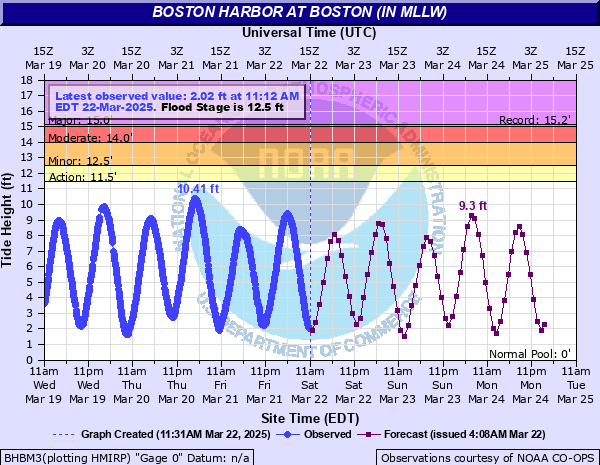
Boston Harbor at Boston (IN MLLW)
Critical Stages
11.5' - Action
12.5' - Flood
14' - Moderate
15' - Major
Latest Observation
Updated: 9:54 PM EST 12/5/25
Status: No Flooding
Stage: 8.6 ft
Flow: -999 kcfs
Forecast
| Time | Stage (ft) | Flow (kcfs) |
|---|---|---|
| 11 PM 12/5 | 10.6 | -999 |
| 12 AM 12/6 | 10.5 | -999 |
| 1 AM 12/6 | 8.9 | -999 |
| 2 AM 12/6 | 6.8 | -999 |
| 3 AM 12/6 | 4.3 | -999 |
| 4 AM 12/6 | 1.8 | -999 |
| 5 AM 12/6 | 0.6 | -999 |
| 6 AM 12/6 | 0.8 | -999 |
| 7 AM 12/6 | 2.4 | -999 |
| 8 AM 12/6 | 5.1 | -999 |
| 9 AM 12/6 | 7.9 | -999 |
| 10 AM 12/6 | 10.5 | -999 |
| 11 AM 12/6 | 12.3 | -999 |
| 12 PM 12/6 | 12.4 | -999 |
| 1 PM 12/6 | 11.1 | -999 |
| 2 PM 12/6 | 8.8 | -999 |
| 3 PM 12/6 | 5.8 | -999 |
| 4 PM 12/6 | 2.6 | -999 |
| 5 PM 12/6 | 0.2 | -999 |
| 6 PM 12/6 | -0.8 | -999 |
| 7 PM 12/6 | -0.2 | -999 |
| 8 PM 12/6 | 1.6 | -999 |
| 9 PM 12/6 | 4.1 | -999 |
| 10 PM 12/6 | 6.8 | -999 |
| 11 PM 12/6 | 9.2 | -999 |
| 12 AM 12/7 | 10.5 | -999 |
| 1 AM 12/7 | 10.1 | -999 |
| 2 AM 12/7 | 8.7 | -999 |
| 3 AM 12/7 | 6.5 | -999 |
| 4 AM 12/7 | 3.9 | -999 |
| 5 AM 12/7 | 1.6 | -999 |
| 6 AM 12/7 | 0.5 | -999 |
| 7 AM 12/7 | 1 | -999 |
| 8 AM 12/7 | 2.8 | -999 |
| 9 AM 12/7 | 5.2 | -999 |
| 10 AM 12/7 | 7.9 | -999 |
| 11 AM 12/7 | 10.5 | -999 |
| 12 PM 12/7 | 12 | -999 |
| 1 PM 12/7 | 11.9 | -999 |
| 2 PM 12/7 | 10.6 | -999 |
| 3 PM 12/7 | 8.2 | -999 |
| 4 PM 12/7 | 5.4 | -999 |
| 5 PM 12/7 | 2.5 | -999 |
| 6 PM 12/7 | 0.3 | -999 |
| 7 PM 12/7 | -0.8 | -999 |
| 8 PM 12/7 | 0.3 | -999 |
| 9 PM 12/7 | 2 | -999 |
| 10 PM 12/7 | 4.3 | -999 |
| 11 PM 12/7 | 7 | -999 |
| 12 AM 12/8 | 9.4 | -999 |
| 1 AM 12/8 | 10.4 | -999 |
| 2 AM 12/8 | 10 | -999 |
| 3 AM 12/8 | 8.5 | -999 |
| 4 AM 12/8 | 6.5 | -999 |
| 5 AM 12/8 | 4 | -999 |
| 6 AM 12/8 | 1.7 | -999 |
| 7 AM 12/8 | 0.8 | -999 |
| 8 AM 12/8 | 1.3 | -999 |
| 9 AM 12/8 | 3 | -999 |
| 10 AM 12/8 | 5.2 | -999 |
| 11 AM 12/8 | 7.7 | -999 |
| 12 PM 12/8 | 10.1 | -999 |
| 1 PM 12/8 | 11.3 | -999 |
| 2 PM 12/8 | 11.1 | -999 |
| 3 PM 12/8 | 9.9 | -999 |
| Time | Stage (ft) | Flow (kcfs) |
|---|---|---|
| 9:54 PM 12/5 | 8.6 | -999 |
| 9:48 PM 12/5 | 8.38 | -999 |
| 9:42 PM 12/5 | 8.13 | -999 |
| 9:36 PM 12/5 | 7.89 | -999 |
| 9:30 PM 12/5 | 7.62 | -999 |
| 9:24 PM 12/5 | 7.35 | -999 |
| 9:18 PM 12/5 | 7.06 | -999 |
| 9:12 PM 12/5 | 6.8 | -999 |
| 9:06 PM 12/5 | 6.54 | -999 |
| 9:00 PM 12/5 | 6.26 | -999 |
| 8:54 PM 12/5 | 5.96 | -999 |
| 8:48 PM 12/5 | 5.69 | -999 |
| 8:42 PM 12/5 | 5.35 | -999 |
| 8:36 PM 12/5 | 5.04 | -999 |
| 8:30 PM 12/5 | 4.73 | -999 |
| 8:24 PM 12/5 | 4.44 | -999 |
| 8:18 PM 12/5 | 4.15 | -999 |
| 8:12 PM 12/5 | 3.86 | -999 |
| 8:06 PM 12/5 | 3.57 | -999 |
| 8:00 PM 12/5 | 3.27 | -999 |
| 7:54 PM 12/5 | 2.96 | -999 |
| 7:48 PM 12/5 | 2.68 | -999 |
| 7:42 PM 12/5 | 2.45 | -999 |
| 7:36 PM 12/5 | 2.18 | -999 |
| 7:30 PM 12/5 | 1.91 | -999 |
| 7:24 PM 12/5 | 1.66 | -999 |
| 7:18 PM 12/5 | 1.42 | -999 |
| 7:12 PM 12/5 | 1.18 | -999 |
| 7:06 PM 12/5 | 0.95 | -999 |
| 6:48 PM 12/5 | 0.35 | -999 |
16' -
This is a degree of flooding that has never been experienced before. Life threatening flooding more than 3 feet deep affects homes and roads from Revere and Winthrop through Hull, Quincy, Braintree, and Weymouth. In Boston, deep flooding affects the Seaport District including Atlantic Avenue, Long Wharf, and the Aquarium MBTA Station. Flooding will occur several hours before and after high tide. Follow the instructions of local officials and evacuate if asked to do so. Find alternate travel routes.
15' -
This is a degree of flooding rarely seen. Life threatening flooding more than 3 feet deep affects many coastal roads and homes in low lying areas in Revere, Winthrop, Hull, Weymouth, Braintree, and Quincy. In Boston, deep flooding affects the Seaport District including Atlantic Avenue, Long Wharf, and the Aquarium MBTA Station. Flooding will occur several hours before and after high tide. Follow the instructions of local officials and evacuate if asked to do so. Find alternate travel routes.
14.5' -
This is a serious flood situation. Many coastal roads become impassable. Flooding 2 to 3 feet deep affects roads and homes in low lying areas in Revere, Winthrop, Hull, Weymouth, Braintree, and Quincy. In Boston, flooding affects the Seaport District including Long Wharf and the Aquarium MBTA Station. Splashover and debris washes onto coastal roads when large waves occur.
14' -
Many coastal roads become impassable. Flooding 1 to 3 feet deep affects coastal roads and some homes in low lying areas in Revere, Winthrop, Hull, Weymouth, Braintree, and Quincy. In Boston, flooding affects portions of the waterfront including Long Wharf and the Aquarium MBTA Station. Splashover and debris washes onto coastal roads when large waves occur.
13.5' -
Some vulnerable coastal roads become impassable around high tide. Flooding 1 to 2 feet deep affects some coastal roads and low lying areas from Revere and Winthrop through Boston to Hull, Braintree, and Quincy. Splashover and debris may wash onto coastal roads when large waves occur.
12.5' -
Shallow pockets of flooding less than one foot deep affects the lowest lying areas, including Morrissey Boulevard in Boston.
| Date | Stage (ft) |
|---|---|
| Jan 4, 2018 | 15.16 |
| Feb 7, 1978 | 15.1 |
| Mar 2, 2018 | 14.67 |
| Jan 13, 2024 | 14.41 |
| Jan 2, 1987 | 14.2 |
| Oct 30, 1991 | 14.14 |
| Jan 10, 2024 | 14.04 |
| Dec 12, 1992 | 14.03 |
| Dec 23, 2022 | 13.97 |
| Mar 3, 2018 | 13.87 |
| Dec 29, 1959 | 13.84 |
| Jan 3, 2014 | 13.84 |
| Feb 19, 1972 | 13.8 |
| Apr 18, 2007 | 13.8 |
| May 25, 2005 | 13.78 |
| Dec 27, 2010 | 13.7 |
| May 26, 2005 | 13.67 |
| Jan 27, 2015 | 13.62 |
| Jun 5, 2012 | 13.58 |
| Jan 31, 2006 | 13.58 |
Data provided by the National Weather Service.