« Back to South Danville Rivers
Merrimack River at Lowell
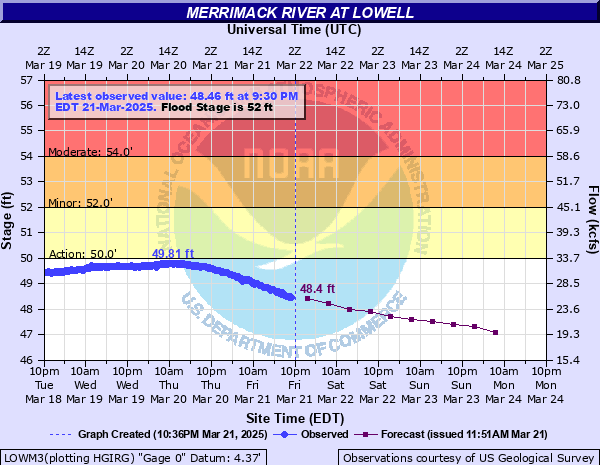
Critical Stages
50' - Action
52' - Flood
54' - Moderate
58' - Major
Latest Observation
Updated: 9:30 PM EST 12/5/25
Status: No Flooding
Stage: 42.38 ft
Flow: 2.85 kcfs
Forecast
| Time | Stage (ft) | Flow (kcfs) |
|---|---|---|
| 1 AM 12/6 | 42.3 | 2.66 |
| 7 AM 12/6 | 42.3 | 2.66 |
| 1 PM 12/6 | 42.2 | 2.43 |
| 7 PM 12/6 | 42.2 | 2.43 |
| 1 AM 12/7 | 42.2 | 2.43 |
| 7 AM 12/7 | 42.2 | 2.43 |
| 1 PM 12/7 | 42.2 | 2.43 |
| 7 PM 12/7 | 42.2 | 2.43 |
| 1 AM 12/8 | 42.2 | 2.43 |
| 7 AM 12/8 | 42.2 | 2.43 |
| Time | Stage (ft) | Flow (kcfs) |
|---|---|---|
| 9:30 PM 12/5 | 42.38 | 2.85 |
| 9:15 PM 12/5 | 42.38 | 2.85 |
| 9:00 PM 12/5 | 42.38 | 2.85 |
| 8:45 PM 12/5 | 42.38 | 2.85 |
| 8:30 PM 12/5 | 42.38 | 2.85 |
| 8:15 PM 12/5 | 42.38 | 2.85 |
| 8:00 PM 12/5 | 42.38 | 2.85 |
| 7:45 PM 12/5 | 42.38 | 2.85 |
| 7:30 PM 12/5 | 42.38 | 2.85 |
| 7:15 PM 12/5 | 42.38 | 2.85 |
| 7:00 PM 12/5 | 42.38 | 2.85 |
| 6:45 PM 12/5 | 42.38 | 2.85 |
| 6:30 PM 12/5 | 42.38 | 2.85 |
| 6:15 PM 12/5 | 42.38 | 2.85 |
| 6:00 PM 12/5 | 42.38 | 2.85 |
| 5:45 PM 12/5 | 42.38 | 2.85 |
| 5:30 PM 12/5 | 42.39 | 2.88 |
| 5:15 PM 12/5 | 42.38 | 2.85 |
| 5:00 PM 12/5 | 42.39 | 2.88 |
| 4:45 PM 12/5 | 42.39 | 2.88 |
| 4:30 PM 12/5 | 42.39 | 2.88 |
| 4:15 PM 12/5 | 42.39 | 2.88 |
| 4:00 PM 12/5 | 42.39 | 2.88 |
| 3:45 PM 12/5 | 42.39 | 2.88 |
| 3:30 PM 12/5 | 42.39 | 2.88 |
| 3:15 PM 12/5 | 42.4 | 2.9 |
| 3:00 PM 12/5 | 42.4 | 2.9 |
| 2:45 PM 12/5 | 42.41 | 2.93 |
| 2:30 PM 12/5 | 42.43 | 2.98 |
| 2:15 PM 12/5 | 42.44 | 3.01 |
65' -
This is a serious flood event. All persons along the Merrimack River should follow the evacuation recommendations from your local emergency managemant officials. If asked to evacuate, do so immediately. All flood protection measures must be rushed to completion in flood prone areas.
62' -
This is a serious flood event. All persons along the Merrimack River should follow the evacuation recommendations from your local emergency managemant officials. If asked to evacuate, do so immediately. All flood protection measures must be rushed to completion in flood prone areas.
60' -
This is a serious flood event. All persons along the Merrimack River from the Massachusetts border through Methuen should follow the evacuation recommendations from your local emergency managemant officials. If asked to evacuate, do so immediately. All flood protection measures must be rushed to completion in flood prone areas.
58' -
Flooding is expected to overspread portions of Route 113 above Pawtucket Falls. Also, portions of Route 110 and several homes and businesses along Route 110 heading north and east into Tewksbury may begin to experience flooding. Follow the direction of your local emergency management officals. If asked to evacuate, do so immediately.
56' -
Flooding will become more widespread from the New Hampshire border through Methuen. Those areas outside local flood protection should take measures to protect property. Follow the directions of your local emergency management agency.
55' -
Flooding will become more widespread from the New Hampshire border through Methuen. Those areas outside local flood protection should take measures to protect property. Follow the directions of your local emergency management agency.
52' -
Lowland flooding is likely along the Merrimack River. Most of the impact will be felt by businesses and mills where basement flooding is likely.
| Date | Stage (ft) |
|---|---|
| Mar 20, 1936 | 68.4 |
| Apr 23, 1852 | 60.6 |
| Sep 23, 1938 | 60.57 |
| May 15, 2006 | 58.84 |
| Apr 17, 2007 | 58.09 |
| Apr 7, 1987 | 57.16 |
| Nov 5, 1927 | 56.5 |
| Apr 6, 1960 | 56 |
| Apr 20, 1933 | 56 |
| Apr 1, 2010 | 54.64 |
| Apr 14, 1934 | 54.02 |
| Jun 1, 1984 | 53.71 |
| Mar 16, 2010 | 53.63 |
| Mar 15, 1977 | 53.41 |
| Apr 8, 1924 | 53.4 |
| Mar 31, 1925 | 53.3 |
| Dec 20, 2023 | 53.16 |
| Oct 23, 1996 | 53.1 |
| Apr 18, 1996 | 53.04999923706 |
| Apr 14, 1940 | 52.93 |
Data provided by the National Weather Service.