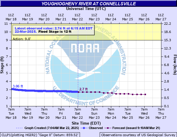
Youghiogheny River at Connellsville
Critical Stages
9' - Action
12' - Flood
16' - Moderate
18' - Major
Latest Observation
Updated: 11:15 AM EST 12/6/25
Status: No Flooding
Stage: 2.31 ft
Flow: 0.857 kcfs
Forecast
| Time | Stage (ft) | Flow (kcfs) |
|---|---|---|
| 1 PM 12/6 | 2.3 | 0.848 |
| 7 PM 12/6 | 2.3 | 0.848 |
| 1 AM 12/7 | 2.3 | 0.848 |
| 7 AM 12/7 | 2.3 | 0.848 |
| 1 PM 12/7 | 2.3 | 0.848 |
| 7 PM 12/7 | 2.2 | 0.762 |
| 1 AM 12/8 | 2.2 | 0.762 |
| 7 AM 12/8 | 2.2 | 0.762 |
| 1 PM 12/8 | 2.2 | 0.762 |
| 7 PM 12/8 | 2.2 | 0.762 |
| 1 AM 12/9 | 2.2 | 0.762 |
| 7 AM 12/9 | 2.2 | 0.762 |
| 1 PM 12/9 | 2.2 | 0.762 |
| 7 PM 12/9 | 2.2 | 0.762 |
| 1 AM 12/10 | 2.2 | 0.762 |
| 7 AM 12/10 | 2.2 | 0.762 |
| 1 PM 12/10 | 2.2 | 0.762 |
| 7 PM 12/10 | 2.2 | 0.762 |
| 1 AM 12/11 | 2.2 | 0.762 |
| 7 AM 12/11 | 2.2 | 0.762 |
| Time | Stage (ft) | Flow (kcfs) |
|---|---|---|
| 11:15 AM 12/6 | 2.31 | 0.857 |
| 11:00 AM 12/6 | 2.31 | 0.857 |
| 10:45 AM 12/6 | 2.31 | 0.857 |
| 10:30 AM 12/6 | 2.31 | 0.857 |
| 10:15 AM 12/6 | 2.31 | 0.857 |
| 10:00 AM 12/6 | 2.32 | 0.866 |
| 9:45 AM 12/6 | 2.31 | 0.857 |
| 9:30 AM 12/6 | 2.31 | 0.857 |
| 9:15 AM 12/6 | 2.32 | 0.866 |
| 9:00 AM 12/6 | 2.32 | 0.866 |
| 8:45 AM 12/6 | 2.32 | 0.866 |
| 8:30 AM 12/6 | 2.32 | 0.866 |
| 8:15 AM 12/6 | 2.32 | 0.866 |
| 8:00 AM 12/6 | 2.32 | 0.866 |
| 7:45 AM 12/6 | 2.32 | 0.866 |
| 7:30 AM 12/6 | 2.32 | 0.866 |
| 7:15 AM 12/6 | 2.32 | 0.866 |
| 7:00 AM 12/6 | 2.32 | 0.866 |
| 6:45 AM 12/6 | 2.32 | 0.866 |
| 6:30 AM 12/6 | 2.32 | 0.866 |
| 6:15 AM 12/6 | 2.32 | 0.866 |
| 6:00 AM 12/6 | 2.32 | 0.866 |
| 5:45 AM 12/6 | 2.32 | 0.866 |
| 5:30 AM 12/6 | 2.31 | 0.857 |
| 5:15 AM 12/6 | 2.31 | 0.857 |
| 5:00 AM 12/6 | 2.31 | 0.857 |
| 4:45 AM 12/6 | 2.32 | 0.866 |
| 4:30 AM 12/6 | 2.31 | 0.857 |
| 4:15 AM 12/6 | 2.31 | 0.857 |
| 4:00 AM 12/6 | 2.31 | 0.857 |
22' -
The entire area of West Connellsville between the River and Crawford Avenues is flooded.
21.96' -
Water reaches the flood of record...October 16, 1954.
20.28' -
Water reaches the level of the ST. Patricks Day Flood and crest on March 18, 1936.
20' -
Floodwaters enter AMTRAK stop on the right bank about 0.2 miles downstream from the gage.
19' -
Floodwaters reach Chessie railroad tracks along right bank at Crawford Street Bridge.
18' -
Flooding affects several homes and small businesses in the immediate vicinity of the Crawford Street Bridge.
17' -
Water reaches homes in the towns Adelaide and Dawson, downstream of Connelsville.
16' -
About 100 homes on the west side of Connellsville flood in the areas of Fifth, Sixth and Seventh Streets.
14.13' -
Water reaches level of March 3, 2015.
14' -
Several inches of water floods basements of about 30 homes along left bank. River is bankful along the left bank just downstream from the Crawford Street Bridge. Water reaches the level of the Hurricane Ivan flood of September 18, 2004.
12' -
Flooding begins in the vicinity of Yough Park.
| Date | Stage (ft) |
|---|---|
| Oct 16, 1954 | 21.96 |
| Mar 18, 1936 | 20.28 |
| Mar 29, 1924 | 19.3 |
| Sep 14, 1971 | 18.64 |
| Jan 19, 1996 | 18.64 |
| Mar 21, 1912 | 17.28 |
| Jun 5, 1941 | 17.02 |
| Jun 23, 1972 | 16.53 |
| Apr 26, 1937 | 15.87 |
| Jan 22, 1917 | 15.2 |
| Mar 22, 1916 | 15 |
| Jan 20, 1920 | 15 |
| Feb 16, 2018 | 14.9 |
| Mar 4, 1934 | 14.9 |
| Apr 3, 2024 | 14.76 |
| Nov 27, 1985 | 14.6 |
| Mar 6, 1967 | 14.55 |
| Sep 10, 2018 | 14.5 |
| Mar 14, 2010 | 14.47 |
| Mar 1, 2021 | 14.37 |
Data provided by the National Weather Service.