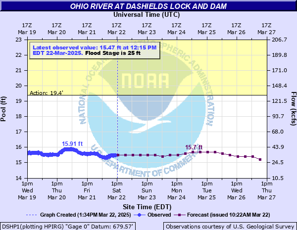
Ohio River at Dashields Lock and Dam
Critical Stages
19.4' - Action
25' - Flood
29' - Moderate
32' - Major
Latest Observation
Updated: 10:15 AM EST 12/6/25
Status: No Flooding
Stage: 14.62 ft
Flow: 18.5 kcfs
Forecast
| Time | Stage (ft) | Flow (kcfs) |
|---|---|---|
| 1 PM 12/6 | 14.5 | 16.7 |
| 7 PM 12/6 | 14.5 | 16.7 |
| 1 AM 12/7 | 14.4 | 15.4 |
| 7 AM 12/7 | 14.4 | 15.4 |
| 1 PM 12/7 | 14.4 | 15.4 |
| 7 PM 12/7 | 14.4 | 15.4 |
| 1 AM 12/8 | 14.3 | 14 |
| 7 AM 12/8 | 14.3 | 14 |
| 1 PM 12/8 | 14.3 | 14 |
| 7 PM 12/8 | 14.3 | 14 |
| 1 AM 12/9 | 14.3 | 14 |
| 7 AM 12/9 | 14.3 | 14 |
| 1 PM 12/9 | 14.3 | 14 |
| 7 PM 12/9 | 14.3 | 14 |
| 1 AM 12/10 | 14.2 | 12.8 |
| 7 AM 12/10 | 14.2 | 12.8 |
| 1 PM 12/10 | 14.2 | 12.8 |
| 7 PM 12/10 | 14.2 | 12.8 |
| 1 AM 12/11 | 14.2 | 12.8 |
| 7 AM 12/11 | 14.2 | 12.8 |
| Time | Stage (ft) | Flow (kcfs) |
|---|---|---|
| 10:15 AM 12/6 | 14.62 | 18.5 |
| 10:00 AM 12/6 | 14.62 | 18.5 |
| 9:45 AM 12/6 | 14.6 | 18.2 |
| 9:30 AM 12/6 | 14.62 | 18.5 |
| 9:15 AM 12/6 | 14.63 | 18.6 |
| 9:00 AM 12/6 | 14.61 | 18.3 |
| 8:45 AM 12/6 | 14.6 | 18.2 |
| 8:30 AM 12/6 | 14.62 | 18.5 |
| 8:15 AM 12/6 | 14.65 | 18.9 |
| 8:00 AM 12/6 | 14.63 | 18.6 |
| 7:45 AM 12/6 | 14.64 | 18.8 |
| 7:30 AM 12/6 | 14.63 | 18.6 |
| 7:15 AM 12/6 | 14.63 | 18.6 |
| 7:00 AM 12/6 | 14.63 | 18.6 |
| 6:45 AM 12/6 | 14.63 | 18.6 |
| 6:30 AM 12/6 | 14.61 | 18.3 |
| 6:15 AM 12/6 | 14.6 | 18.2 |
| 6:00 AM 12/6 | 14.59 | 18 |
| 5:45 AM 12/6 | 14.59 | 18 |
| 5:30 AM 12/6 | 14.53 | 17.2 |
| 5:15 AM 12/6 | 14.53 | 17.2 |
| 5:00 AM 12/6 | 14.54 | 17.3 |
| 4:45 AM 12/6 | 14.52 | 17 |
| 4:30 AM 12/6 | 14.53 | 17.2 |
| 4:15 AM 12/6 | 14.54 | 17.3 |
| 4:00 AM 12/6 | 14.54 | 17.3 |
| 3:45 AM 12/6 | 14.52 | 17 |
| 3:30 AM 12/6 | 14.52 | 17 |
| 3:15 AM 12/6 | 14.51 | 16.9 |
| 3:00 AM 12/6 | 14.5 | 16.7 |
48' -
The railroad tracks flood in the vicinity of Chadwick Street in Sewickley.
45' -
Water flowing through the railroad underpass reaches the intersection of Chestnut and Chadwick Streets in Sewickley.
37' -
State Route 51 at Stoops Ferry Road at Narrows Run floods, and the parking lot behind the Sewickley Station on Chestnut Street in Sewickley floods. Water reaches the parking lot of the Paradise Island Bowl on Neville Island.
34' -
Flooding reaches front yards of homes along Chestnut Avenue between White and Ferry Streets in Sewickley.
33' -
Water reaches the parking lot of the United States Coast Guard Station.
32' -
Front River Road on Neville Island begins to flood.
31' -
Flooding begins in the vicinity of I-79 intersection and Grand Avenue on Neville Island from water backing up into drains.
30' -
Water is in basements of low-lying houses along front River Road on Neville Island.
28' -
Backyards of low lying houses along Front River Road on Nevelle Island are flooded. Chestnut Avenue is flooded near intersection with Ferry Street
27' -
The access roads to Dashileds Locks and Dam and the United States Coast Guard Station begin to flood. The beach area at Paradise Island Bowl on Neville Island begins to flood.
26.4' -
Lock walls are overtopped.
23' -
Navigation suspended at Dashields Locks and Dam, lock out of service.
| Date | Stage (ft) |
|---|---|
| Mar 18, 1936 | 42.8 |
| Dec 31, 1942 | 35.9 |
| Jan 20, 1996 | 33.2 |
| Jun 24, 1972 | 33 |
| Mar 7, 1975 | 32.1 |
| Oct 16, 1954 | 31.4 |
| Mar 11, 1964 | 30 |
| Sep 19, 2004 | 29.9 |
| Jan 22, 1959 | 28.8 |
| Dec 4, 1959 | 27.5 |
| Jan 7, 2005 | 27.18 |
| Feb 14, 1966 | 26.9 |
| Apr 4, 2024 | 26.82 |
| Apr 1, 1960 | 26.8 |
| Dec 31, 1990 | 26.4 |
| Feb 17, 2018 | 26.03 |
| Sep 11, 2018 | 25.98 |
| Nov 6, 1984 | 24.4 |
| Dec 19, 1990 | 24.2 |
| Mar 16, 2007 | 22.76 |
Data provided by the National Weather Service.