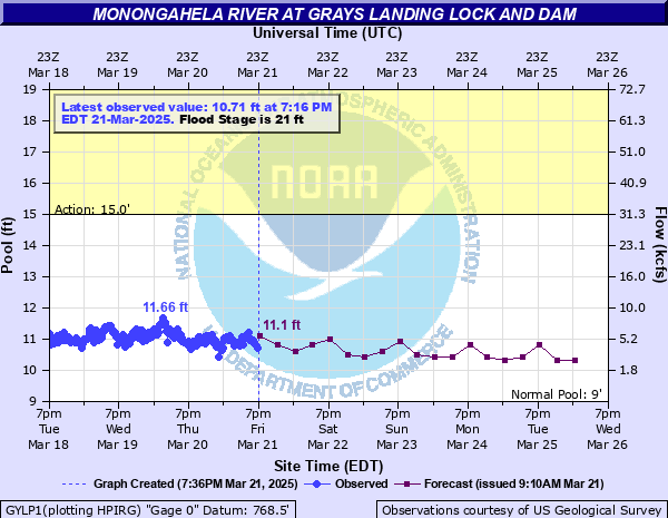
Monongahela River at Grays Landing Lock and Dam
Critical Stages
15' - Action
21' - Flood
25' - Moderate
27' - Major
Latest Observation
Updated: 11:16 AM EST 12/6/25
Status: No Flooding
Stage: 10.43 ft
Flow: 3.01 kcfs
Forecast
| Time | Stage (ft) | Flow (kcfs) |
|---|---|---|
| 1 PM 12/6 | 10.5 | 3.26 |
| 7 PM 12/6 | 10.5 | 3.26 |
| 1 AM 12/7 | 10.5 | 3.26 |
| 7 AM 12/7 | 10.5 | 3.26 |
| 1 PM 12/7 | 10.6 | 3.71 |
| 7 PM 12/7 | 10.5 | 3.26 |
| 1 AM 12/8 | 10.5 | 3.26 |
| 7 AM 12/8 | 10.5 | 3.26 |
| 1 PM 12/8 | 10.6 | 3.71 |
| 7 PM 12/8 | 10.6 | 3.71 |
| 1 AM 12/9 | 10.5 | 3.26 |
| 7 AM 12/9 | 10.5 | 3.26 |
| 1 PM 12/9 | 10.5 | 3.26 |
| 7 PM 12/9 | 10.5 | 3.26 |
| 1 AM 12/10 | 10.5 | 3.26 |
| 7 AM 12/10 | 10.5 | 3.26 |
| 1 PM 12/10 | 10.5 | 3.26 |
| 7 PM 12/10 | 10.5 | 3.26 |
| 1 AM 12/11 | 10.6 | 3.71 |
| 7 AM 12/11 | 10.6 | 3.71 |
| Time | Stage (ft) | Flow (kcfs) |
|---|---|---|
| 11:16 AM 12/6 | 10.43 | 3.01 |
| 11:01 AM 12/6 | 10.45 | 3.08 |
| 10:46 AM 12/6 | 10.43 | 3.01 |
| 10:31 AM 12/6 | 10.46 | 3.12 |
| 10:16 AM 12/6 | 10.45 | 3.08 |
| 10:01 AM 12/6 | 10.42 | 2.98 |
| 9:46 AM 12/6 | 10.43 | 3.01 |
| 9:31 AM 12/6 | 10.47 | 3.15 |
| 9:16 AM 12/6 | 10.47 | 3.15 |
| 9:01 AM 12/6 | 10.49 | 3.23 |
| 8:46 AM 12/6 | 10.48 | 3.19 |
| 8:31 AM 12/6 | 10.42 | 2.98 |
| 8:16 AM 12/6 | 10.48 | 3.19 |
| 8:01 AM 12/6 | 10.5 | 3.26 |
| 7:46 AM 12/6 | 10.43 | 3.01 |
| 7:31 AM 12/6 | 10.58 | 3.61 |
| 7:16 AM 12/6 | 10.33 | 2.67 |
| 7:01 AM 12/6 | 10.53 | 3.38 |
| 6:46 AM 12/6 | 10.52 | 3.34 |
| 6:31 AM 12/6 | 10.55 | 3.47 |
| 6:16 AM 12/6 | 10.53 | 3.38 |
| 6:01 AM 12/6 | 10.52 | 3.34 |
| 5:46 AM 12/6 | 10.55 | 3.47 |
| 5:31 AM 12/6 | 10.6 | 3.71 |
| 5:16 AM 12/6 | 10.51 | 3.3 |
| 5:01 AM 12/6 | 10.56 | 3.52 |
| 4:46 AM 12/6 | 10.61 | 3.76 |
| 4:31 AM 12/6 | 10.52 | 3.34 |
| 4:16 AM 12/6 | 10.55 | 3.47 |
| 4:01 AM 12/6 | 10.56 | 3.52 |
36' -
Water reaches the flood of record...July 1, 1888.
35' -
Flood waters reach the historic log cabin along Front Street in Greensboro.
34' -
Flood waters reach the corner of Front and County Streets in Greensboro.
31' -
Flood waters reach the Bed and Breakfast on County Street in Greensboro.
30.5' -
Water reaches level of the November 5, 1985 flood.
28.4' -
Water reaches the level of the St. Patricks Day Flood and crest on March 18, 1936.
25.8' -
Water reaches the level reached during the rain and snowmelt flood on January 20, 1996.
25' -
Flood waters reach Martin Ferry Road in the village of Glasworks.
24' -
The lock walls are overtopped at Grays Landing Lock and Dam.
23.95' -
Water levels reach the flood levels of the flood of July 29, 2017.
22.78' -
Water reaches the level reached on March 4, 2015.
21' -
The lock at Grays Landing Lock and Dam goes out of service, and navigation is suspended.
19' -
The bike trail floods in Greensboro near County Street.
| Date | Stage (ft) |
|---|---|
| Jul 1, 1888 | 36 |
| Nov 5, 1985 | 30.5 |
| Mar 18, 1936 | 28.4 |
| Jan 20, 1996 | 25.8 |
| Feb 19, 2000 | 24.5 |
| Jul 29, 2017 | 23.95 |
| Mar 4, 2015 | 22.78 |
| Feb 17, 2018 | 22.07 |
| Mar 1, 2021 | 21.77 |
| Dec 14, 2007 | 21.7 |
| Dec 14, 2007 | 21.37 |
| Apr 4, 2024 | 21.02 |
| May 4, 2009 | 21 |
| Mar 21, 2002 | 20.7 |
| Jan 26, 2010 | 20.6 |
| Nov 23, 2011 | 20.09 |
| Mar 7, 2004 | 19.34 |
| Apr 16, 2007 | 19.31 |
| Jun 5, 2008 | 19.27 |
| Feb 23, 2003 | 19 |
Data provided by the National Weather Service.