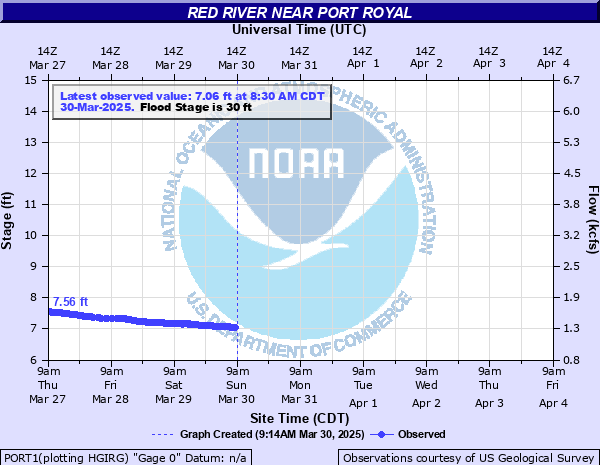
Red River near Port Royal
Critical Stages
25' - Action
30' - Flood
38' - Moderate
40' - Major
Latest Observation
Updated: 9:30 AM CST 12/6/25
Status: No Flooding
Stage: 4.76 ft
Flow: 0.338 kcfs
Forecast
Forecast not available for this location.
| Time | Stage (ft) | Flow (kcfs) |
|---|---|---|
| 9:30 AM 12/6 | 4.76 | 0.338 |
| 9:00 AM 12/6 | 4.77 | 0.341 |
| 8:30 AM 12/6 | 4.77 | 0.341 |
| 8:00 AM 12/6 | 4.77 | 0.341 |
| 7:30 AM 12/6 | 4.77 | 0.341 |
| 7:00 AM 12/6 | 4.77 | 0.341 |
| 6:30 AM 12/6 | 4.77 | 0.341 |
| 6:00 AM 12/6 | 4.77 | 0.341 |
| 5:30 AM 12/6 | 4.78 | 0.344 |
| 5:00 AM 12/6 | 4.78 | 0.344 |
| 4:30 AM 12/6 | 4.78 | 0.344 |
| 4:00 AM 12/6 | 4.78 | 0.344 |
| 3:30 AM 12/6 | 4.78 | 0.344 |
| 3:00 AM 12/6 | 4.78 | 0.344 |
| 2:30 AM 12/6 | 4.79 | 0.347 |
| 2:00 AM 12/6 | 4.79 | 0.347 |
| 1:30 AM 12/6 | 4.8 | 0.35 |
| 1:00 AM 12/6 | 4.8 | 0.35 |
| 12:30 AM 12/6 | 4.8 | 0.35 |
| 12:00 AM 12/6 | 4.81 | 0.353 |
| 11:30 PM 12/5 | 4.81 | 0.353 |
| 11:00 PM 12/5 | 4.82 | 0.356 |
| 10:30 PM 12/5 | 4.82 | 0.356 |
| 10:00 PM 12/5 | 4.83 | 0.359 |
| 9:30 PM 12/5 | 4.83 | 0.359 |
| 9:00 PM 12/5 | 4.83 | 0.359 |
| 8:30 PM 12/5 | 4.84 | 0.362 |
| 8:00 PM 12/5 | 4.84 | 0.362 |
| 7:30 PM 12/5 | 4.85 | 0.365 |
| 7:00 PM 12/5 | 4.85 | 0.365 |
52' -
Record flooding is impacting many homes near the river, and many main roads are affected as well including the northbound lanes of I-24, Hwy 161, Porters Chapel Rd, portions of Hwy 238 near Port Royal State Park, Warfield Blvd near Shady Bluff Trail, Buzzard Creek Rd, and Keysburg Rd.
50' -
Widespread flooding is impacting homes on Rivermont Dr, River Run, Idlewood Dr, Wimbledon Ct, Colin Ct, E Accipiter Cir, Pond Apple Rd, Foxfire Rd, Hay Market Rd, Riverhaven Dr, Stonegate Dr and Willow Bend Dr. Water reaches Hwy 161, Porters Chapel Rd, Hwy 238 near Port Royal State Park, the northbound lanes of I-24, Warfield Blvd near Shady Bluff Trail, Buzzard Creek Rd, and Keysburg Rd. Water approaches Hwy 238 near Port Royal Rd just south of Port Royal State Park which may be impassable.
48' -
Flooding continues to impact homes on Rivermont Dr, River Run, Idlewood Dr, Wimbledon Ct, Colin Ct, E Accipiter Cir, Pond Apple Rd, Foxfire Rd, Hay Market Rd, Riverhaven Dr, Stonegate Dr and Willow Bend Dr. Water reaches Hwy 161 near the state line, Porters Chapel Rd near Hugh Gill Rd, and Hwy 238 near Port Royal State Park. Water approaches northbound lanes of I-24 near the river, Warfield Blvd near Shady Bluff Trail, Buzzard Creek Rd, and Keysburg Rd, which may be impassable at higher levels.
46' -
Homes on Rivermont Dr, River Run, Idlewood Dr, and Wimbledon Ct are impacted and homes on Colin Ct, E Accipiter Cir, Pond Apple Rd, Foxfire Rd, Hay Market Rd, and Riverhaven Dr begin to be impacted. Water reaches yards of homes on Stonegate Dr and Willow Bend Dr, and approaches Hwy 161 near the Kentucky State Line, Porters Chapel Rd near Hugh Gill Rd, and Hwy 238 just north of the bridge at Port Royal State Park which may be impassable at higher levels.
44' -
Water reaches homes on Rivermont Dr, River Run, Idlewood Dr, and Wimbledon Ct, and reaches yards of homes on Colin Ct, E Accipiter Cir, Pond Apple Rd, Foxfire Rd, Hay Market Rd, and Riverhaven Dr. Water reaches the Port Royal State Park Trail of Tears Trailhead parking area, and approaches yards of homes on Stonegate Dr and Willow Bend Dr.
42' -
Flood waters begin to approach homes on Rivermont Dr, River Run, Idlewood Dr, and Wimbledon Ct, and approach yards of homes on Colin Ct, E Accipiter Cir, Pond Apple Rd, Foxfire Rd, Hay Market Rd, and Riverhaven Dr. Roads are also impacted and impassable, including Port Royal Rd near Hwy 238 and Dunbar Cave Rd just west of Warfield Blvd.
40' -
Significant flooding continues to affect areas along the river, including the Red River Valley Park, Port Royal Rd near Hwy 238, Dunbar Cave Rd just west of Warfield Blvd which is covered with water, and portions of the Swan Lake Golf Course. Water reaches yards of homes on Rivermont Dr, River Run, Idlewood Dr, and Wimbledon Ct.
38' -
Significant flooding is impacting agricultural land, parks, and access areas along the river, including the Red River Valley Park where several campsites are flooded, and Port Royal Rd near Hwy 238 which is covered with water. Water approaches Dunbar Cave Rd just west of Warfield Blvd and may be impassable at higher levels, and water reaches low lying portions of the Swan Lake Golf Course.
36' -
Flooding continues to affect agricultural land, parks, and access areas along the river, including the Red River Valley Park where water reaches campsites and evacuations may be needed, and Port Royal Rd near Hwy 238 which is covered with water. Water approaches Dunbar Cave Rd just west of Warfield Blvd and may be impassable at higher levels.
34' -
Flooding continues to affect agricultural land and adjacent areas along the river, including the Porter Chapel Public Access Area, and the Red River Valley Park where water approaches campsites and evacuations may be needed for higher levels. Water approaches Port Royal Rd near Hwy 238 which may be impassable at higher levels.
32' -
Flood waters continue to impact agricultural land and adjacent areas along the river from the Kentucky State Line through Adams, past Port Royal State Park, to Clarksville. This includes the Red River Valley Park where water covers most of the parking area, the Porters Chapel Public Access area, The River Club golf course which is mostly covered, and portions of the Clarksville Country Club.
30' -
Low lying agricultural areas along the Red River from the Kentucky State Line through Adams, past Port Royal State Park, and down to Clarksville begin to flood. This includes the Red River Valley Park where water is up to the parking area, the Porters Chapel Public Access area, The River Club golf course, and portions of the Clarksville Country Club.
28' -
Portions of the Red River Valley Park and canoe launch, and the Porters Chapel Public Access parking area begin to be inundated. Water continues to inundate agricultural areas along the river, the Port Royal State Park public access area, and the golf course at The River Club. Portions of the golf course at the Clarksville Country Club begin to be inundated.
26' -
Low lying agricultural areas along the river begin to be inundated, and water continues to affect the Port Royal State Park public access area and parking lot, as well as portions of the golf course at The River Club.
24' -
The Port Royal State Park public access area and parking lot begin to be inundated, and water begins to inundate low lying portions of the golf course at The River Club.
| Date | Stage (ft) |
|---|---|
| May 3, 2010 | 49.48 |
| Mar 13, 1975 | 48.26 |
| Jan 23, 1937 | 44.4 |
| Feb 27, 1962 | 43.18 |
| May 20, 1983 | 42.36 |
| Dec 9, 1978 | 42.14 |
| Mar 3, 1997 | 41.46 |
| May 8, 1984 | 40.54 |
| Apr 5, 1968 | 39.5 |
| Jan 11, 1974 | 39.36 |
| Jun 11, 1998 | 38.05 |
| Feb 4, 1990 | 37.91 |
| Jan 23, 1999 | 37.88 |
| Feb 24, 2019 | 37.52 |
| Feb 15, 1989 | 37.24 |
| Jun 7, 1981 | 36.69 |
| Dec 22, 1990 | 35.45 |
| Apr 4, 2008 | 35.2 |
| Jan 28, 2009 | 34.59 |
| Dec 9, 1972 | 34.42 |
Data provided by the National Weather Service.