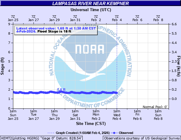
Lampasas River near Kempner
Critical Stages
16' - Action
18' - Flood
26' - Moderate
33' - Major
Latest Observation
Updated: 4:15 AM CST 12/10/25
Status: No Flooding
Stage: 1.25 ft
Flow: 0.036 kcfs
Forecast
Forecast not available for this location.
| Time | Stage (ft) | Flow (kcfs) |
|---|---|---|
| 4:30 AM 12/10 | 1.24 | 0.0348 |
| 4:25 AM 12/10 | 1.24 | 0.0348 |
| 4:20 AM 12/10 | 1.24 | 0.0348 |
| 4:15 AM 12/10 | 1.25 | 0.036 |
| 4:10 AM 12/10 | 1.25 | 0.036 |
| 4:05 AM 12/10 | 1.24 | 0.0348 |
| 4:00 AM 12/10 | 1.25 | 0.036 |
| 3:55 AM 12/10 | 1.25 | 0.036 |
| 3:50 AM 12/10 | 1.24 | 0.0348 |
| 3:45 AM 12/10 | 1.26 | 0.0374 |
| 3:40 AM 12/10 | 1.23 | 0.0335 |
| 3:35 AM 12/10 | 1.25 | 0.036 |
| 3:30 AM 12/10 | 1.24 | 0.0348 |
| 3:25 AM 12/10 | 1.24 | 0.0348 |
| 3:20 AM 12/10 | 1.23 | 0.0335 |
| 3:15 AM 12/10 | 1.24 | 0.0348 |
| 3:10 AM 12/10 | 1.24 | 0.0348 |
| 3:05 AM 12/10 | 1.25 | 0.036 |
| 3:00 AM 12/10 | 1.24 | 0.0348 |
| 2:55 AM 12/10 | 1.24 | 0.0348 |
| 2:50 AM 12/10 | 1.24 | 0.0348 |
| 2:45 AM 12/10 | 1.24 | 0.0348 |
| 2:40 AM 12/10 | 1.24 | 0.0348 |
| 2:35 AM 12/10 | 1.25 | 0.036 |
| 2:30 AM 12/10 | 1.24 | 0.0348 |
| 2:25 AM 12/10 | 1.24 | 0.0348 |
| 2:20 AM 12/10 | 1.25 | 0.036 |
| 2:15 AM 12/10 | 1.24 | 0.0348 |
| 2:10 AM 12/10 | 1.23 | 0.0335 |
| 2:05 AM 12/10 | 1.25 | 0.036 |
45' -
Widespread and significant major flooding is expected along the river. The Highway 190 brdige will be submerged, and dangerous flooding will impact the nearby RV park as well as multiple roads upstream and downstream of the gage.
38' -
Significant major flooding is expected along the river. The RV park near the gage will sustain significant flooding, and Highway 190 will begin to flood near the bridge. Dangerous flooding will impact FM 3170 and CR 4530 downstream of the gage. Many roadways upstream of the gage will also flood.
35' -
Major flooding is expected along the river. The RV park near the river will flood, and the cabins near the river will have multiple feet of water in them. Dangerous flooding is expected downstream along FM 3170 and CR 4530. The slough upstream of the gage will be flooded as well as several low water crossings nearby.
33' -
Major flooding is expected. Cabins near the river at the RV park will have several feet of water in them. FM 3170 downstream of the gage will have several feet of water across it at multiple low water crossings and near the bluff overlook. The slough upstream of the gage will be flooded, as well as several low water crossings nearby.
32' -
Moderate flooding is expected along the river. Cabins near the river at the RV park will be flooded. FM 3170 downstream of the gage will have several feet of water across it at multiple low water crossings and near the bluff overlook. The slough upstream of the gage will flood.
30' -
Moderate flooding is expected along the river. Cabins near the river at the RV park will begin to flood. FM 3170 downstream of the gage will have several feet of water across it at multiple low water crossings and near the bluff overlook. The slough upstream of the gage will also flood.
26' -
Moderate flooding along the river is expected. FM 3170 downstream of the gage will flood at a few low water crossings. CR 4530 will also flood in a few areas.
18' -
Minor flooding is expected along the river.
| Date | Stage (ft) |
|---|---|
| Sep 1, 1873 | 45 |
| May 13, 1957 | 37 |
| Dec 20, 1991 | 35 |
| Dec 20, 1991 | 35 |
| Oct 4, 1959 | 34 |
| Jul 13, 2025 | 33.21 |
| May 16, 1965 | 32.98 |
| May 5, 2024 | 32.67 |
| Mar 16, 1998 | 30.59 |
| Jun 28, 2007 | 28.57 |
| Mar 30, 2007 | 26.88 |
| Feb 20, 1997 | 26.29 |
| Jul 4, 2007 | 24.76 |
| Jun 3, 1986 | 21.97 |
| Jun 6, 1985 | 21.59 |
| May 17, 2024 | 21.09 |
| Apr 28, 2009 | 20.45 |
| Feb 4, 1992 | 20.28 |
| Jun 16, 1981 | 20.11 |
| Nov 17, 2004 | 20.06 |
Data provided by the National Weather Service.