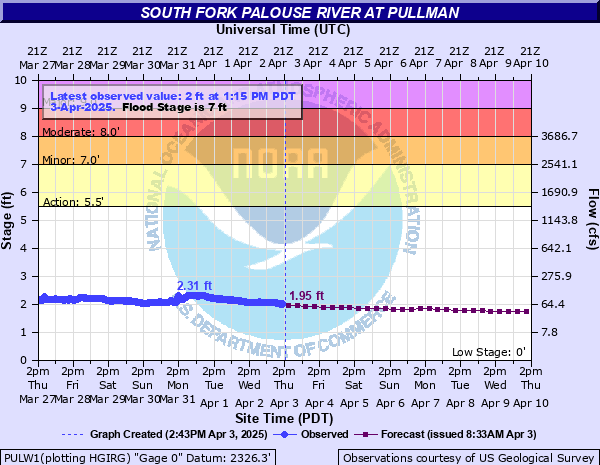
South Fork Palouse River at Pullman
Critical Stages
5.5' - Action
7' - Flood
8' - Moderate
9' - Major
Latest Observation
Updated: 1:15 PM PST 12/16/25
Status: No Flooding
Stage: 1.63 ft
Flow: 0.028 kcfs
Forecast
| Time | Stage (ft) | Flow (kcfs) |
|---|---|---|
| 4 PM 12/16 | 1.79 | 0.038 |
| 10 PM 12/16 | 1.8 | 0.039 |
| 4 AM 12/17 | 2.24 | 0.104 |
| 10 AM 12/17 | 2.56 | 0.168 |
| 4 PM 12/17 | 2.61 | 0.178 |
| 10 PM 12/17 | 2.49 | 0.153 |
| 4 AM 12/18 | 2.37 | 0.13 |
| 10 AM 12/18 | 2.26 | 0.107 |
| 4 PM 12/18 | 2.29 | 0.113 |
| 10 PM 12/18 | 2.68 | 0.193 |
| 4 AM 12/19 | 3.07 | 0.297 |
| 10 AM 12/19 | 3.14 | 0.319 |
| 4 PM 12/19 | 3.07 | 0.297 |
| 10 PM 12/19 | 2.91 | 0.25 |
| 4 AM 12/20 | 2.72 | 0.202 |
| 10 AM 12/20 | 2.53 | 0.161 |
| 4 PM 12/20 | 2.42 | 0.14 |
| 10 PM 12/20 | 2.34 | 0.123 |
| 4 AM 12/21 | 2.27 | 0.109 |
| 10 AM 12/21 | 2.2 | 0.096 |
| 4 PM 12/21 | 2.15 | 0.087 |
| 10 PM 12/21 | 2.15 | 0.087 |
| 4 AM 12/22 | 2.25 | 0.105 |
| 10 AM 12/22 | 2.41 | 0.138 |
| 4 PM 12/22 | 2.52 | 0.159 |
| 10 PM 12/22 | 2.51 | 0.157 |
| 4 AM 12/23 | 2.47 | 0.149 |
| 10 AM 12/23 | 2.38 | 0.132 |
| 4 PM 12/23 | 2.31 | 0.117 |
| 10 PM 12/23 | 2.26 | 0.107 |
| 4 AM 12/24 | 2.22 | 0.1 |
| 10 AM 12/24 | 2.21 | 0.098 |
| 4 PM 12/24 | 2.23 | 0.102 |
| 10 PM 12/24 | 2.27 | 0.109 |
| 4 AM 12/25 | 2.26 | 0.107 |
| 10 AM 12/25 | 2.22 | 0.1 |
| 4 PM 12/25 | 2.2 | 0.096 |
| 10 PM 12/25 | 2.22 | 0.1 |
| 4 AM 12/26 | 2.25 | 0.105 |
| Time | Stage (ft) | Flow (kcfs) |
|---|---|---|
| 1:15 PM 12/16 | 1.63 | 0.028 |
| 1:00 PM 12/16 | 1.64 | 0.028 |
| 12:45 PM 12/16 | 1.65 | 0.029 |
| 12:30 PM 12/16 | 1.65 | 0.029 |
| 12:15 PM 12/16 | 1.66 | 0.03 |
| 12:00 PM 12/16 | 1.67 | 0.03 |
| 11:45 AM 12/16 | 1.67 | 0.03 |
| 11:30 AM 12/16 | 1.67 | 0.03 |
| 11:15 AM 12/16 | 1.68 | 0.031 |
| 11:00 AM 12/16 | 1.68 | 0.031 |
| 10:45 AM 12/16 | 1.69 | 0.031 |
| 10:30 AM 12/16 | 1.7 | 0.032 |
| 9:15 AM 12/16 | 1.75 | 0.035 |
| 9:00 AM 12/16 | 1.75 | 0.035 |
| 8:45 AM 12/16 | 1.76 | 0.036 |
| 8:30 AM 12/16 | 1.77 | 0.037 |
| 8:15 AM 12/16 | 1.77 | 0.037 |
| 8:00 AM 12/16 | 1.78 | 0.038 |
| 7:45 AM 12/16 | 1.78 | 0.038 |
| 7:30 AM 12/16 | 1.78 | 0.038 |
| 7:15 AM 12/16 | 1.77 | 0.037 |
| 7:00 AM 12/16 | 1.76 | 0.036 |
| 6:45 AM 12/16 | 1.75 | 0.035 |
| 6:30 AM 12/16 | 1.74 | 0.035 |
| 6:15 AM 12/16 | 1.73 | 0.034 |
| 6:00 AM 12/16 | 1.72 | 0.033 |
| 5:45 AM 12/16 | 1.72 | 0.033 |
| 5:30 AM 12/16 | 1.72 | 0.033 |
| 5:15 AM 12/16 | 1.72 | 0.033 |
| 5:00 AM 12/16 | 1.72 | 0.033 |
10' -
Severe flooding of residential and business areas can be expected from Pullman downstream to Hooper.
9' -
Water will be several feet deep on Main Street and inches deep on Grand Ave and other neighboring streets. Major flooding of businesses, homes, and roads along the river can be expected. Missouri Flat Creek will likely be out of its banks and flowing over Grand Ave, Stadium Way, and beginning to flood homes and businesses on Park Street. Paradise Cr and the river will approach homes and businesses on Professional Mall and Bleasner Drives. Equivalent to the February 1996 flood.
7' -
Minor flooding in the residential and business areas along the river in and around Pullman can be expected. Ponding of water on portions of Grand Ave near Missouri Flat Creek. Flooding in portions of Spring Street Skate Park, the City Palyfields, and the Pullman RV Park.
6.5' -
Water will be up to the bottom of the pedestrian bridge at Main and Pine Street. The low spot on Morton Street near Reaney Park will be flooded. Water will be up along the foundations of the older commercial buildings along Poplar Street near its intersection with State Street as well as the older buildings on Main Street bewteen Kamiaken and Paradise Streets. Flooding of pasture land downstream of Pullman.
4.5' -
Minor flooding near the shoreline and bench at Riverfront Park in downtown Pullman.
| Date | Stage (ft) |
|---|---|
| Mar 1, 1910 | 11.8 |
| Feb 26, 1948 | 9.5 |
| Jan 21, 1972 | 9.46 |
| Feb 9, 1996 | 9.04 |
| Jan 1, 1997 | 8.83 |
| Feb 13, 1979 | 8.25 |
| Feb 23, 2025 | 7.61 |
| Dec 23, 1964 | 7.11 |
| Mar 10, 2017 | 7.03 |
| Mar 26, 2012 | 6.96 |
| Feb 3, 1963 | 6.91 |
| Apr 9, 2019 | 6.9 |
| Jan 24, 1959 | 6.5 |
| Jan 15, 1974 | 6.34 |
| Jan 8, 2009 | 6.05 |
| Jan 13, 1973 | 6 |
| Dec 22, 1933 | 6 |
| Dec 28, 2023 | 5.83 |
| Jan 16, 2011 | 5.75 |
| Jan 7, 1969 | 5.25 |
Data provided by the National Weather Service.