Smoky Hill River near Junction City
Critical Stages
17' - Action
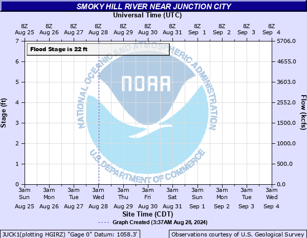
22' - Flood
32' - Moderate
44' - Major
Latest Observation
Updated: 6:09 PM LMT 12/31/00
Status: Obs Not Current
Stage: -999 ft
Flow: -999 kcfs
Forecast
Forecast not available for this location.
Observation history not available.
38.5' -
North end of the highway 77 bridge over the smoky hill river floods.
38.2' -
Flood waters reach the top of the levee on the south bank of the river.
32.1' -
Flood waters reach the low steel on the north end of the highway 77 bridge over the smoky hill river.
22' -
Water spreads over north and south banks of the smoky hill river and lowlands near the river flood.
| Date | Stage (ft) |
|---|---|
| Jul 12, 1951 | 35.9 |
| Jun 5, 2005 | 23.8 |
| May 24, 1995 | 23.5 |
| May 25, 2019 | 23.46 |
| May 12, 1993 | 23.2 |
| May 13, 1993 | 23.19 |
| May 28, 1995 | 22.75 |
| May 18, 1995 | 22.62 |
| Nov 3, 1998 | 21.45 |
| May 9, 1993 | 20.95 |
| May 8, 2007 | 20.3 |
| Jun 28, 1957 | 17 |
| Apr 1, 1998 | 15.33 |
Data provided by the National Weather Service.