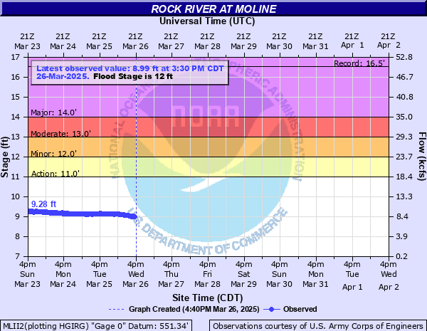
Rock River at Moline
Critical Stages
11' - Action
12' - Flood
13' - Moderate
14' - Major
Latest Observation
Updated: 1:30 PM CST 12/15/25
Status: No Flooding
Stage: 7.9 ft
Flow: 2.93 kcfs
Forecast
Forecast not available for this location.
| Time | Stage (ft) | Flow (kcfs) |
|---|---|---|
| 2:30 PM 12/15 | 7.91 | 2.97 |
| 2:15 PM 12/15 | 7.91 | 2.97 |
| 2:00 PM 12/15 | 7.9 | 2.93 |
| 1:45 PM 12/15 | 7.9 | 2.93 |
| 1:30 PM 12/15 | 7.9 | 2.93 |
| 1:15 PM 12/15 | 7.89 | 2.89 |
| 1:00 PM 12/15 | 7.9 | 2.93 |
| 12:45 PM 12/15 | 7.88 | 2.85 |
| 12:30 PM 12/15 | 7.89 | 2.89 |
| 12:15 PM 12/15 | 7.89 | 2.89 |
| 12:00 PM 12/15 | 7.88 | 2.85 |
| 11:45 AM 12/15 | 7.88 | 2.85 |
| 11:30 AM 12/15 | 7.88 | 2.85 |
| 11:15 AM 12/15 | 7.89 | 2.89 |
| 11:00 AM 12/15 | 7.89 | 2.89 |
| 10:45 AM 12/15 | 7.88 | 2.85 |
| 10:30 AM 12/15 | 7.9 | 2.93 |
| 10:15 AM 12/15 | 7.88 | 2.85 |
| 10:00 AM 12/15 | 7.88 | 2.85 |
| 9:45 AM 12/15 | 7.88 | 2.85 |
| 9:30 AM 12/15 | 7.88 | 2.85 |
| 9:15 AM 12/15 | 7.88 | 2.85 |
| 9:00 AM 12/15 | 7.88 | 2.85 |
| 8:45 AM 12/15 | 7.87 | 2.81 |
| 8:30 AM 12/15 | 7.87 | 2.81 |
| 8:15 AM 12/15 | 7.88 | 2.85 |
| 8:00 AM 12/15 | 7.87 | 2.81 |
| 7:45 AM 12/15 | 7.86 | 2.77 |
| 7:30 AM 12/15 | 7.86 | 2.77 |
| 7:15 AM 12/15 | 7.87 | 2.81 |
17.5' -
The Sears Dam is under water in Rock Island.
15.5' -
Water affects the intersection of Highways 150 and 6. Steel Dam is under water in Milan.
15.3' -
Flood waters begin to encroach onto the on-ramp from east-bound I-280 to north-bound I-74 northeast of Moline.
15.2' -
Water affects the lowest streets on Vandruffs Island.
15' -
Water affects business parking lots on 52nd Avenue in Moline. Water also affects most homes on South Shore Drive and North Shore Drive.
14' -
Major Flood Stage. Water affects South Shore Drive and North Shore Drive in Moline west of the 27th Street bridge. Water limits access to homes on South Shore Drive east of the I-74 bridge. Water also affects portions of 60th Street south of John Deere Road.
13.2' -
Water affects 60th Street south of John Deere Road in Moline and 56th Ave from Green Valley Park 48th St. Water is on Canal Road in Big Island. Smith's Island is affected by flood waters.
13' -
Moderate Flood Stage. In Moline, water affects homes on South Shore Drive and cuts off access to homes east of the I-74 bridge. Water also affects 49th Avenue south of the theater. Water affects Vandruff Island.
12.5' -
Water affects some residences in the lower Friendship Farm area. 60th St is under water south of the Green Valley Sports Complex. 56th St along the north side of the river is under water.
12' -
Minor Flood Stage. Water affects residences near the 27th Street bridge. Water is over portions of 60th St south of Green Valley Sports Complex and portions of 56th Ave along the north side of the river.
11' -
Water affects agricultural land upstream from Moline.
| Date | Stage (ft) |
|---|---|
| Apr 22, 2013 | 16.53 |
| Mar 6, 2008 | 16.38 |
| Jun 2, 2019 | 16.21 |
| Apr 27, 1973 | 16.15 |
| Jun 8, 2002 | 15.79 |
| May 21, 1974 | 15.7 |
| Mar 17, 2019 | 15.57 |
| Jul 26, 2017 | 15.4 |
| May 3, 2019 | 15.36 |
| Feb 24, 2018 | 15.32 |
| Feb 24, 1997 | 15.31 |
| Jun 1, 1996 | 15.25 |
| Feb 24, 1971 | 15.2 |
| Mar 25, 1979 | 15.1 |
| Jan 20, 2017 | 15.1 |
| Jun 17, 2000 | 15.01 |
| Mar 11, 2009 | 14.99 |
| Jun 12, 1993 | 14.93 |
| Jun 17, 2008 | 14.91 |
| Mar 11, 1929 | 14.9 |
Data provided by the National Weather Service.