« Back to Taylor Cemetery Rivers
Mississippi River at Illinois City
Critical Stages
14' - Action
15' - Flood
16' - Moderate
18' - Major
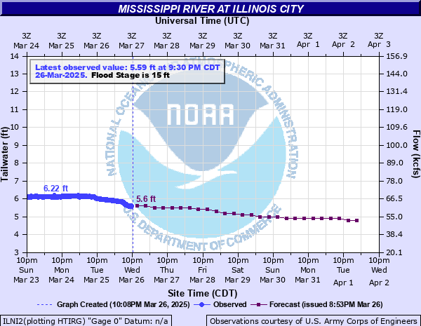
Latest Observation
Updated: 5:00 PM CST 12/15/25
Status: No Flooding
Stage: 3.76 ft
Flow: 34.8 kcfs
Forecast
| Time | Stage (ft) | Flow (kcfs) |
|---|---|---|
| 6 PM 12/15 | 3.8 | 35.4 |
| 12 AM 12/16 | 3.7 | 33.9 |
| 6 AM 12/16 | 3.6 | 32.4 |
| 12 PM 12/16 | 3.6 | 32.4 |
| 6 PM 12/16 | 3.6 | 32.4 |
| 12 AM 12/17 | 3.6 | 32.4 |
| 6 AM 12/17 | 3.5 | 31 |
| 12 PM 12/17 | 3.5 | 31 |
| 6 PM 12/17 | 3.5 | 31 |
| 12 AM 12/18 | 3.5 | 31 |
| 6 AM 12/18 | 3.5 | 31 |
| 12 PM 12/18 | 3.5 | 31 |
| 6 PM 12/18 | 3.5 | 31 |
| 12 AM 12/19 | 3.5 | 31 |
| 6 AM 12/19 | 3.5 | 31 |
| 12 PM 12/19 | 3.5 | 31 |
| 6 PM 12/19 | 3.5 | 31 |
| 12 AM 12/20 | 3.5 | 31 |
| 6 AM 12/20 | 3.5 | 31 |
| 12 PM 12/20 | 3.5 | 31 |
| 6 PM 12/20 | 3.5 | 31 |
| 12 AM 12/21 | 3.5 | 31 |
| 6 AM 12/21 | 3.5 | 31 |
| 12 PM 12/21 | 3.5 | 31 |
| 6 PM 12/21 | 3.5 | 31 |
| 12 AM 12/22 | 3.5 | 31 |
| 6 AM 12/22 | 3.5 | 31 |
| Time | Stage (ft) | Flow (kcfs) |
|---|---|---|
| 5:00 PM 12/15 | 3.76 | 34.8 |
| 4:50 PM 12/15 | 3.76 | 34.8 |
| 4:40 PM 12/15 | 3.76 | 34.8 |
| 4:30 PM 12/15 | 3.76 | 34.8 |
| 4:20 PM 12/15 | 3.76 | 34.8 |
| 4:10 PM 12/15 | 3.76 | 34.8 |
| 4:00 PM 12/15 | 3.76 | 34.8 |
| 3:50 PM 12/15 | 3.75 | 34.6 |
| 3:40 PM 12/15 | 3.75 | 34.6 |
| 3:30 PM 12/15 | 3.76 | 34.8 |
| 3:20 PM 12/15 | 3.75 | 34.6 |
| 3:10 PM 12/15 | 3.76 | 34.8 |
| 3:00 PM 12/15 | 3.75 | 34.6 |
| 2:50 PM 12/15 | 3.75 | 34.6 |
| 2:40 PM 12/15 | 3.74 | 34.5 |
| 2:30 PM 12/15 | 3.74 | 34.5 |
| 2:20 PM 12/15 | 3.74 | 34.5 |
| 2:10 PM 12/15 | 3.74 | 34.5 |
| 2:00 PM 12/15 | 3.75 | 34.6 |
| 1:50 PM 12/15 | 3.75 | 34.6 |
| 1:40 PM 12/15 | 3.75 | 34.6 |
| 1:30 PM 12/15 | 3.76 | 34.8 |
| 1:20 PM 12/15 | 3.76 | 34.8 |
| 1:10 PM 12/15 | 3.77 | 34.9 |
| 1:00 PM 12/15 | 3.78 | 35.1 |
| 12:50 PM 12/15 | 3.78 | 35.1 |
| 12:40 PM 12/15 | 3.78 | 35.1 |
| 12:30 PM 12/15 | 3.78 | 35.1 |
| 12:20 PM 12/15 | 3.78 | 35.1 |
| 12:10 PM 12/15 | 3.78 | 35.1 |
29' -
Water reaches the top of the Milan levee.
24.5' -
Water reaches the top of the Andalusia levee.
22.5' -
Water affects the entire state park at Fairport and is at the foundations of facilities there.
21.5' -
Water affects the Post Office and several commercial buildings in Buffalo.
20.5' -
Water affects Front Street and several homes in Buffalo. Water also affects the fish hatchery at Fairport.
20' -
Water affects Buffalos Front Street at Franklin and on Iowa Highway 22 west of town. Water affects Illinois Highway 92 west of Andalusia.
19.5' -
Water affects Buffalos Franklin Street and into some yards from seepage. At Buffalo Shores, water is at the foundations of several homes.
19' -
Water affects the Clarks Ferry Recreational Area at Montpelier.
18.5' -
Water floods Andalusias Second Street in the unprotected area. Water is also at the foundations of several homes in Midway Beach.
18' -
Water affects the state park campground at Fairport.
17' -
Water affects the Buffalo Shores Access Area. Lock and Dam 16 is closed.
16.98' -
Lock and Dam 16 is closed.
16' -
Water affects the park at Andalusia.
13' -
Water affects residents on Smiths Island.
| Date | Stage (ft) |
|---|---|
| Jul 9, 1993 | 24.1 |
| Apr 28, 1965 | 23.27 |
| May 3, 2019 | 23.23 |
| Jun 17, 2008 | 22.96 |
| Jun 2, 2019 | 22.81 |
| Apr 25, 2001 | 22.41 |
| Jul 5, 2014 | 22.23 |
| May 2, 2023 | 21.22 |
| Apr 10, 2019 | 20.83 |
| Apr 23, 2011 | 20.74 |
| Apr 22, 2013 | 20.3 |
| Jul 11, 2024 | 20.11 |
| Apr 25, 1973 | 20.05 |
| May 1, 2008 | 19.94 |
| Apr 26, 1969 | 19.69 |
| Apr 20, 1997 | 19.57 |
| Apr 28, 1952 | 19.5 |
| May 9, 1975 | 19.45 |
| Apr 28, 1951 | 19.43 |
| Oct 13, 2018 | 19.39 |
Data provided by the National Weather Service.