New River near Gum Branch
Critical Stages
13' - Action
14' - Flood
16' - Moderate
22' - Major
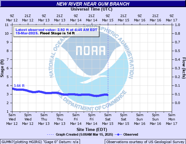
Latest Observation
Updated: 12:45 AM EST 12/15/25
Status: No Flooding
Stage: 2.45 ft
Flow: 0.028 kcfs
Forecast
Forecast not available for this location.
| Time | Stage (ft) | Flow (kcfs) |
|---|---|---|
| 12:45 AM 12/15 | 2.45 | 0.028 |
| 12:30 AM 12/15 | 2.45 | 0.028 |
| 12:15 AM 12/15 | 2.45 | 0.028 |
| 12:00 AM 12/15 | 2.46 | 0.029 |
| 11:45 PM 12/14 | 2.46 | 0.029 |
| 11:30 PM 12/14 | 2.45 | 0.028 |
| 11:15 PM 12/14 | 2.46 | 0.029 |
| 11:00 PM 12/14 | 2.45 | 0.028 |
| 10:45 PM 12/14 | 2.45 | 0.028 |
| 10:30 PM 12/14 | 2.45 | 0.028 |
| 10:15 PM 12/14 | 2.45 | 0.028 |
| 10:00 PM 12/14 | 2.45 | 0.028 |
| 9:45 PM 12/14 | 2.45 | 0.028 |
| 9:30 PM 12/14 | 2.44 | 0.028 |
| 9:15 PM 12/14 | 2.44 | 0.028 |
| 9:00 PM 12/14 | 2.44 | 0.028 |
| 8:45 PM 12/14 | 2.43 | 0.027 |
| 8:30 PM 12/14 | 2.43 | 0.027 |
| 8:15 PM 12/14 | 2.42 | 0.027 |
| 8:00 PM 12/14 | 2.42 | 0.027 |
| 7:45 PM 12/14 | 2.42 | 0.027 |
| 7:30 PM 12/14 | 2.42 | 0.027 |
| 7:15 PM 12/14 | 2.42 | 0.027 |
| 7:00 PM 12/14 | 2.42 | 0.027 |
| 6:45 PM 12/14 | 2.41 | 0.026 |
| 6:30 PM 12/14 | 2.41 | 0.026 |
| 6:15 PM 12/14 | 2.41 | 0.026 |
| 6:00 PM 12/14 | 2.41 | 0.026 |
| 5:45 PM 12/14 | 2.41 | 0.026 |
| 5:30 PM 12/14 | 2.41 | 0.026 |
25' -
Catastrophic flooding along the New River north of Jacksonville. Numerous homes and businesses inundated by several feet of water both north and south of the river. Water backs up small tributaries and severely floods homes in those areas as well. Travel in northern Onslow county is next to impossible.
22' -
Significant flooding along the New River around Gum Branch. Water inundates homes in the River Bluff, River Hill, and Rock Creek subdivisions. Additionally, along Briar Hollow Drive, Old Beechtree Lane, and Rhodestown Road many homes have water up to thier foundations, while some homes are inundated. Water overtops the bridges on Northwest Bridge Road and Rhodestown Road. Farmland along the river experiences severe losses.
20' -
Several raised homes are cut off at the end of Forest Bluff Drive. Water threatens homes of South Bluff Circle, Falls Creek Court, Rivers Edge Court, and Old Beechtree Lane. Northwest Bridge Road and Rhodestown Road are likely impassable due to water flowing over the road near the bridges.
16' -
Water surrounds homes towards the end of Forest Bluff Drive. Water inundates Lazy River Court. Many acres of farmland along the river are flooded.
14' -
Water threatens homes at the end of Forest Bluff Drive. Minor farmland flooding along the river occurs.
| Date | Stage (ft) |
|---|---|
| Sep 15, 2018 | 25.76 |
| Sep 16, 1999 | 25.12 |
| Oct 9, 2016 | 20.61 |
| Oct 1, 2010 | 20.55 |
| Oct 9, 2005 | 20.32 |
| Sep 2, 2006 | 19.99 |
| Sep 20, 1955 | 19.99 |
| Nov 23, 2006 | 19.18 |
| Aug 28, 1998 | 18.22 |
| Aug 10, 2024 | 16.75 |
| Aug 15, 2004 | 15.86 |
| Mar 3, 1994 | 15.5 |
| Sep 18, 2024 | 14.83 |
| Nov 14, 2020 | 14.5 |
| Jul 3, 2003 | 14.14 |
| Dec 28, 2023 | 14.11 |
| Feb 7, 2010 | 13.05 |
| Apr 26, 2017 | 12.99 |
| Aug 18, 1992 | 12.85 |
| Aug 29, 2011 | 12.19 |
Data provided by the National Weather Service.