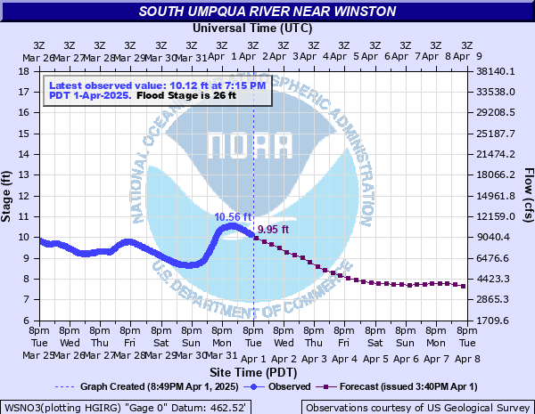
South Umpqua River near Winston
Critical Stages
22' - Action
26' - Flood
30' - Moderate
32' - Major
Latest Observation
Updated: 3:15 PM PST 12/5/25
Status: No Flooding
Stage: 3.68 ft
Flow: 0.255 kcfs
Forecast
| Time | Stage (ft) | Flow (kcfs) |
|---|---|---|
| 10 PM 12/5 | 4.37 | 0.529 |
| 4 AM 12/6 | 5.1 | 0.963 |
| 10 AM 12/6 | 5.56 | 1.31 |
| 4 PM 12/6 | 5.57 | 1.32 |
| 10 PM 12/6 | 5.49 | 1.25 |
| 4 AM 12/7 | 5.34 | 1.14 |
| 10 AM 12/7 | 5.15 | 0.997 |
| 4 PM 12/7 | 5.03 | 0.915 |
| 10 PM 12/7 | 4.96 | 0.869 |
| 4 AM 12/8 | 4.92 | 0.843 |
| 10 AM 12/8 | 4.88 | 0.817 |
| 4 PM 12/8 | 4.82 | 0.779 |
| 10 PM 12/8 | 4.76 | 0.743 |
| 4 AM 12/9 | 4.72 | 0.719 |
| 10 AM 12/9 | 4.82 | 0.779 |
| 4 PM 12/9 | 5.12 | 0.977 |
| 10 PM 12/9 | 5.39 | 1.18 |
| 4 AM 12/10 | 5.49 | 1.25 |
| 10 AM 12/10 | 5.72 | 1.45 |
| 4 PM 12/10 | 6.03 | 1.74 |
| 10 PM 12/10 | 6.25 | 1.97 |
| 4 AM 12/11 | 6.34 | 2.06 |
| 10 AM 12/11 | 6.27 | 1.99 |
| 4 PM 12/11 | 6.16 | 1.87 |
| 10 PM 12/11 | 6.03 | 1.74 |
| 4 AM 12/12 | 5.91 | 1.62 |
| 10 AM 12/12 | 5.78 | 1.5 |
| 4 PM 12/12 | 5.65 | 1.39 |
| 10 PM 12/12 | 5.55 | 1.3 |
| 4 AM 12/13 | 5.46 | 1.23 |
| 10 AM 12/13 | 5.37 | 1.16 |
| 4 PM 12/13 | 5.3 | 1.11 |
| 10 PM 12/13 | 5.27 | 1.08 |
| 4 AM 12/14 | 5.21 | 1.04 |
| 10 AM 12/14 | 5.13 | 0.983 |
| 4 PM 12/14 | 5.07 | 0.942 |
| 10 PM 12/14 | 5 | 0.895 |
| 4 AM 12/15 | 4.94 | 0.856 |
| Time | Stage (ft) | Flow (kcfs) |
|---|---|---|
| 3:15 PM 12/5 | 3.68 | 0.255 |
| 3:00 PM 12/5 | 3.68 | 0.255 |
| 2:45 PM 12/5 | 3.68 | 0.255 |
| 2:30 PM 12/5 | 3.68 | 0.255 |
| 2:15 PM 12/5 | 3.68 | 0.255 |
| 2:00 PM 12/5 | 3.68 | 0.255 |
| 1:45 PM 12/5 | 3.68 | 0.255 |
| 1:30 PM 12/5 | 3.68 | 0.255 |
| 1:15 PM 12/5 | 3.68 | 0.255 |
| 1:00 PM 12/5 | 3.68 | 0.255 |
| 12:45 PM 12/5 | 3.68 | 0.255 |
| 12:30 PM 12/5 | 3.68 | 0.255 |
| 12:15 PM 12/5 | 3.68 | 0.255 |
| 12:00 PM 12/5 | 3.68 | 0.255 |
| 11:45 AM 12/5 | 3.68 | 0.255 |
| 11:30 AM 12/5 | 3.67 | 0.252 |
| 11:15 AM 12/5 | 3.67 | 0.252 |
| 11:00 AM 12/5 | 3.68 | 0.255 |
| 10:45 AM 12/5 | 3.68 | 0.255 |
| 10:30 AM 12/5 | 3.67 | 0.252 |
| 10:15 AM 12/5 | 3.67 | 0.252 |
| 10:00 AM 12/5 | 3.67 | 0.252 |
| 9:45 AM 12/5 | 3.66 | 0.248 |
| 9:30 AM 12/5 | 3.66 | 0.248 |
| 9:15 AM 12/5 | 3.66 | 0.248 |
| 9:00 AM 12/5 | 3.66 | 0.248 |
| 8:45 AM 12/5 | 3.66 | 0.248 |
| 8:30 AM 12/5 | 3.66 | 0.248 |
| 8:15 AM 12/5 | 3.66 | 0.248 |
| 8:00 AM 12/5 | 3.66 | 0.248 |
32' -
Significant flooding can be expected from south of the town of Dillard downstream to the civil bend area near Winston and through Greed to the Little Valley area. Flooding can also be expected in the Myrtle Creek vicinity along Interstate 5. Severe bank erosion can be expected along the South Umpqua River and also flooded railroad beds in some areas along the South Umpqua River in the vicinity of Winston.
30' -
A good portion of Highway 99 is flooded south of the town of Dillard along with homes and businesses along Highway 99 south of Dillard and along the South Umpqua River. Some street flooding is also possible in the town of Dillard.
29' -
Highway 99 near the town of Dillard begins to flood. Expect flooding of homes and businesses along Highway 99 and the South Umpqua River in the vicinity of Dillard.
28' -
Expect widespread low-land and agricultural flooding from Winston downstream toward the Happy Valley Road area.
26' -
The South Umpqua River is at flood stage. Low-land flooding can be expected from Winston upstream to Dillard.
| Date | Stage (ft) |
|---|---|
| Dec 23, 1964 | 34.28 |
| Jan 16, 1974 | 32.64 |
| Oct 29, 1950 | 32.4 |
| Dec 22, 1955 | 31.55 |
| Feb 21, 1927 | 31.2 |
| Jan 17, 1971 | 30.62 |
| Jan 18, 1953 | 30.36 |
| Dec 26, 1955 | 30.34 |
| Feb 18, 1983 | 30.32 |
| Mar 17, 2025 | 29.47 |
| Nov 23, 1953 | 29.03 |
| Jan 7, 1948 | 29 |
| Dec 6, 1981 | 28.74 |
| Dec 8, 1996 | 28.4 |
| Jan 4, 1966 | 27.98 |
| Jan 20, 1964 | 26.84 |
| Dec 31, 2005 | 26.62 |
| Dec 11, 1956 | 26.26 |
| Jan 29, 1958 | 26.01 |
| Feb 13, 1984 | 25.74 |
Data provided by the National Weather Service.